
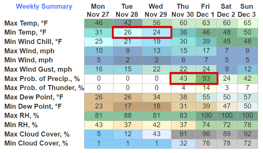
Subfreezing mornings Tue & Weds – hard freeze both mornings – many of us will be colder than that – coldest temps around sunrise – redboxed below are the 24° and 26° lows – then a warmup rest of the week.
Drought continues – severe and extreme for Davidson and Williamson Co – air was so dry this morning we almost tied the Nov 27 record for driest precipitable water – if you squeezed out all the water from the atmosphere you’d only get 0.17″ from it – for reference that is duh-rye.
Fire danger remains – “there will be at least a marginal fire danger tomorrow owing to very low afternoon relative humidity values, but winds probably won’t be strong enough for red flag conditions” (NWS-Nashville) – outdoor burning is never OK in Nashville – looks like Williamson’s ban was lifted, source – either way, burning not a good idea.
Rain expected late Thursday into Friday – “The 13Z NBM [a weather model] gives BNA at 47% chance of measuring 1″ or more during that 24- hour period, and a 76% chance of at least 0.5″.” (NWS-Nashville) – Storms unlikely but due to our proximity to the low pressure center causing the rain, we may squeeze out a few bolts – no concerns about severe weather (hail, wind, tornadoes).
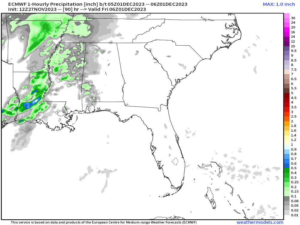
Below is the end of the 90 hour Euro as of midnight Thursdays night – suggests most of the rain will be Friday morning through the afternoon:
Weekend EduGuess – few drive by showers possible – more likely Sunday than Saturday – appears to be a weak system – need better data to determine weekend plans – would not alter any plans now.
Quick References:
Weather changes constantly.
Follow @NashSevereWx on Twitter for any changes to this forecast.
Live coverage during tornado and severe thunderstorm warnings:

Look good.
Support the mission.

We are 100% community supported. No ads. No subscription fees. Keep it free for everyone.


Categories: Forecast Blogs (Legacy)
You must be logged in to post a comment.