Tonight
Showers should develop and scatter across middle TN. There’s a small chance we will see one or two. Fog develops overnight and lasts into this morning. If you were foggy this morning, it’s likely you’ll be foggy Wednesday morning.

Showers should develop and scatter across middle TN. There’s a small chance we will see one or two. Fog develops overnight and lasts into this morning. If you were foggy this morning, it’s likely you’ll be foggy Wednesday morning.

Very light, scattered showers or a thunderstorm possible today. Odds of one getting you are pretty low, but if it’s going to happen, the HRRR thinks 6pm is the most likely time:


Like today, the odds of rain are small. If it’s going to rain, early evening is the most likely time. Here’s the Hi-Res NAM showing Wednesday night at 7pm:
 Thursday, Friday & Steeplechaseday
Thursday – High 82
Much like today and Wednesday — chance of rain or a thunderstorm, most likely in the late afternoon/evening hours.
Friday – High 77
Thunderstorms are likely Friday into Friday night. Our NWS was talking about it this morning:
MODELS CONTINUE TO PROMOTE THE ARRIVAL OF A PRETTY DECENT COLD FRONT . . . SLICING ACROSS THE MID-STATE FRIDAY NIGHT INTO SATURDAY AND USHERING IN A PERIOD OF RATHER COOL TEMPERATURES FOR SUNDAY AND MONDAY.
I’ve had about 50 people ask: “What about Steeplechase?” Approximately 100% of them are women, all wondering what to wear.

Before we dive in, a disclaimer: I’m about to show weather models for Friday & Saturday. Weather models are never the Gospel Truth, and are certainly not to be relied upon 5 days away. They are a decent indication of what might happen.
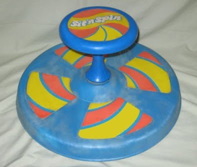
The weather version of the

is a low pressure center. A few important differences between the Sit-n-Spin and a low pressure sit and spin include:
Similarities:
For the last several days, this particular low pressure center has been cut off from the winds which would push it into the Atlantic Ocean. Yesterday it was around Memphis. Today it crawled to E MS and N AL, which is around where all the models think it’ll be tomorrow as it drifts further east and spins light rain showers into middle Tennessee. Here’s the NAM model, which is a fair representation of the rest of the models:
This afternoon we thought the rain — which moved east — was going to stay east. It hasn’t.
At 7:27pm, light rain showers crept northwest across both counties:
Why is this happening? This satellite image (from 7:15pm) explains:
A Flood Watch is in effect until 7 am Sunday. Here’s an official graphic:

It’s going to rain tonight and into the overnight hours. The ETA for Williamson, then Davidson, Counties is between 8pm and 9pm tonight. Follow along on Twitter for more frequent and detailed updates (@NashSevereWx).
There’s a very small – almost unmentionable – chance of a stray shower tonight. If we get one, it shouldn’t be enough to rain us out. We’ll make it to 80.
A slightly better chance of a shower or thunderstorm. The best chance will be in the afternoon. Rain-out chances are low. High of 78.
After a dry and warm week, rain threatens to return this weekend.
A chance of rain is in Thursday’s forecast, but the better chances are Friday and Saturday. Looks like a very slow rain system.
The Hi-Res NAM delivers showers Friday. Here it is Friday night at 7pm:
Just finished the NWS week-ahead briefing. Here’s what’s up:
Rainfall totals over the weekend:

No river or creek in Davidson or Williamson County is expected to rise further. Here are three (actually, four) examples to put your mind at ease.
No rain expected through Wednesday night:
 Temps will top out in the upper 70s or low 80s Monday through Wednesday. A small chance of rain arrives Wednesday through Saturday. No severe weather in the forecast.