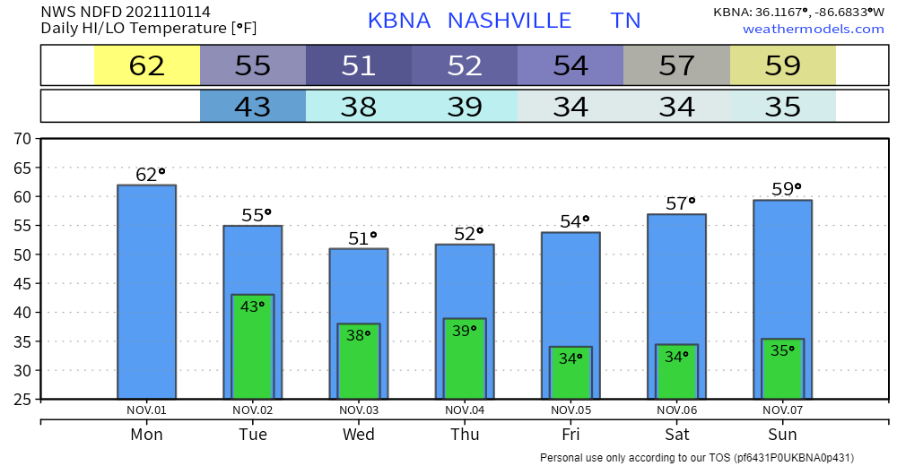
Now that Halloween’s come and gone…. next stop: Thanksgiving and cooler temps. Not much changing today. Highs in the low 60s and lows in the low 40s overnight. After that, brisk and overcast.

Now that Halloween’s come and gone…. next stop: Thanksgiving and cooler temps. Not much changing today. Highs in the low 60s and lows in the low 40s overnight. After that, brisk and overcast.
Pretty much all the action from this morning is out over the Plateau now. Didn’t turn out to be much more than lots of rain and the occasional rumble of thunder. Many of you probably slept right through it.
Today is basically a photocopy of yesterday… Clear skies, no rain. Should be another beautiful day, just bump temps up a couple degrees. Highs today will be in the mid 70s.
Tomorrow will bring us the highest temps of the week with highs in the upper 70s to near 80. It’s only fitting that rain follows soon after. Still looking like the incoming cold front will bring us action on Thursday, though minimal. Not looking like anything severe, but T-storms are a possibility. Mostly the annoying, scattered light rain. The Nam 3km model illustrates what it thinks this will look like on radar. Take exact timing with a grain of salt.
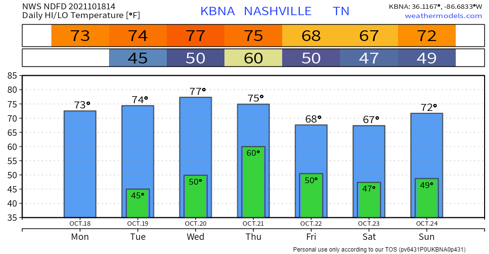
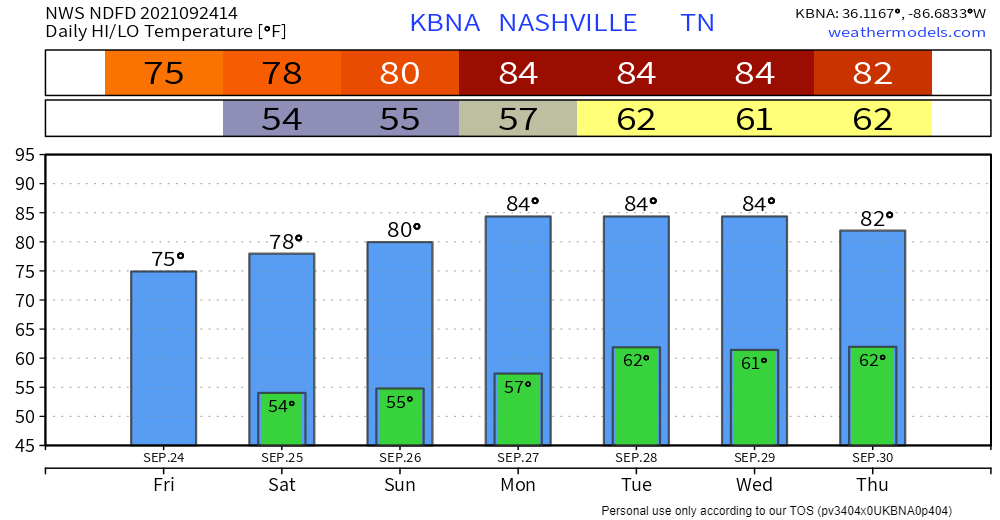
We’re finally down to near-normal temps for this time of year. Highs today hover around in the low 70s. Humidity is an afterthought. Good riddance.
Beautiful night for some Monday Night Football. Temps in the low 60s by kickoff, so set a reminder to grab your favorite hoodie. Doing a touchdown celebration for clear skies and no rain!

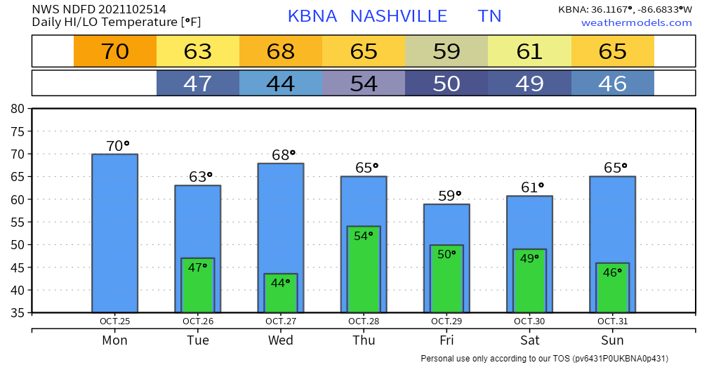
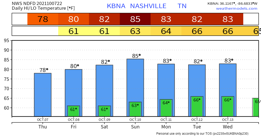
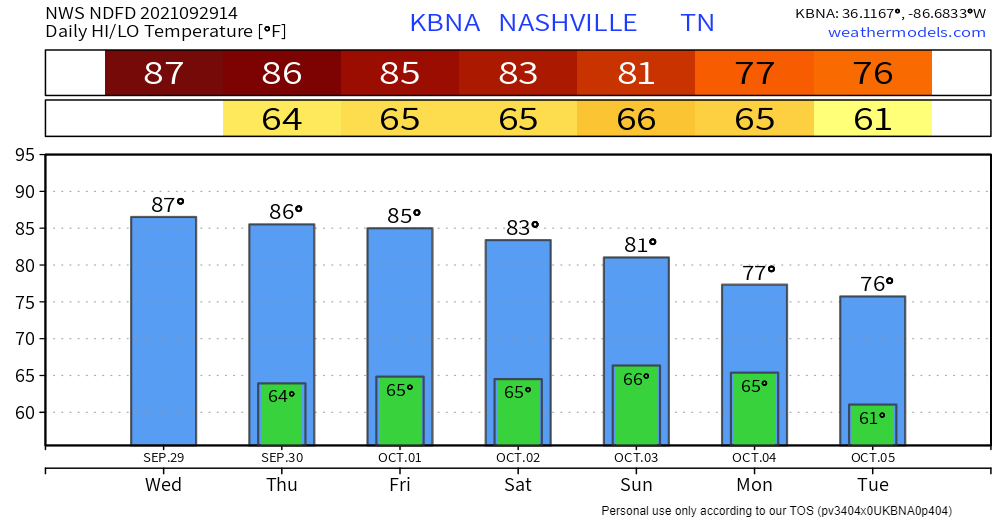
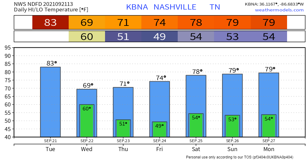
Very warm few days ahead for October. Well above average highs in the mid 80s (on the order of ten or so degrees warmer than usual). Muggy dewps stick around for the week.
Hold on to your hats… expecting wind speeds between 10 and 20 mph throughout the day (gusts up to 30 mph possible!). A few clouds in the sky, but otherwise a sunny, warm day. Nothing to ruin any outdoor plans.
After a few rainy days, we enjoyed a mainly rain-free day except for some mist this morning. The rainfall is stacking up.
Guess what… we’re warming back up. Expect no less when it’s Fall in TN. One of these days we won’t have to rely on rain to bring us more Fall-like temps.
Much quieter today after a wet weekend. There is a possibility of isolated showers in our area. Any rain should be light in nature, not rainout-quality. HRRR thinks most of the action will take place to our southeast.
Back to summer feels today. Highs up into the mid 80s. A real muggy day for it to be fall… dewps in the mid 60s and it’s not going away for a few days. I wouldn’t try to manifest flannel weather just yet.
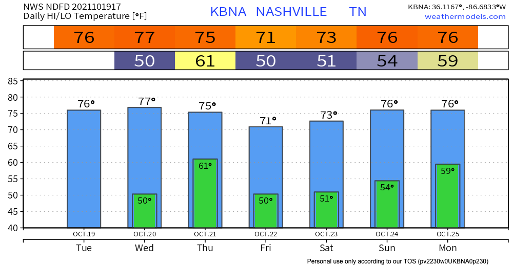
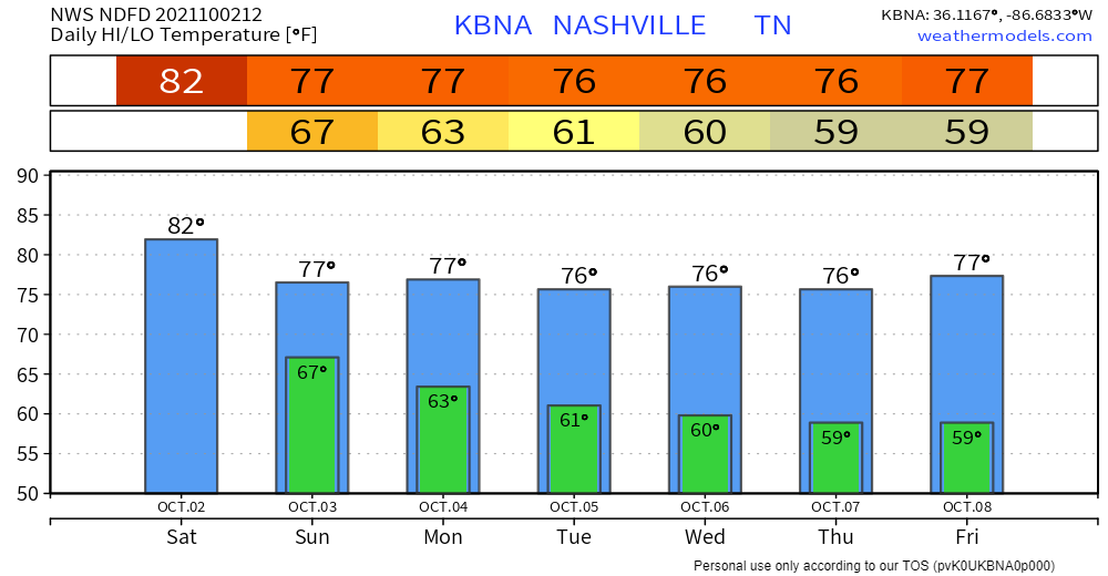
Yes, temps are on an upward trend. But we’re staying well below normal for at least today. Looking at highs in the mid 70s. We get closer to that normal threshold tomorrow… highs hang out around the upper 70s/low 80s through the weekend. Dewps in the 50s will keep you nice and comfortable, so don’t sweat it.
We’ve had a pretty wet last few days. Scattered showers and storms during the day today are the precursor to tonight’s round. Tonight into tomorrow is when we’ll see most of it. HRRR has us drying off by tomorrow morning.