
We’ve had a pretty wet last few days. Scattered showers and storms during the day today are the precursor to tonight’s round. Tonight into tomorrow is when we’ll see most of it. HRRR has us drying off by tomorrow morning.
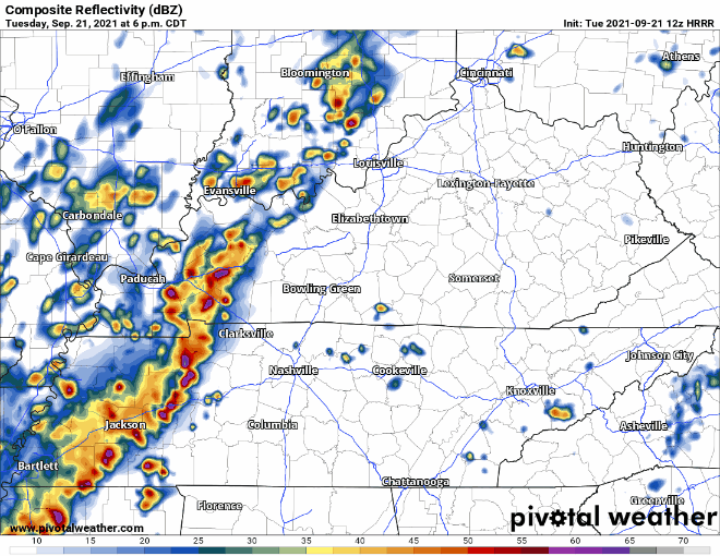
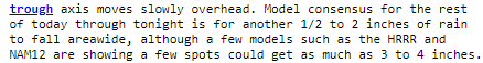
Around an inch is likely tonight. As always, localized values could be higher. May not sound like much, but enough to be wary of with all the rain we still have on the ground. Saturated ground doesn’t want to take in more rain. WPC keeping us in the “slight” risk category (10-20% risk of rainfall exceeding flash flood guidance within 25 miles of you). No watches/warnings have been issued yet, but keep your eyes and ears open to your alert systems.
A few of the storms tonight could be on the stronger side. Occasional thunder/lightning and gusty winds. Not expecting anything to develop into severe.
Textbook First Day of Fall
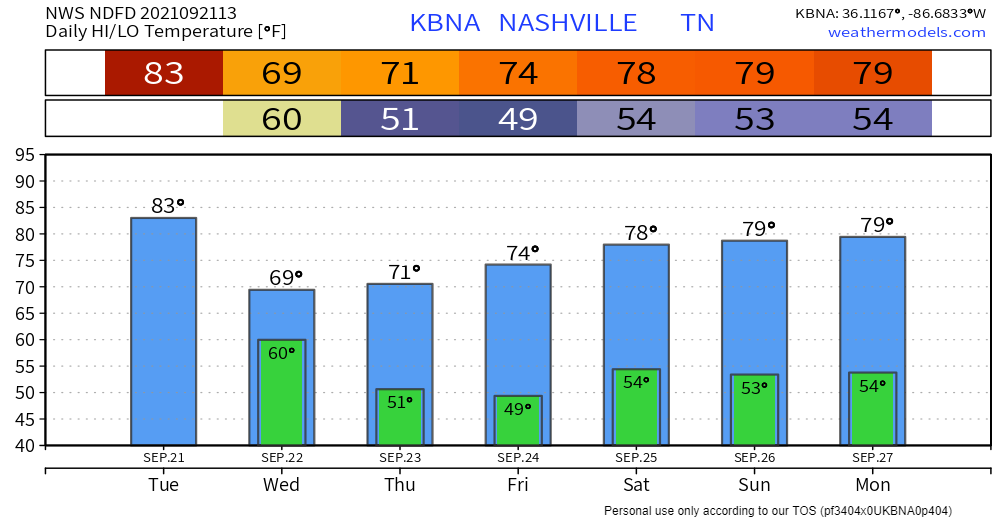
Rain will be out just in time tomorrow for us to enjoy our first taste of Fall. The cold front behind all this rain will bring us highs up to the low 70s tomorrow, then the mid to upper 70s the next couple days. Feels like the first actually COLD front we’ve had in awhile.
It’s going to be a breezy day. We’re staying dry and cool(er) for a few days. Comfortable dewps. It’s almost that time… Fall is upon us!

Categories: Forecast Blogs (Legacy)
You must be logged in to post a comment.