
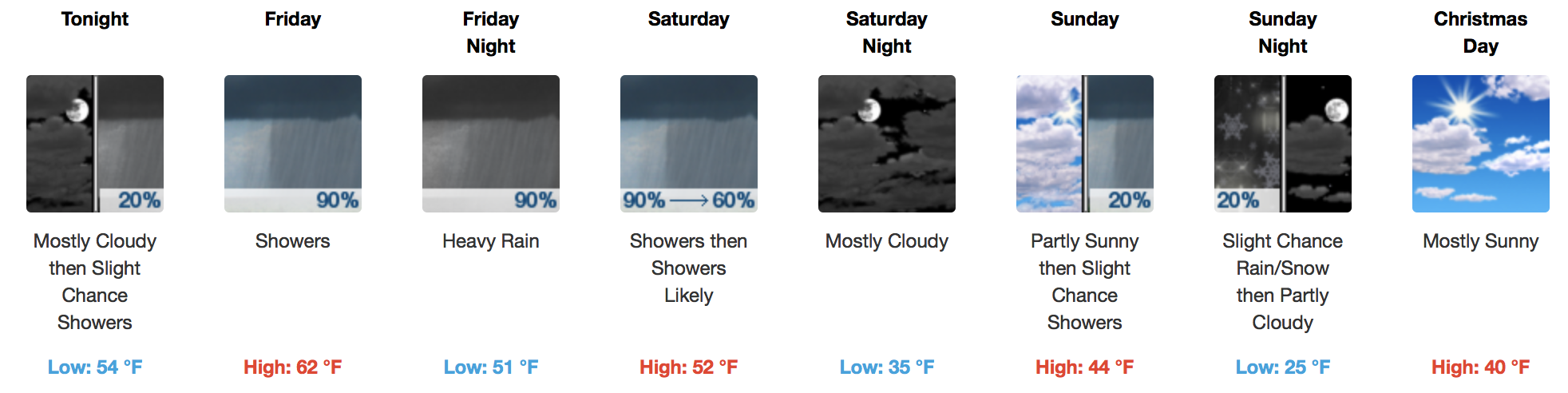
Lots of Rain On the Way, Flooding A Concern
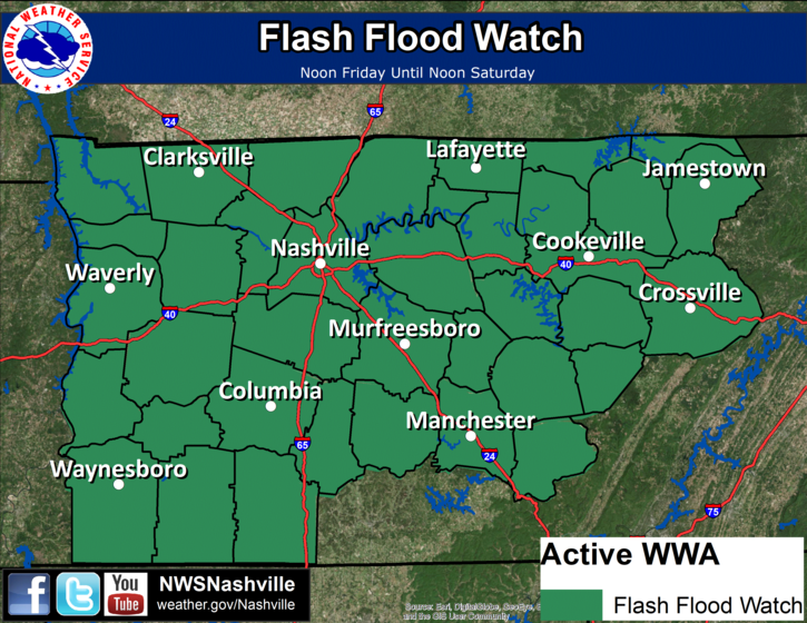
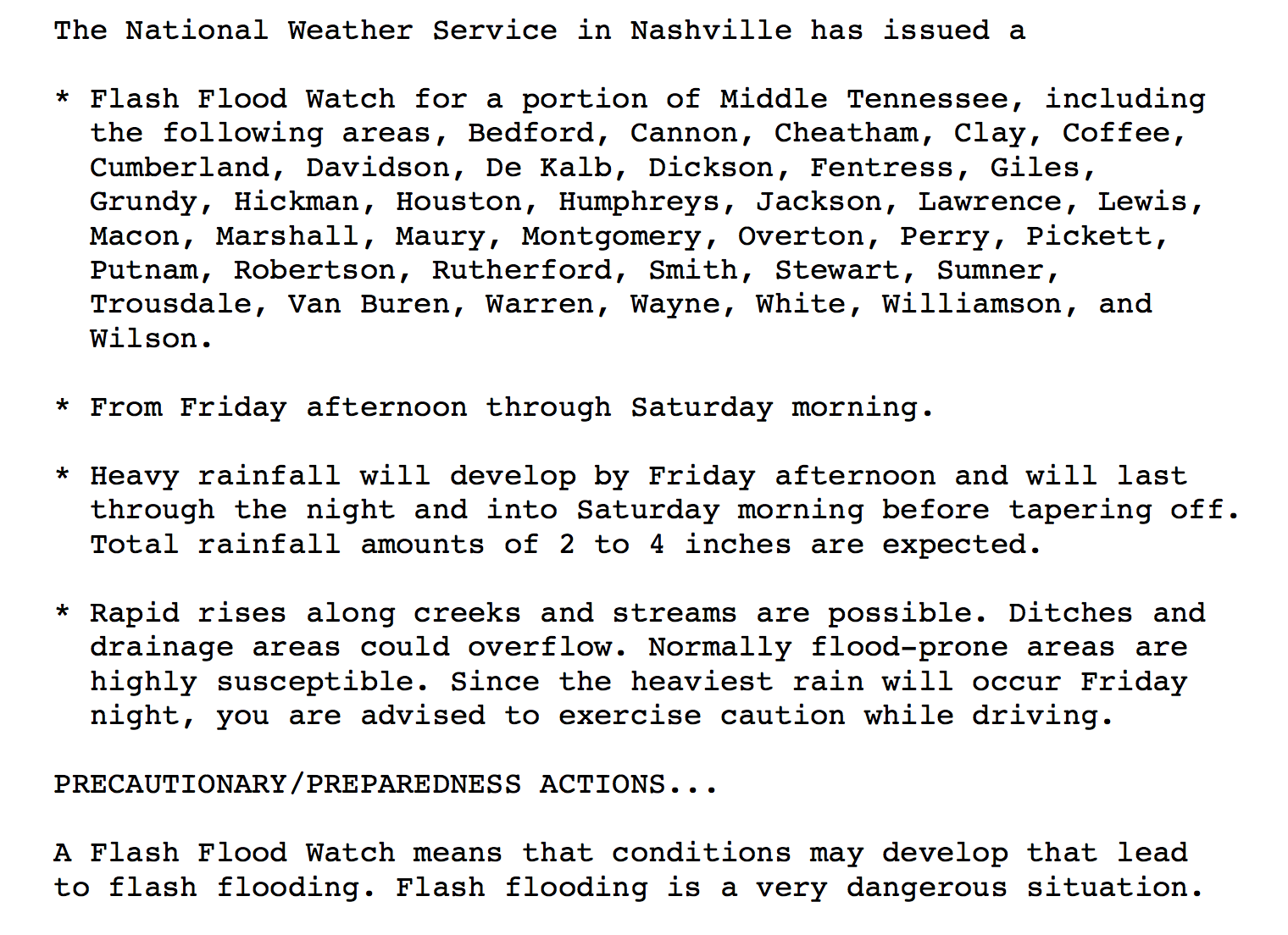
Since writing the blog this morning, NWS Nashville has since gone ahead and issued a Flash Flood Watch for Friday and Saturday:
To provide a general overview of how things are expected to play out, here’s a solution by the latest GFS model:
Latest GFS Loop of Entire Rain Event
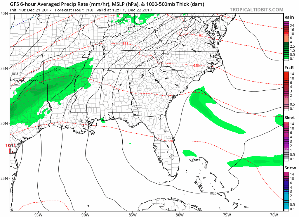
Models are in good agreement with producing the heaviest precipitation over the Nashville metro and points to the northwest. It’s not out of the question to get a few embedded thunderstorms with this, either, Friday afternoon and evening. These heavier pockets could locally enhance rainfall totals, too.
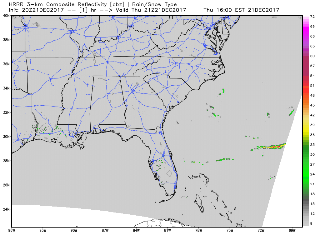
Latest HRRR Loop…indicates rain approaching by 9-10AM Friday from the southwest
UPDATED NWS Nashville Rainfall Totals Forecast through Saturday
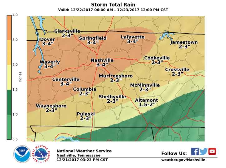
The heaviest precipitation shield is dependent on where the warm front sets up. Regardless, 3+ inches of rain are possible by Saturday before the cold front pushes through and takes the rain with it.
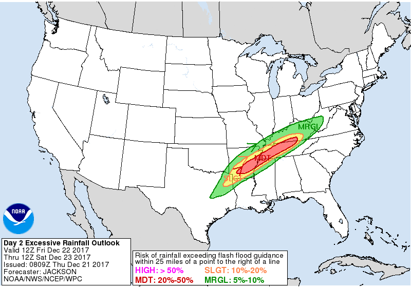
WPC Excessive Rainfall Outlook…we are in a moderate risk for experiencing flash flood-producing rainfall.
With holiday travel approaching, stay tuned to changing weather conditions and slick roads that will likely develop. Flooded roadways are also possible in areas prone to such activity.
Cold Air Behind The Heavy Rain
Some moisture in the mid-levels will swing through Sunday into Monday, possibly turning to a few flurries early Monday morning. No accumulations are expected, even if a few flakes fall.
The Christmas holiday through mid-week appears dry and cold, but models vary beyond that. Precipitation could reenter the picture by late Wednesday, but we will wait on that for now.

Categories: Forecast Blogs (Legacy)
You must be logged in to post a comment.