Today
We dodged storms last night. They stayed mostly in Kentucky, although there were severe thunderstorm warnings in the counties to our north and northeast. One of them had supercell structure, like a spaceship:
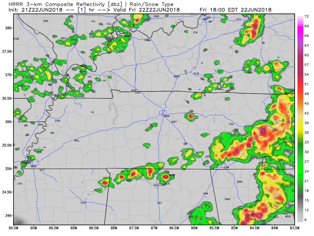
After some strong, damaging storms to our south today, HRRR suggests we are done with the rain for tonight. More storms expected tomorrow.
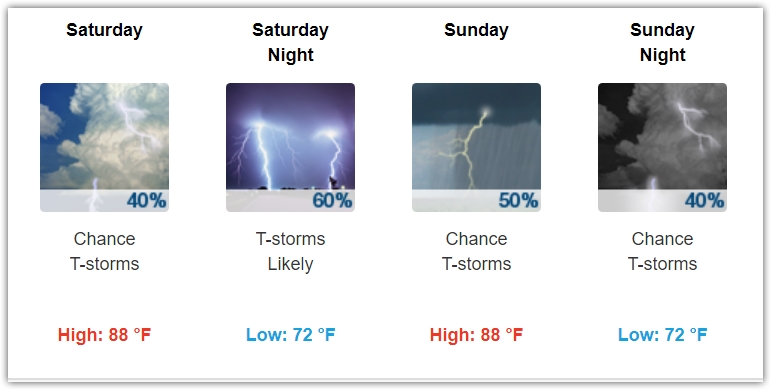
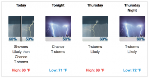
The typical summertime status quo remains intact for this weekend. Storms look like they could be severe again on Sunday as the atmosphere recharges following possible rain/storms Saturday night. Highs will be in the upper 80s with the muggy-meter in the uncomfortable range.
Who is ready for some rain?! It’s coming. Tropical moisture is arriving.
The HRRR model below shows off and on showers this afternoon, then a lot of light arriving arriving after midnight.

We are expecting the high temperature to be right around 90º today with dew point temperatures in the upper 60s (uncomfortable range).
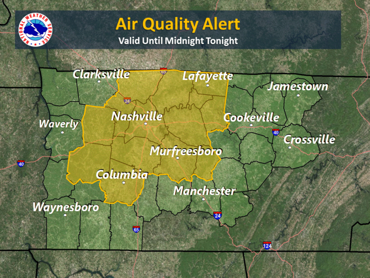
NOTE: Air Quality Alert today.
Hello, humidity! Dew points are going to creep back up into the mid-60s today as high temperatures continue to creep up into the mid-90s.
Later today, a frontal boundary will begin to approach Nashville and middle Tennessee. It may stall out just before it reaches Williamson and Davidson County areas, setting up for a weekend of dodging showers and storms.
Up goes the mercury in Nashville. Today is going to be the warmest day this week as our warming trend continues. Humidity will be tolerable, some may find it comfortable. We are still in a dry spell, with only an incredibly low chance of an extremely isolated shower and storm somewhere in Williamson and Davidson Counties. (Editor’s Note: It’s not going to rain today).
Just sit back and imagine, rain-free, mid-upper 80º days in June… wait!

No need to imagine, that’s exactly what we are going to have most of this week! Just look at this:

High pressure is centered over central Missouri this morning. It will eventually move into the Tennessee River Valley by tomorrow, maintaining near-normal temperatures with comfortable dew points.
Holy cow! It’s June! Where does the time go?

The overarching system that gave us showers and thunderstorms is on the way out this morning. However, there will be enough temperature recovery with residual small-scale boundaries to produce isolated to scattered thunderstorms. Isolated severe storms cannot be ruled out of the picture; however, the HRRR model doesn’t really think anything of consequence will pop over us today. Below is the NAM3 model:
Alberto is finally on the way out of Tennessee. Thus, the Flash Flood Watch has been discontinued for Williamson and Davidson Counties.
Alberto has left exceptionally humid air behind, with dew points in the low 70s expected through Saturday. That’s low-end oppressive:
Good morning Nashville! We are moving back into the summertime pattern with hit or miss showers and storms all day. It looks like coverage will be fairly good for the daytime hours, dying out by sunset. HRRR illustrates. A couple of these storms could be on the strong side, so stay aware if you have plans outside today. The good news is that these should be “pulse” storms, and organized severe weather is not expected.