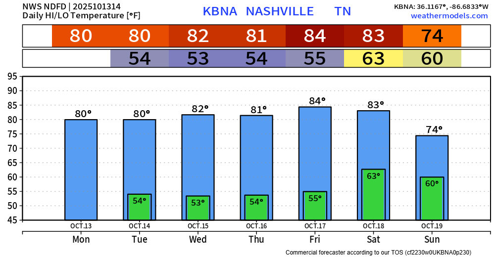
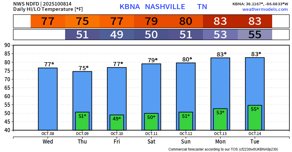
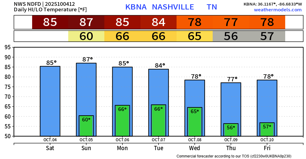
We continue our streak of cool mornings, warm afternoons, and staying dry throughout the work week.
Average high for this time of the year is ~75°, so we’ll be several degrees above average throughout the week.

We continue our streak of cool mornings, warm afternoons, and staying dry throughout the work week.
Average high for this time of the year is ~75°, so we’ll be several degrees above average throughout the week.
In the near-term, our days and nights will be near carbon copies of each other, highs around 80….morning lows in the low-mid 50s.
Looking toward next weekend, a trough of low pressure “of decent strength” (NWS) could move through from west to east. While it’s too soon to tell whether we could get severe weather out of it, these are the types of Fall systems that can deliver such.
The pattern continues. Mornings will be cool in the low 50s with localized fog.
Afternoon highs will range from the upper 70s to lower 80s…plenty of sun.
No rain until at least next weekend. The GFS hints at a *possible* weak system on Saturday/Sunday a week from now, but that’s gonna need to come into better view before we get to excited about it.

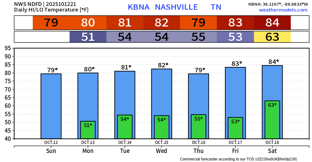
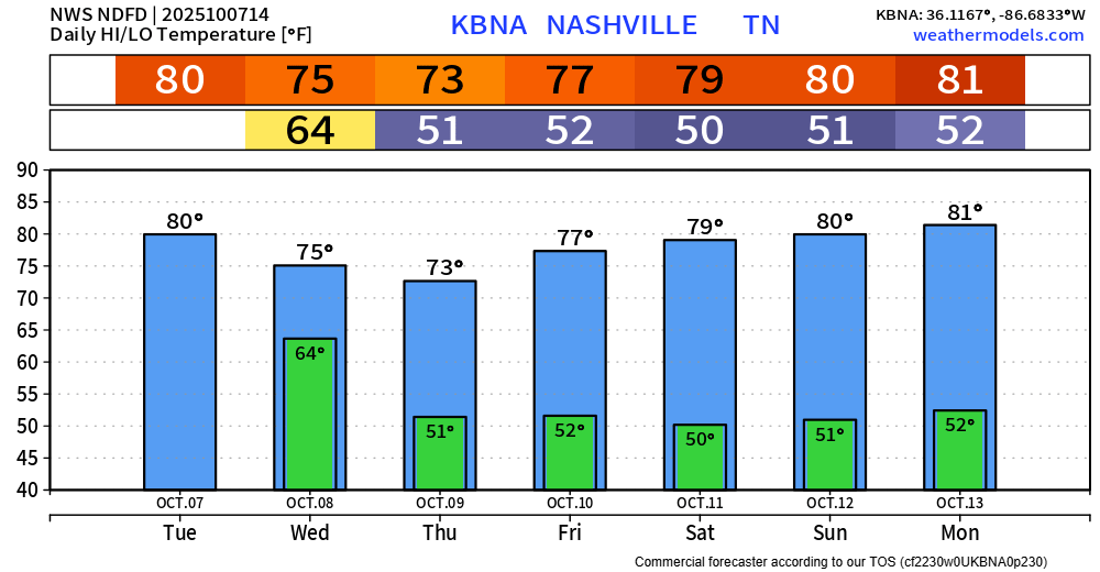
Strap yourself in. Ready? For the next week:
We’ll wake up with cool mornings, not a bad idea to have a light jacket for the walk out the door. Lows near 50° thru this weekend.
We’ll warm up nicely each day thanks to plenty of sun. Highs in the mid to upper 70s this week, low to mid 80s for at least the first half of next week.
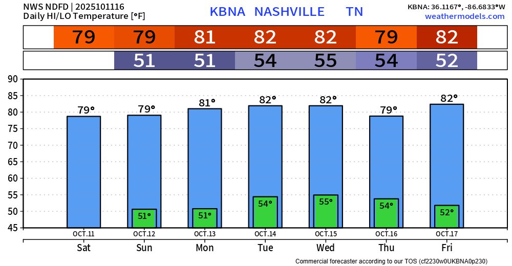
The cold front has made its way thru, bringing in cooler and drier air.
You’ll probably need a light jacket to walk out the door for at least the next 7 days. Lows will bottom out near 50°.
You’ll then forget where your jacket is as you walk out the door to temps in the mid to upper 70s.
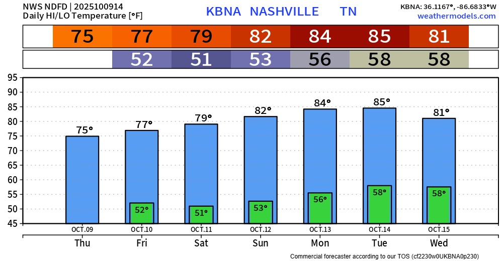
Scattered on/off showers will continue to move through both of our counties thru late this afternoon.
Wouldn’t be shocked if a few of us saw a thunderstorm around the lunchtime to early afternoon timeframe, but no severe weather is expected.
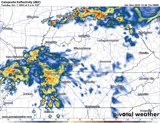
Scattered light showers will continue throughout the day on Monday. We should get a break this afternoon and evening before more rain moves in overnight. You can always check the radar on our website here: Radar | Nashville Severe Weather
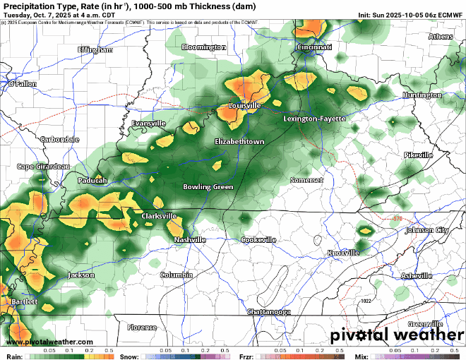
Showers will be fairly isolated on Monday, mostly confined to the afternoon and evening. Don’t think this causes any rainouts to any practices or games, rainfall totals will be very light.
Much higher rain chances will be around Tuesday late morning thru the early morning hours of Wednesday. Coverage will be much more widespread thanks to a cold front passing thru. Most everyone should get a decent bit of rain. Won’t be surprised if a few of us hear a few rumbles of thunder, but no severe weather is expected.
A seasonally warm but dry weekend is underway.
High temps will be in the mid 80s, thankfully dewpoints will behave so it won’t feel too muggy.
Rain chances reintroduce themselves Monday thru Wednesday.
You must be logged in to post a comment.