
Cloud cover will hang on for a good portion of the day, but we’ll stay dry with some fairly warm temps in the mid 60s.
Sunday will have a lot more sun, but temperatures will remain similar, highs remain in the mid 60s.

Cloud cover will hang on for a good portion of the day, but we’ll stay dry with some fairly warm temps in the mid 60s.
Sunday will have a lot more sun, but temperatures will remain similar, highs remain in the mid 60s.

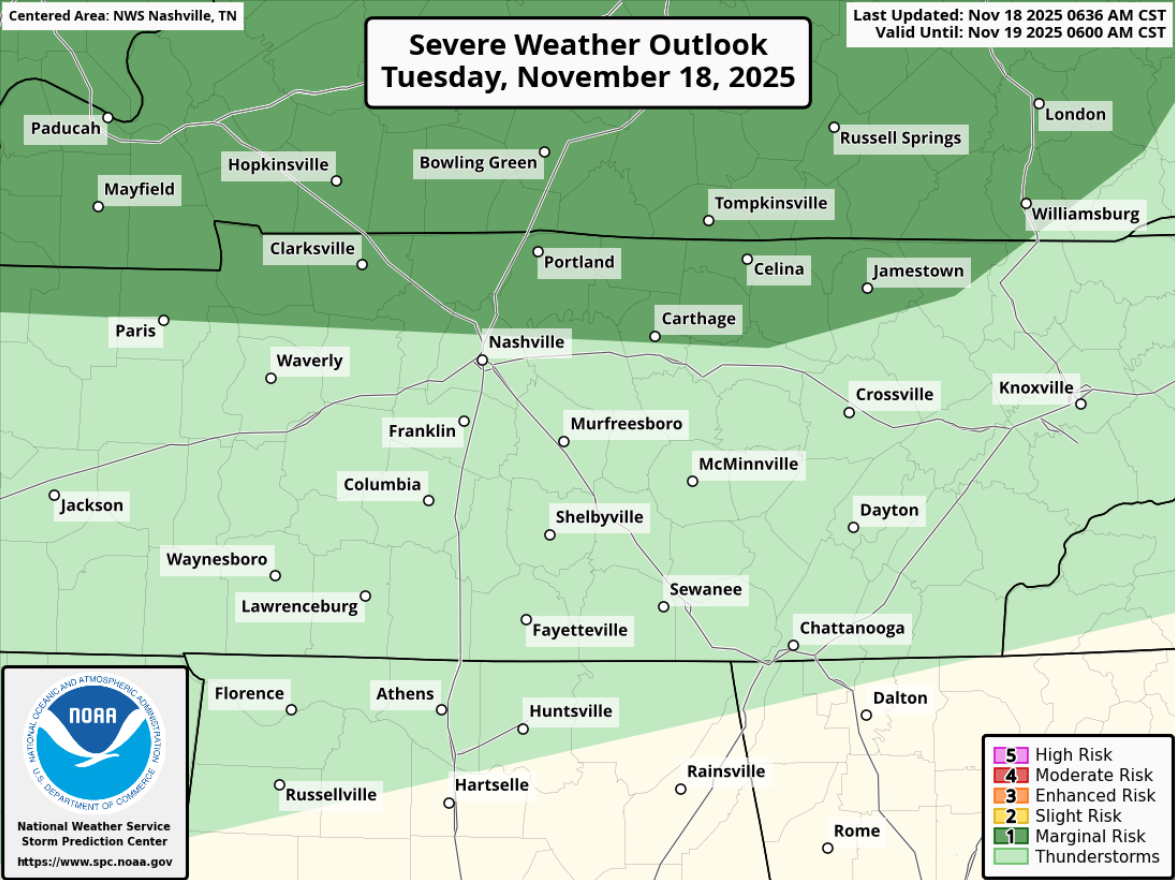
Last night, the Storm Prediction Center introduced a very-low end threat of severe weather for this evening into the overnight hours. Emphasis on very low-end.
To be specific, there’s a 5% chance of damaging straight-line winds and a 2% chance of a tornado within 25 miles. Did I mention this was a very low-end threat?
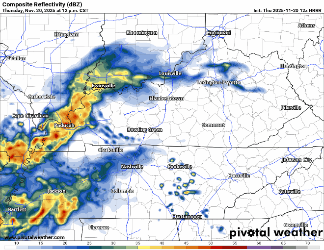
Morning showers have moved thru and there’s more on the way.
HRRR model shows more on/off showers (maybe a rumble of thunder) arriving shortly after lunch, lasting thru this evening. No severe concerns.
Today (Wednesday) will be dry with warm temps. Sun should peak out more and more as we get later in the day.
Rain chances return midday-ish Thursday and will continue thru the evening hours. Scattered showers and (non-severe) storms will be possible.
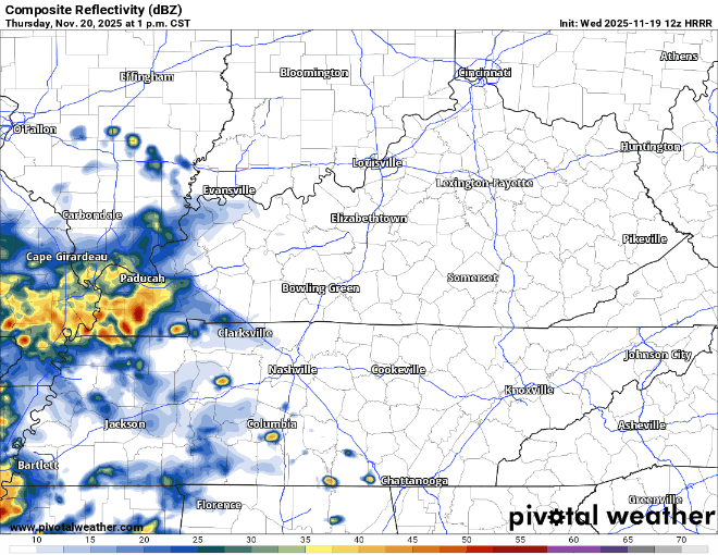
Our rain/storm chances are returning today, although we aren’t guaranteed rain.
To address the elephant in the room first, the Storm Prediction Center has outlooked most of Davidson Co. and far NW WillCo. with a 5% chance of damaging straight-line and hail, as well as a 2% chance of a tornado – all within 25 miles.
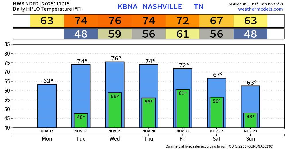
No shortage of warm weather this week. High temps will be in the low to mid 70s for most of the week, with a few exceptions such as today and later this weekend.
There also won’t be any shortages of rain chances this week, although rainfall totals seem to be manageable.
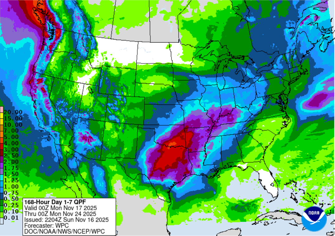
Monday will be the last day without any rain chances for a while, as we enter a wet (and warm) pattern.
Rain chances return Tuesday PM and will stick around daily thru the end of the week. Models are still disagreeing with each other on timing, so I’m hesitant to start giving out any specifics on that just yet.
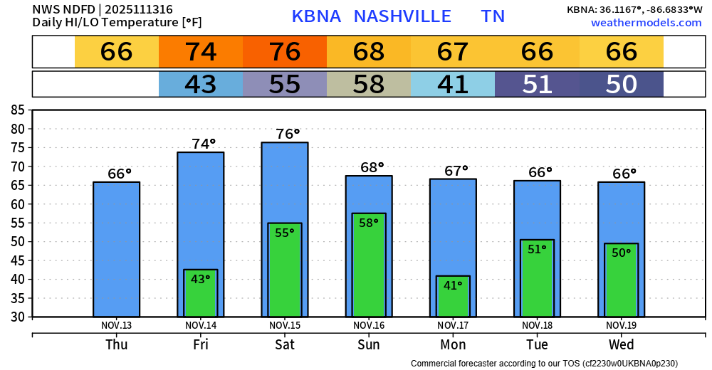
Beautiful day ongoing, we’ll make it close to our daily record high of 79° – set in 1964.
Temperatures will remain warm over at least the next 7 days, but we won’t have the dry weather to go along with it.
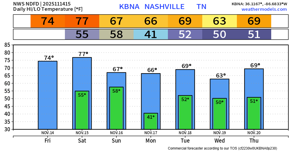
Today and Saturday will be “get outside” days. High temps will be nearly 15° above average. Plenty of sun, it’ll feel like Spring – except for the sun setting at 4:39p.
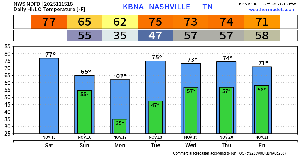
Remainder of the forecast, temps will still be warm – just not as warm with highs in the mid to upper 60s. Mornings will still have a chill to them.
Temperatures will continue to be very nice, especially for mid-November standards. Highs in the mid 70s Friday and Saturday, mid to upper 60s otherwise. Outdoor plans are encouraged Friday and Saturday.
You must be logged in to post a comment.