
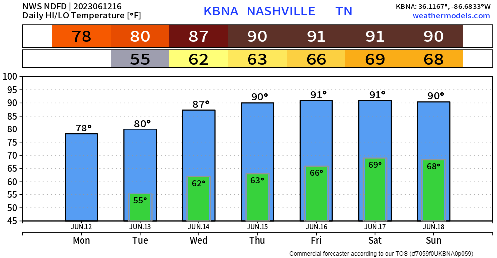
June 13, 2022 the high got to 97°, which was a record for June 13. Today our high is 80° and dry. I’ll take today.
Tomorrow temps will return to where they ought to be for this time of the year, accompanied by Wattery chances.

June 13, 2022 the high got to 97°, which was a record for June 13. Today our high is 80° and dry. I’ll take today.
Tomorrow temps will return to where they ought to be for this time of the year, accompanied by Wattery chances.
Today will be a lovely June day as high temps may not even reach 80° thanks to abundant cloud cover.
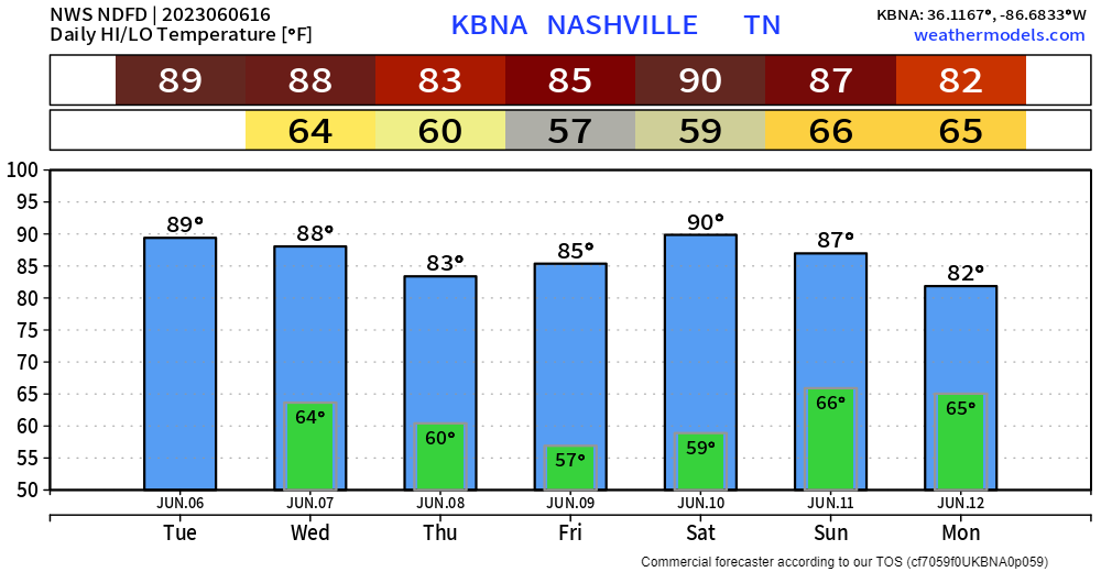
Today and Tuesday look dry for the most part, Wattery chances exist Tuesday but a majority of it looks to stay to our south.
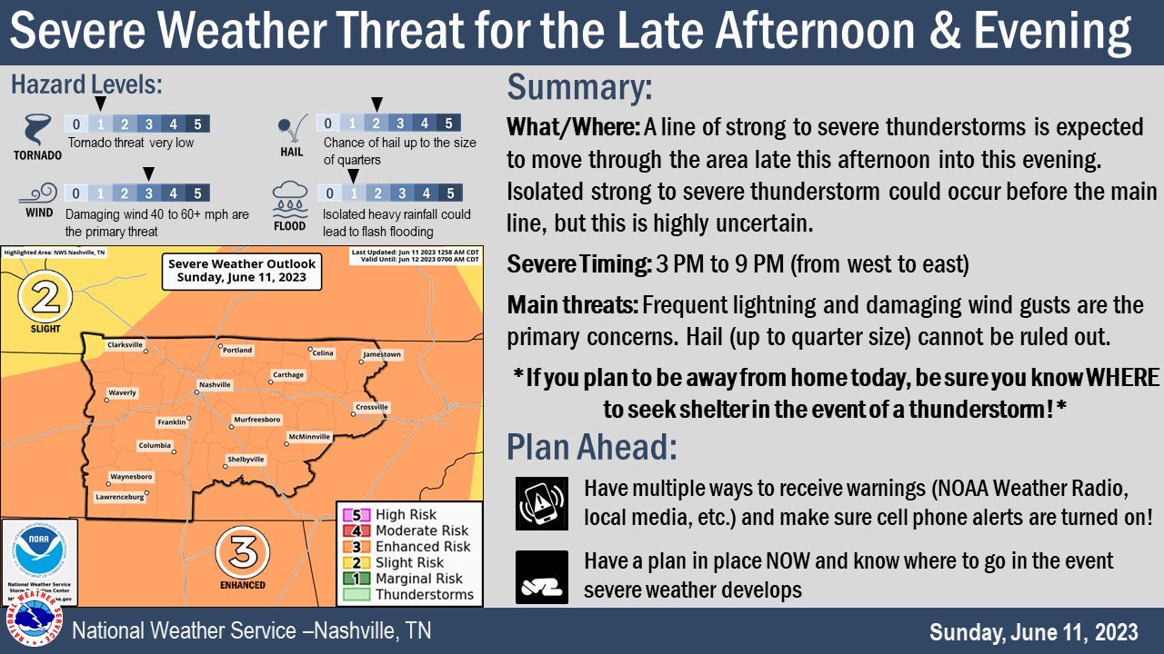
The Storm Prediction Center has outlooked both of our counties with a
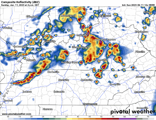
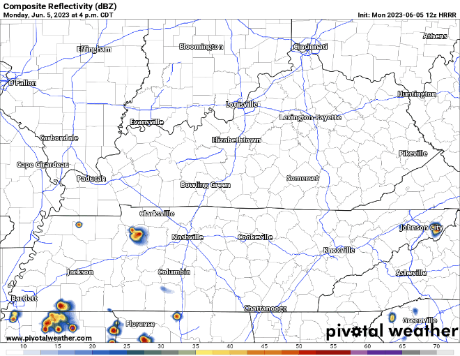
HRRR model (above) thinks 6-8pm is the timeframe for our two counties. This could change throughout the day, so keep tuned for updates. The primary threat is damaging straight-line winds, followed by severe hail, and then a tornado.
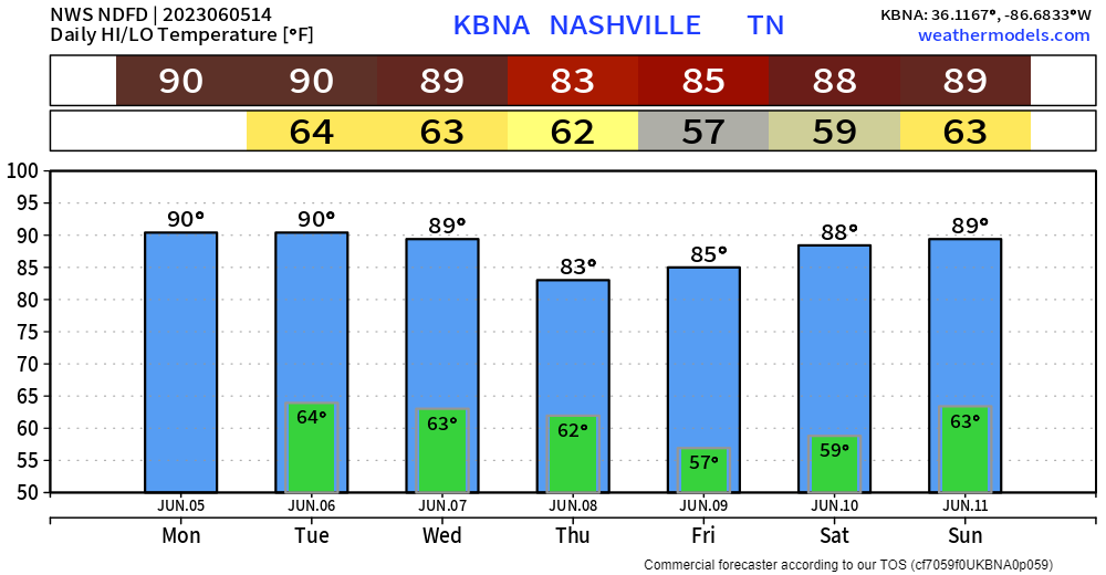
Another dry, yet warm today. Enjoy it because starting tomorrow we get active weather wise.
Air Quality Alert will be in effect all day. “The general public is not likely to be affected. Active children and adults, and people with a respiratory disease such as Asthma, should limit prolonged outdoor exertion.”

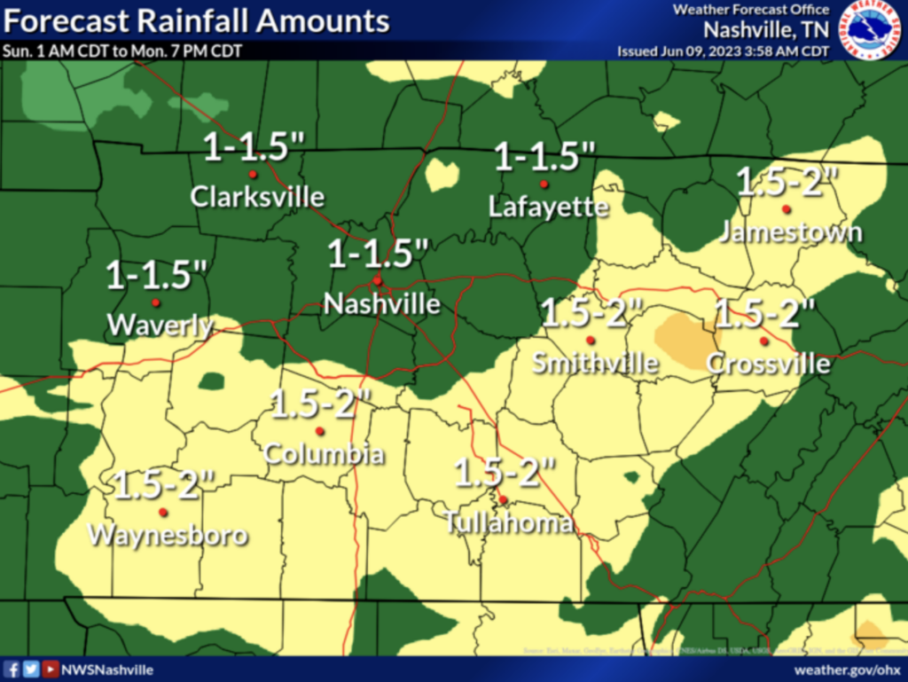
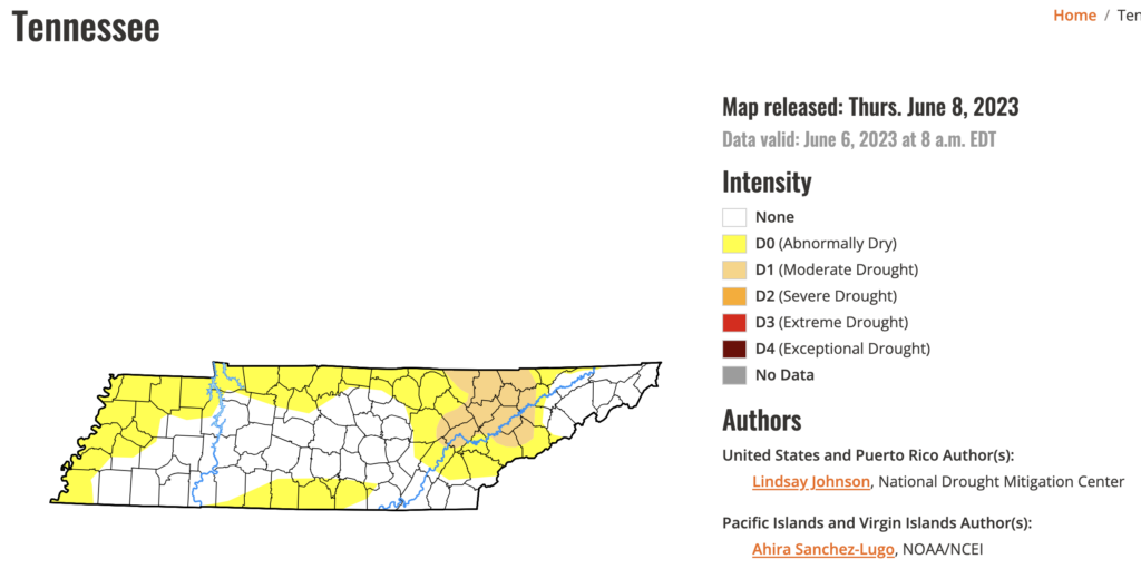
Rain will be a welcome sight to many this weekend…unless you have outdoor plans. Latest U.S. Drought Monitor has us as “abnormally dry.” Sounds right.
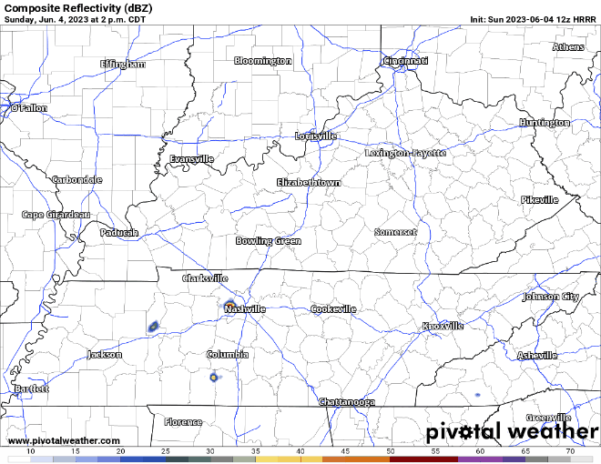
Hi-Res Models, which are just coming into view, generally agree that scattered showers and storms will arrive Sunday morning. That’s about all we can get from those models right now….because that’s as far out as they go. The lower-res models pick up from there and keep rain off/on all day Sunday into Sunday night.
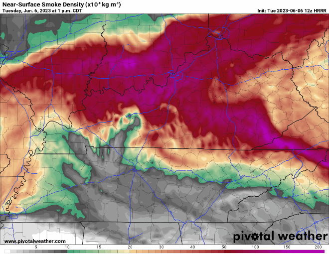
Been seeing a lot of questions about the smoke/haze. Most of it has exited our area and most of what you saw was fog this morning, with a little haze mixed in. Here’s the current near-surface smoke density.
Still seeing some smoke from the wildfires in Canada. A graphic from NWS Atlanta visualizes it well.
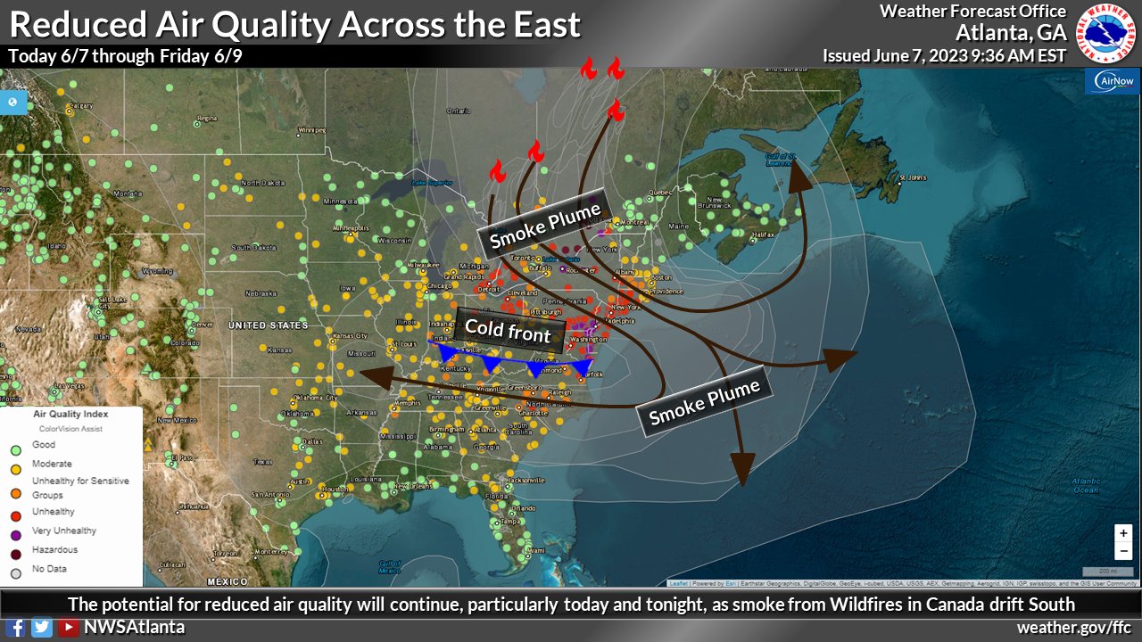
The cold front will be responsible for the clouds and rain we see today. It’ll also aid in pushing the smoke and haze out.
We’ll be dry today but incoming smoke from wildfires in Canada will be impacting us, especially tonight thru Wednesday morning.
Although it’ll make for a cool looking sunset tonight and sunrise tomorrow, the smoke will drop the air quality. People with respiratory issues may need to limit time outdoors.
Wattery chances will be mostly confined to those south of I-40.
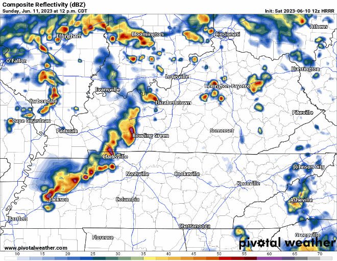
HRRR model (above) thinks your best chance of seeing anything will be in the afternoon/evening, with chances dropping when the sun goes down, on my side of town. No severe weather concerns. Lightning, gusty winds, small hail, heavy rain are all possible, y’all know the routine by now.
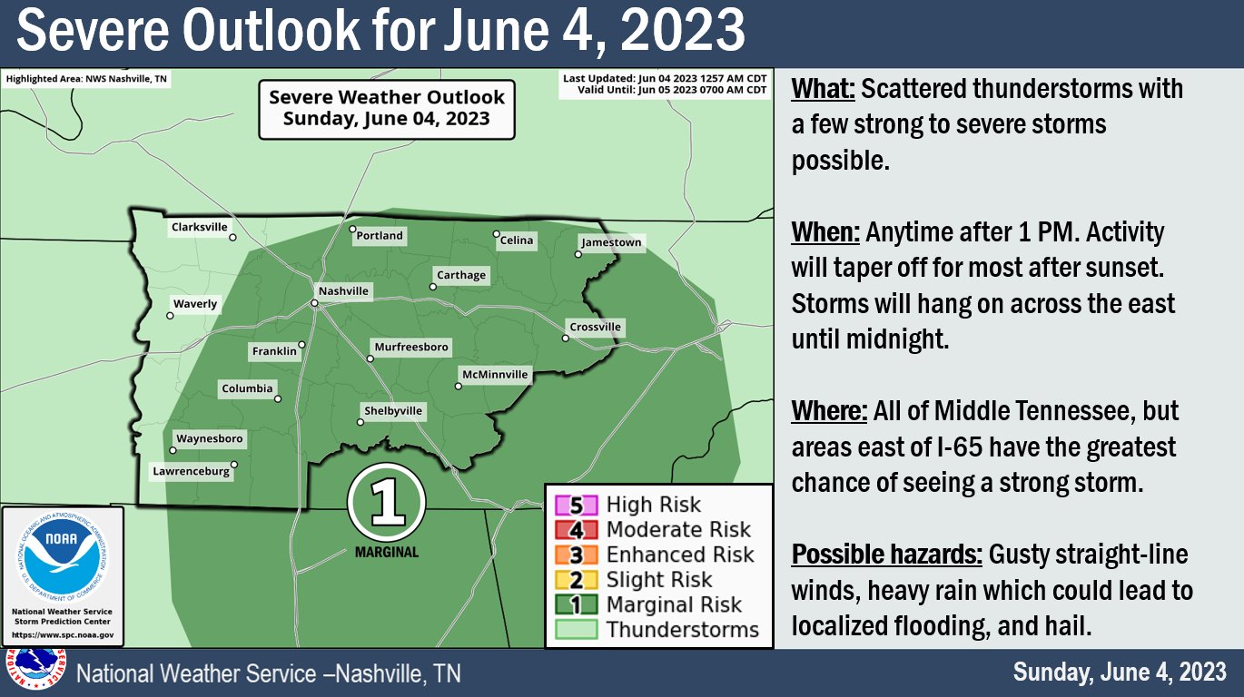
The Storm Prediction Center has outlooked both of our counties with a 5% chance of damaging winds within 25 miles.
The graphic above sums it up well but let us dive into more details.
HRRR model (above) agrees with the timeframe of 1pm – sunset, maybe lingering a little longer after.
You must be logged in to post a comment.