
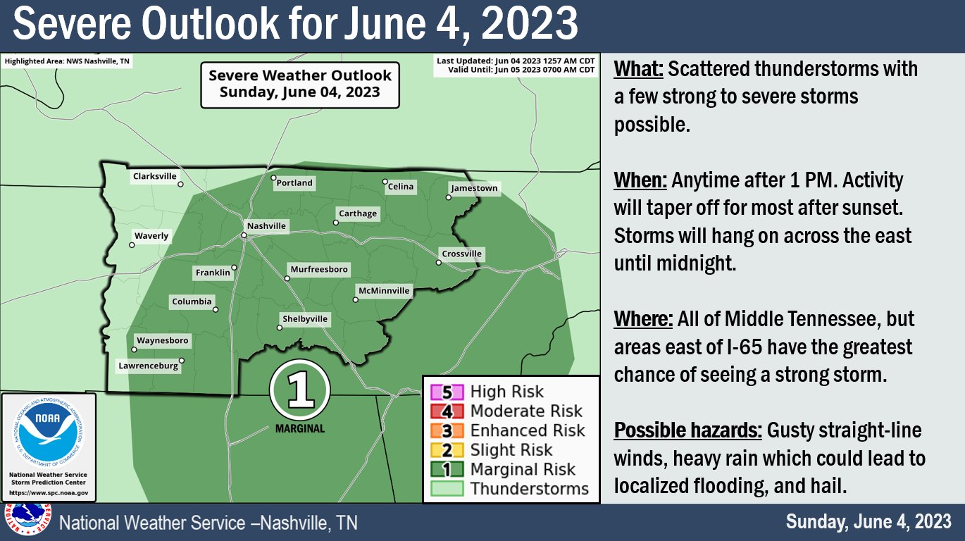
The Storm Prediction Center has outlooked both of our counties with a 5% chance of damaging winds within 25 miles.
The graphic above sums it up well but let us dive into more details.
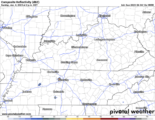
HRRR model (above) agrees with the timeframe of 1pm – sunset, maybe lingering a little longer after.
- These storms will be Crazy Ivans, so look to the east for incoming rain.
- Damaging winds (58mph+) are the main threat, small hail cannot be ruled out
- Although heavy rain cannot be ruled out, flash flooding is not a big concern
- We are not! concerned about tornadoes, there is no wind shear up there today to make anything spin
- Most storms today will stay below severe limits
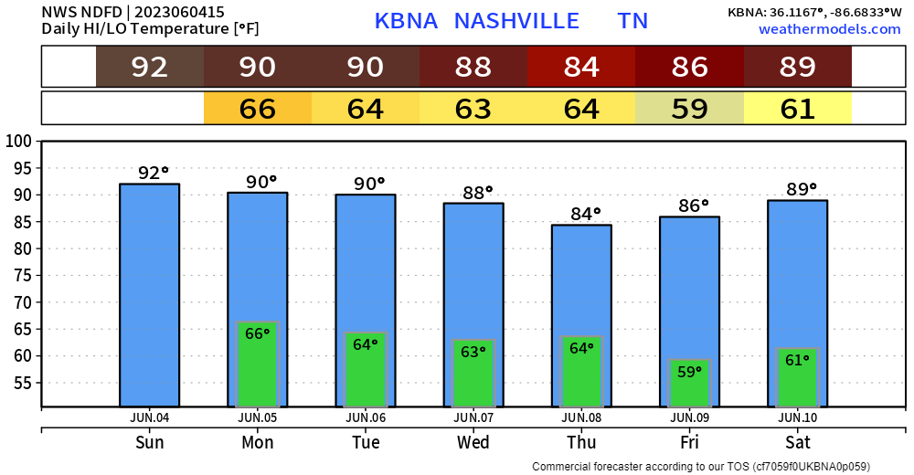
In the meantime, we’ll be cookin’. Temps will be pushing the low 90’s. Seeing some rain/storm wouldn’t be the worst thing as it’d cool you down, and some rain would be nice. Thankfully the dewpoints will not be problematic, and we won’t have to deal with a heat index.
Rest of the Week
- Temps will stay slightly above average for the beginning of the week, “cooling” down slightly, then getting back up near 90° later in the week
- Low Wattery chances will exist daily. Monday carries the best chances of you seeing anything
- CMA forecast still doesn’t look awful, but we are still too far out for me to say anything with my chest
Quick References:
Weather changes constantly.
Follow @NashSevereWx on Twitter for any changes to this forecast.
Live coverage during tornado and severe thunderstorm warnings:

Look good.
Support the mission.

We are 100% community supported. No ads. No subscription fees. Keep it free for everyone.


Categories: Forecast Blogs (Legacy)
You must be logged in to post a comment.