
Wattery chances will be mostly confined to those south of I-40.
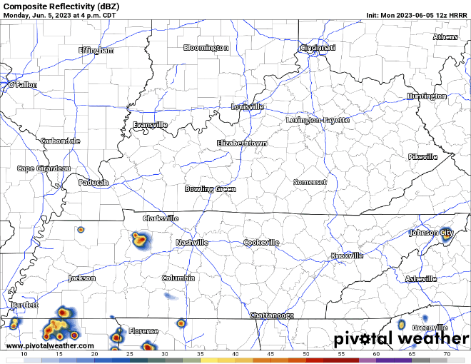
HRRR model (above) thinks your best chance of seeing anything will be in the afternoon/evening, with chances dropping when the sun goes down, on my side of town. No severe weather concerns. Lightning, gusty winds, small hail, heavy rain are all possible, y’all know the routine by now.
Tomorrow Wattery chances will be next to zero, however some smoke from wildfires in Canada will find its way and the sky will likely appear hazy.
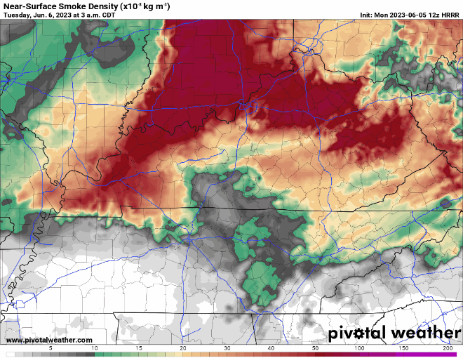
Smoke will arrive overnight tonight and stick around thru at least Wednesday morning. This will make for some snazzy sunrises/sunsets. Air quality may be affected and people with respiratory issues may have to limit their time outdoors.
Rest of the Week/CMA Fest
- Wattery chances return Wednesday and stick around Thursday
- As of this very moment, rain chances look next to zero Friday and Saturday. That would be huge for CMA Fest goers. Confidence will increase as we get closer
- Rain chances increase for Sunday
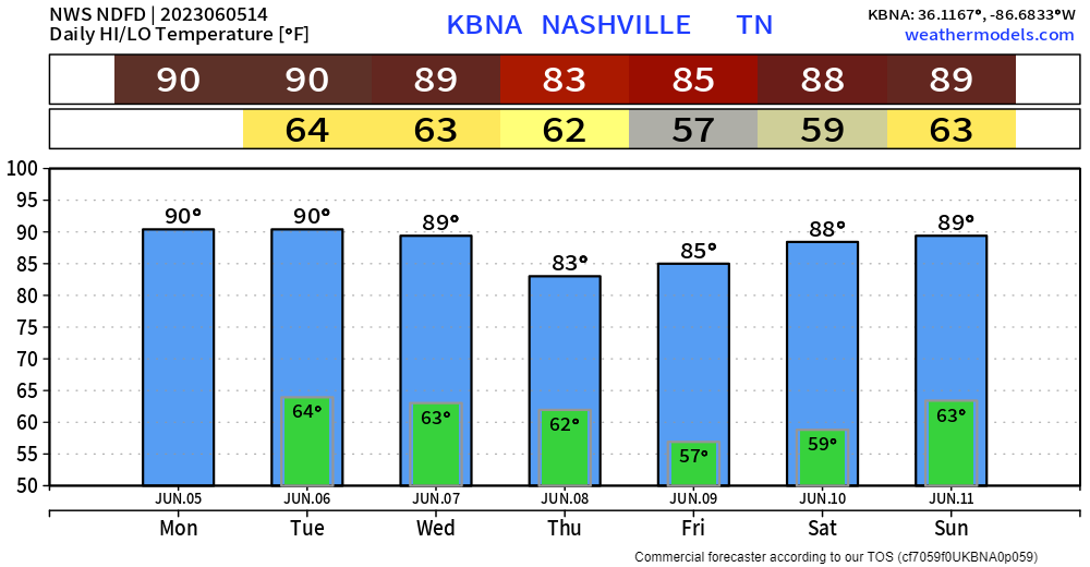
- Near norm temps for early June
Quick References:
Weather changes constantly.
Follow @NashSevereWx on Twitter for any changes to this forecast.
Live coverage during tornado and severe thunderstorm warnings:

Look good.
Support the mission.

We are 100% community supported. No ads. No subscription fees. Keep it free for everyone.


Categories: Forecast Blogs (Legacy)
You must be logged in to post a comment.