
Dry day, but a warm day. BNA did end up reaching 91°. That’s about ten degrees above average, and just a little shy of the daily record high of 92° set all the way back in 1891.
Tomorrow we’ll once again get close to the 90° mark, but we’ll also have some rain/storm chances to deal with.
Models don’t really like our chances of seeing much, if any rain tomorrow. HRRR model (below) keeps the overwhelming majority of the action to our north and east.
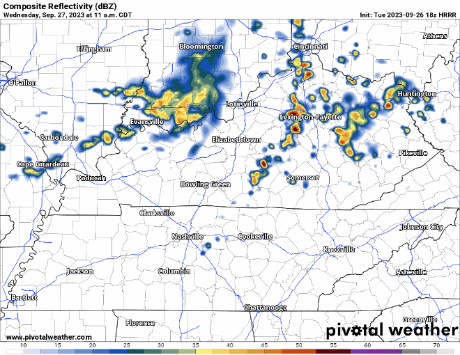
If you happen to see a shower/storm, it could be on the strong to severe side.
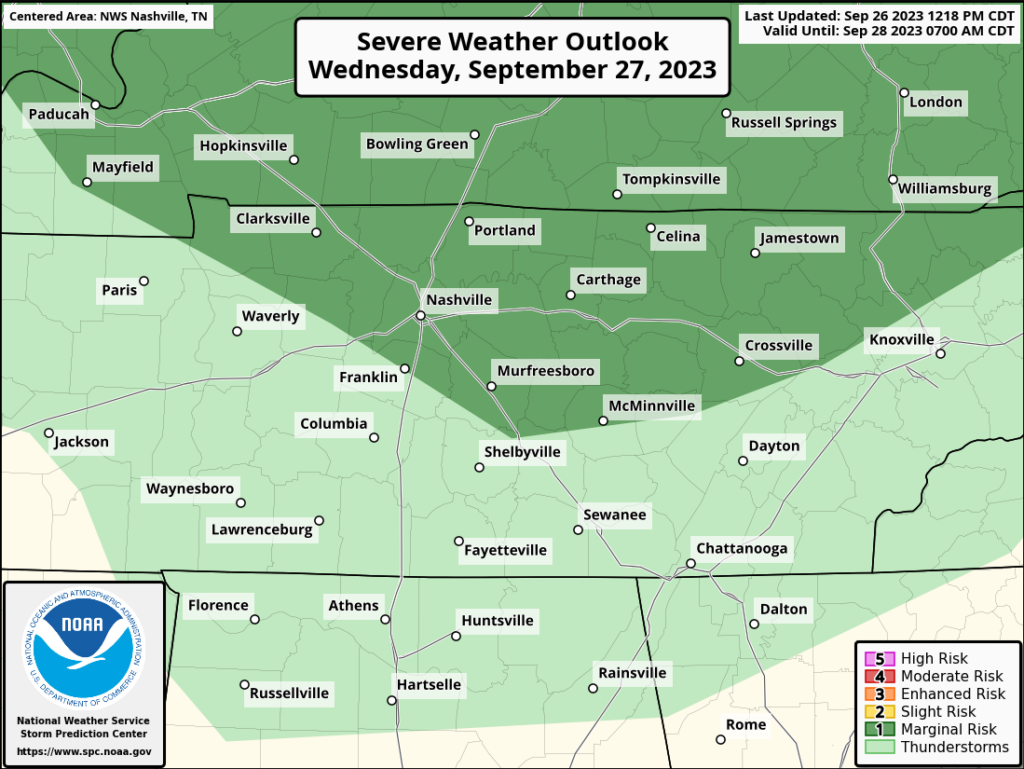
The Storm Prediction Center has outlooked the northern half of WillCo. and all of Davidson Co. with a 5% chance of damaging straight-line winds and/or damaging hail within 25 miles. We are not outlooked for tornadoes.
The chance of you seeing rain is low, and the chance of you seeing severe weather is very low. However, the chance is not zero, so keep an eye on the radar tomorrow. Our best chance to see anything would be afternoon/evening.
Thursday will have our best rain chances of the week.
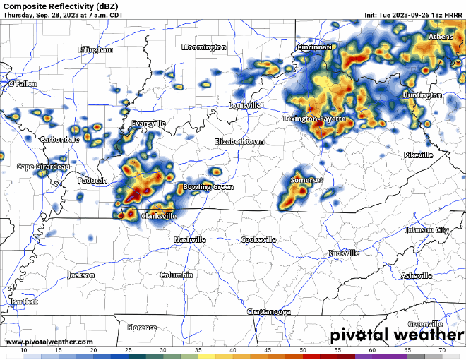
HRRR model (above) thinks some rain/storms move through around mid-morning thru the early afternoon, subject to change. We are not outlooked for severe weather, but some thunder is possible.
We’ll dry out for Friday and the rest of the weekend. Temps still stuck in the mid 80’s, with dewpoints in the mid 60’s.
“hey that’s not sitting on my front porch sippin’ on my PSL type of weather.”

Quick References:
Weather changes constantly.
Follow @NashSevereWx on Twitter for any changes to this forecast.
Live coverage during tornado and severe thunderstorm warnings:

Look good.
Support the mission.

We are 100% community supported. No ads. No subscription fees. Keep it free for everyone.


Categories: Forecast Blogs (Legacy)
You must be logged in to post a comment.