
It will certainly feel like August as high temps get into the low 90’s, although we could fail to make it there if cloud cover starts to dominate. Dewpoints in the low 70’s will make it feel gross.

It will certainly feel like August as high temps get into the low 90’s, although we could fail to make it there if cloud cover starts to dominate. Dewpoints in the low 70’s will make it feel gross.

A t-rex may seem really intimidating. However, it has such tiny arms that it kinda makes you laugh. Maybe if they hadn’t gone extinct, they’d be a lot more terrifying too, but since they are, and they can’t prove me any differently, I think the intimidation factor goes away after you laugh at their tiny arms.

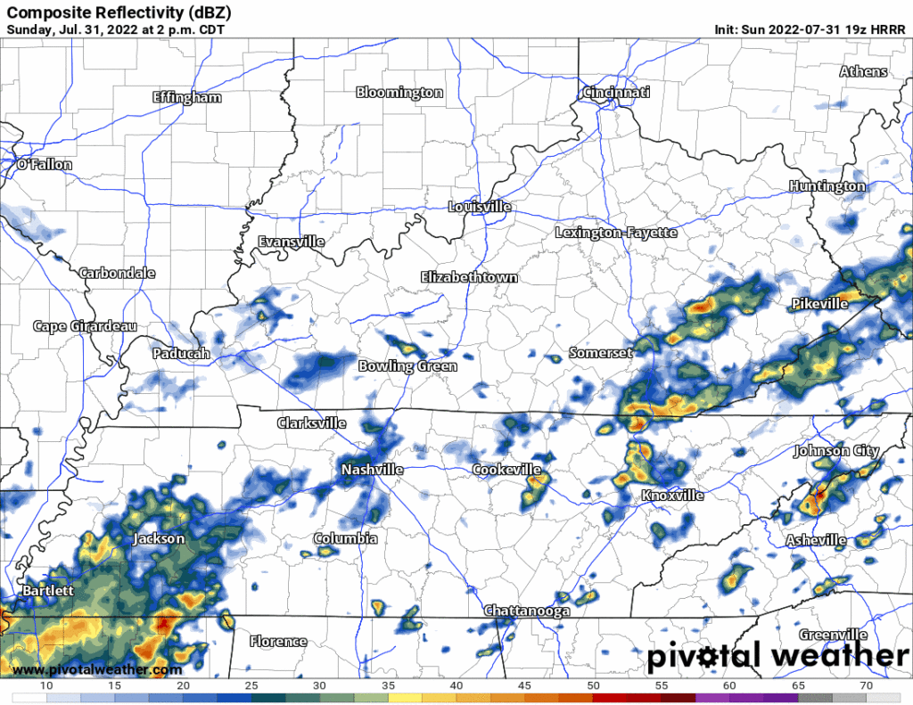
Most of the rain today stayed west. Tonight the heaviest showers will be south. Few showers possible later this afternoon and tonight:
We are not worried about any severe weather.
Recently we’ve seen the heaviest rain over Will Co. and parts of Nashville south of I-40:

Models are like your next-door neighbors. You think they are good people, and you feel like you can somewhat trust them. But then you hear that one story about them from ’08 and you start reconsidering everything you’ve ever thought about them.

Some real drought busting rain moving through this morning. Watch out for water over roads and as always, turn around, don’t drown.
HRRR model thinks the current rain moves out by a bit after lunchtime. It then thinks, emphasis on thinks, we stay clear for the remainder of the day. I have my doubts about this, our atmosphere will still be water-loaded. The Wattery may hand out more winning tickets, and they may not be as rare as the one-billion-dollar winning ticket. Outdoor planners stay connected and informed but so far looks okay. If storms do form, more chances of flash flooding and a low probability of a strong storm or two. Not worried about tornadoes.

Good news is,
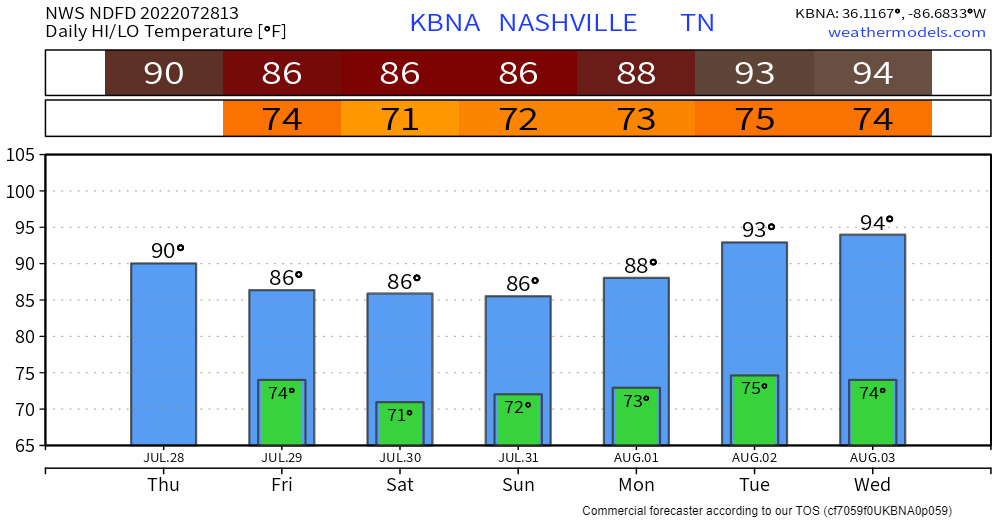
Temps are on the downward trend (for now) as we may not get to 90° today, and only mid 80’s this weekend. Bad news, dewpoints will still be not-so-kind and be in the low 70’s. Also mid 90’s return next week in case you missed them.

You very well may feel like you are in the movie ‘Groundhog Day’. At least it’s not cold?
“When will it rain at my house?”
“Maybe sometime this afternoon.”
“That’s so vague, why can’t you promise a time?”

It may not rain in the traditional sense today while yardworking, but you’ll be sweating on your greens if you do, does that count as watering?
Most of the rain will probably (?) stay north of us today (or maybe not? keep reading), which is good news for us, but has created serious flash flooding in St. Louis and surrounding areas. 8″+ of rain in and around St. Louis prompted a Flash Flood Emergency, which you may know that term from our March 2021 flash flooding. If you know anyone in that area, give them a shout and check in on them.
If I had 3 words to sum up the next 7 days…

Thankfully I don’t have a word limit.
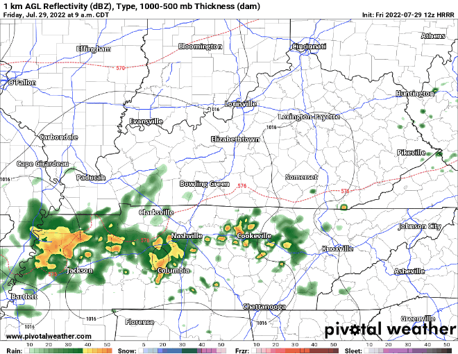
Rain this morning is staying to our north in Kentucky.
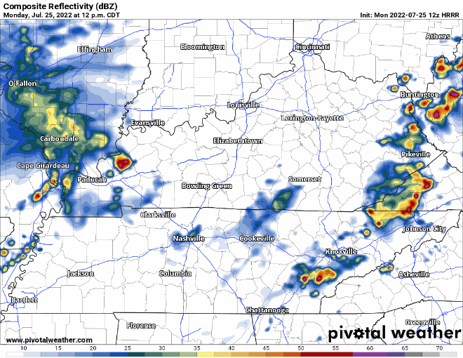
HRRR model (above) thinks those morning showers fizzle out up there, and it’s not until this afternoon when winning Wattery tickets are handed out. More storms also expected to form after sunset. Storm Prediction Center removed us from any severe weather chances, including tornadoes, lightning is possible with any of the storms, which is enough to alter outdoor plans.

A Heat Advisory is issued by NWS-Nashville when they think the heat index (“feels like”) will hit 105°.

What was that about showers or storms today?
The Wattery returns next week! Monday especially.
You must be logged in to post a comment.