

A Heat Advisory is issued by NWS-Nashville when they think the heat index (“feels like”) will hit 105°.
- We were under a Heat Advisory for today, but it was just canceled.
- Why? We started “cooler,” there’s cloud cover, and we may get an iso shower or storm this afternoon.
- Max expected heat index today “only” 102°.
- “Only”

What was that about showers or storms today?
- I can’t show you a model that has a storm popping up on us during the day. I’m not expecting rain. It’s possible but yeah, not expecting anything.
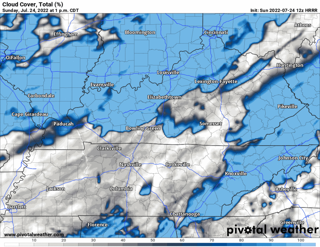
- Clouds tossing shade expected to roll in mid-afternoon, right when we’d hit the max feels like temp. Begone 105° heat index potential! Just One Oh Two. Here’s the HRRR model rolling those clouds in:
The Wattery returns next week! Monday especially.
- Monday, there should be many Wattery winners.
- NWS-Nashville calls Monday’s rain/storm chances “likely.”
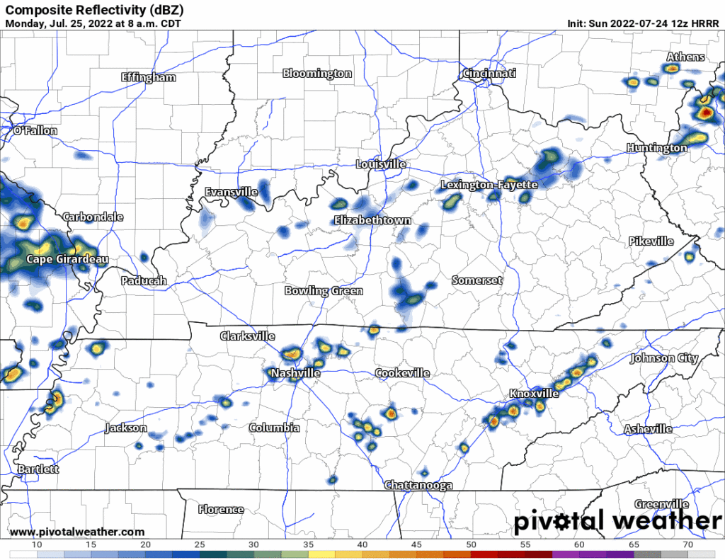
- So does the 12 run HRRR model. It thinks rain starts in spots before lunch then really picks up into the afternoon:
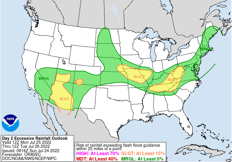
- Rainfall may be excessive. WPC estimates the probability of a flash flood event within 25 miles of you between 15% and 40%:
- It is possible you get shut out entirely. It’s Wattery szn, after all.
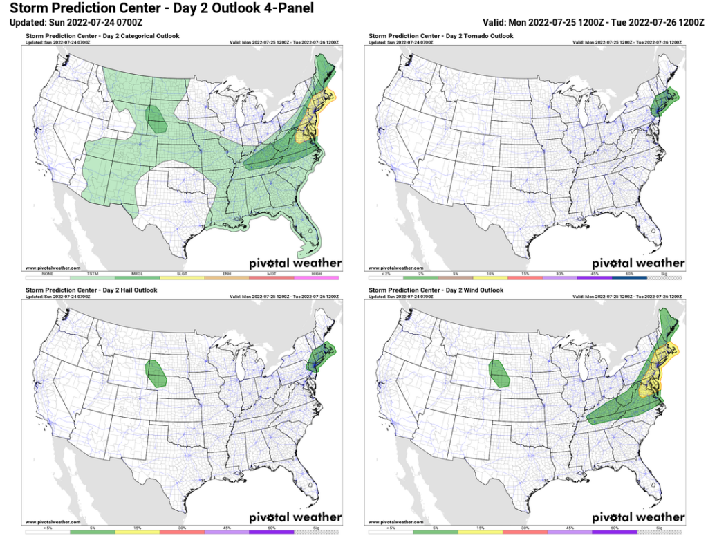
- Lightning, and a 5% probability of a damaging straight line wind event (remember our Microburst blog last Friday?), join excessive rain as Monday’s low probability hazards. Tornadoes, hail are not outlooked for us by SPC:
Wattery chances exist each day this week. Monday may be extra, also: Thursday!
- WPC has already outlooked us for excessive rainfall potential Thursday. See below.
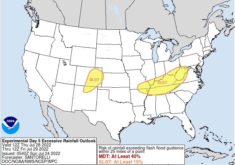
- Friday also looks quite wet.
- This does not look like a good week for my double elimination softball tournament.
Weekend Cool Down? Some of y’all’vebeen sliding up in my texter and tweeter asking about low 80°s and upper 70°s as the high temp Friday through the weekend into next week. In late July? Is Early Fall here? PSL szn upon us (#VileBrew)? Is this sus?
- Notice the Euro data, below, it’s got highs 83° Friday, 79° Sunday, 83° Tuesday, wuuuut?
- Y’all, this is not the Autumn you’re looking for.
- First, those temps will only happen if it’s raining . . . a lot . . . Thursday through Tuesday.
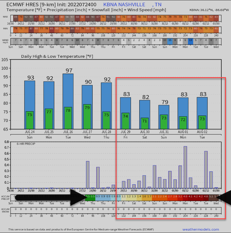
- That Euro data says 5″ of rain 6 days. If spread out sensibly, we can handle it, and we kinda need it with much of us still “abnormally dry.” If we get the rain in short heavy bursts, obv, there’s a flash flood risk.
- Caution: rainfall amount accuracy at this range not great. Sideye rainfall amount data.
- Low temps will have top of the scale (for us) high dewpoints into the lower/mid 70°s. Guh-rowse.
- Those low temps are not an autumn airmass, y’all, it’s a wet swamp.
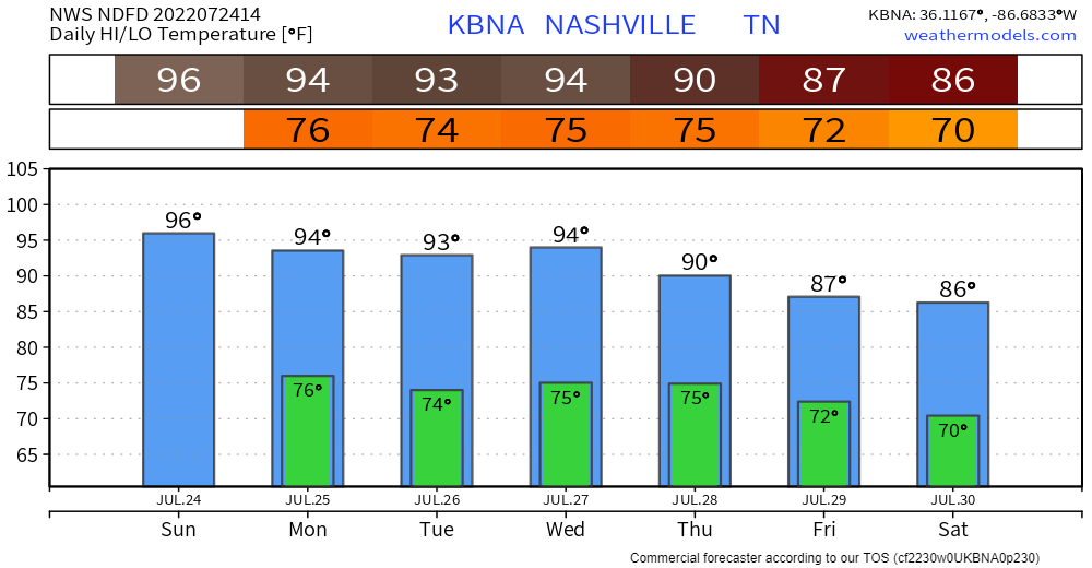
Here’s the latest NDFD 7 day temp graphic:
Quick References:
Weather changes constantly.
Follow @NashSevereWx on Twitter for any changes to this forecast.
Live coverage during tornado and severe thunderstorm warnings.

Look good.
Support the mission.

We are 100% community supported. No ads. No subscription fees. Keep it free for everyone.


Categories: Forecast Blogs (Legacy)
You must be logged in to post a comment.