

Most of the rain today stayed west. Tonight the heaviest showers will be south. Few showers possible later this afternoon and tonight:
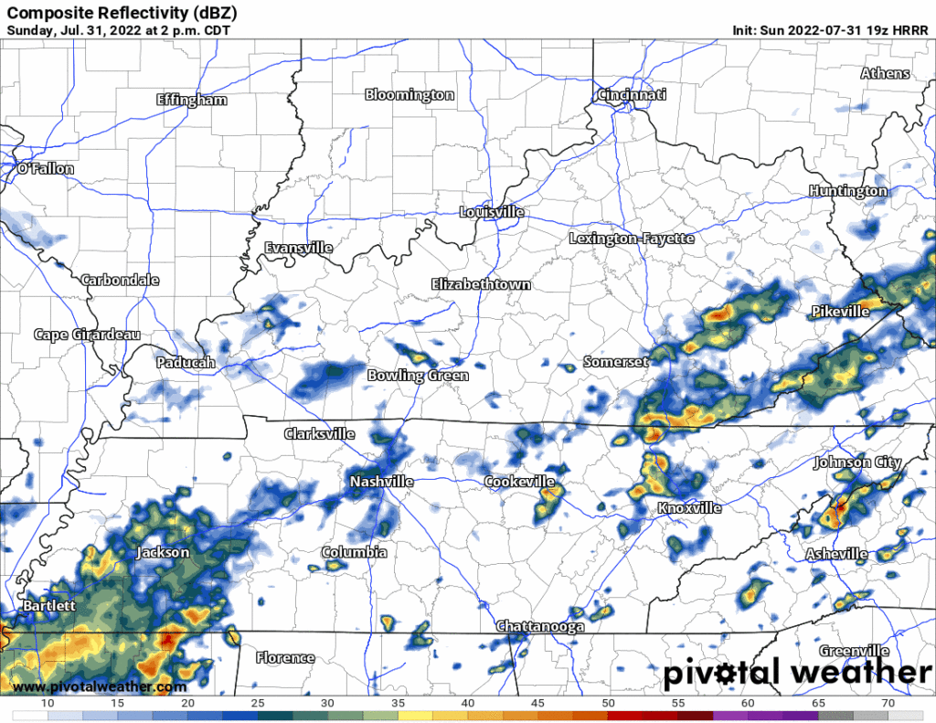
We are not worried about any severe weather.
Recently we’ve seen the heaviest rain over Will Co. and parts of Nashville south of I-40:
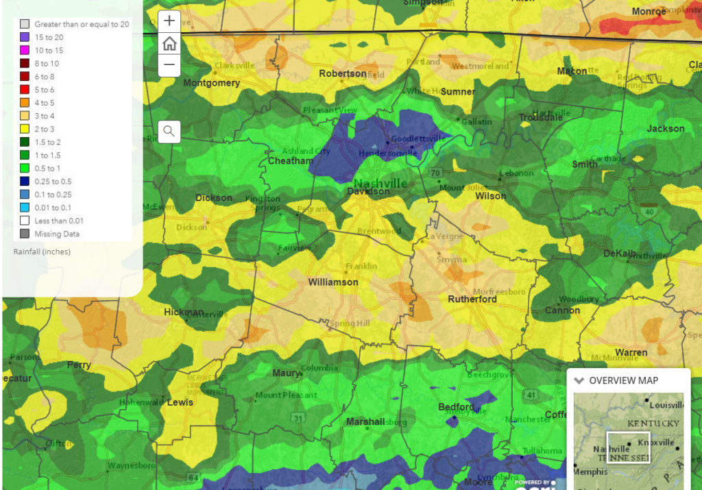
Flash flooding may be a concern if downpours “train” over those yellow areas but right now that looks unlikely.
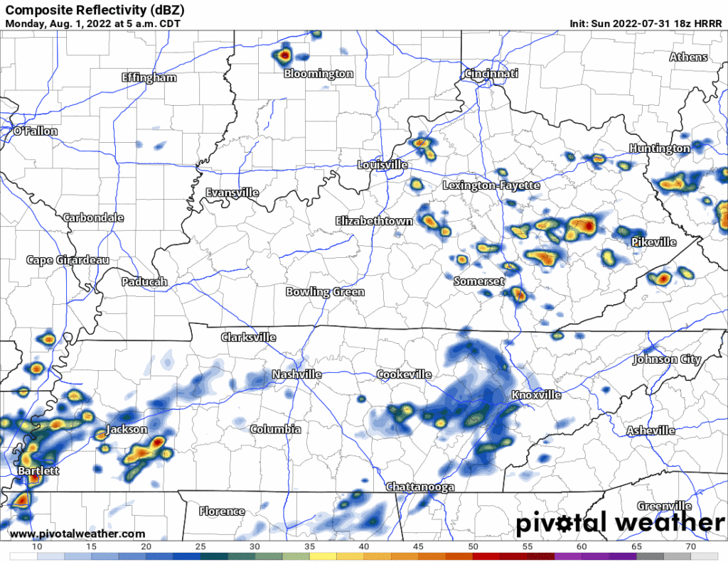
More scattered showers are possible Monday morning show up in the HRRR model above. No severe weather worries with these, maybe some unlikely, isolated flash flooding, especially if places receive a lot of rain today. These showers/maybe lightningstorms should move out by the afternoon.
Tuesday we return to more of a “summertime pattern,” which could mean many different things I suppose.
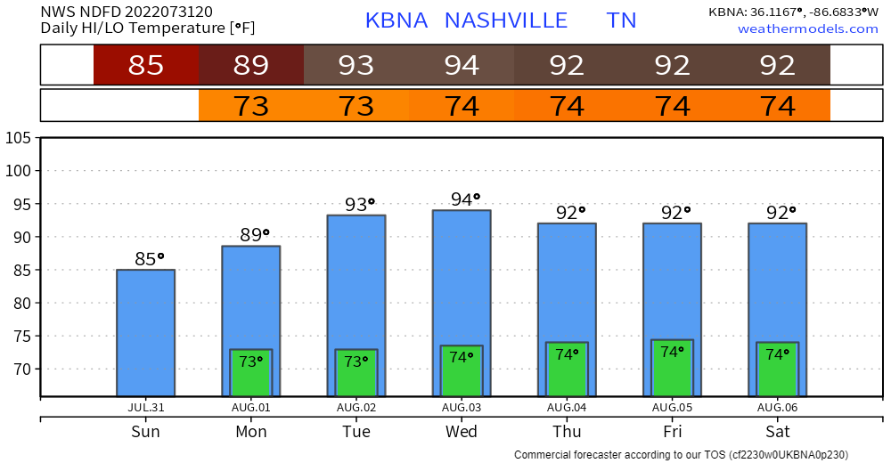
High temps in the mid 90’s paired with dewpoints in the low 70’s will send heat index values back into the low 100’s. Wattery chances daily, but very few winning tickets will be drawn. Best of luck to you and your lawn.
Quick References:
Weather changes constantly.
Follow @NashSevereWx on Twitter for any changes to this forecast.
Live coverage during tornado and severe thunderstorm warnings.

Look good.
Support the mission.

We are 100% community supported. No ads. No subscription fees. Keep it free for everyone.


Categories: Forecast Blogs (Legacy)
You must be logged in to post a comment.