

Models are like your next-door neighbors. You think they are good people, and you feel like you can somewhat trust them. But then you hear that one story about them from ’08 and you start reconsidering everything you’ve ever thought about them.
Models are usually pretty good. Some more than others. But any one of them have a hard time handling summer airmasses. If I had won that 1.3-billion-dollar lottery, I might spend a majority of my winnings trying to create a model that can. But since I didn’t win, we are forced to stick with what we got.
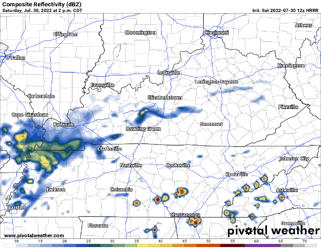
HRRR model (above) shows showers/storms staying south of us this afternoon/evening. Then another batch forming N of us and staying away. Fingers crossed for outdoor planners and Nashville SC fans, so far looks good. However, summer airmass may have other ideas. Would it surprise me if those storms formed right on top of us? Nope. But I can’t show you a model that thinks this does happen. If you are a Vancouver fan, it is going to rain all night and I would not bother going to the game.
Sunday the rain returns.
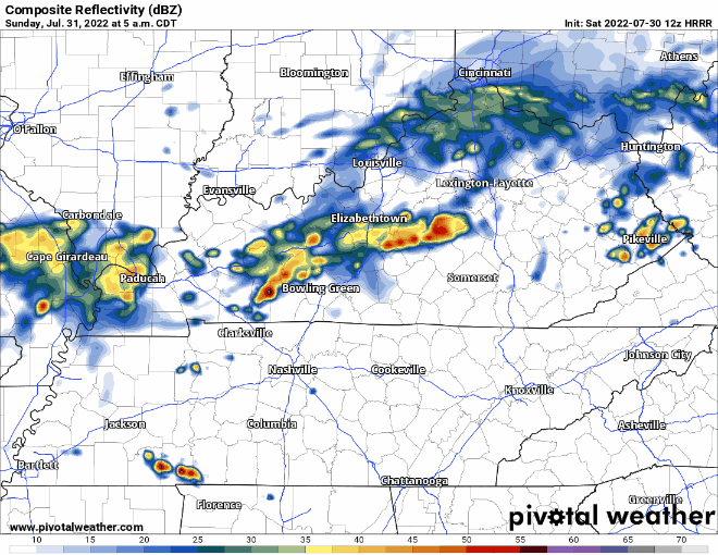
HRRR model (above) thinks showers/storms might try to disrupt your Sunday morning church or brunch but thinks most of the activity will miss us.
Then sometime in the afternoon another round of lightningstorms, H-triple-R thinks most of storms miss us to the south, but I highly doubt this is exactly how the radar looks. Fingers crossed the “floodier” rains stay to the south, but the storms don’t really listen to us, so stay tuned. We are not outlooked for any severe weather, including tornadoes.
Monday is the last day the stationary boundary will be hanging out AKA probably last day of possible “floody” rains. Looks like best rain chances morning thru the afternoon.
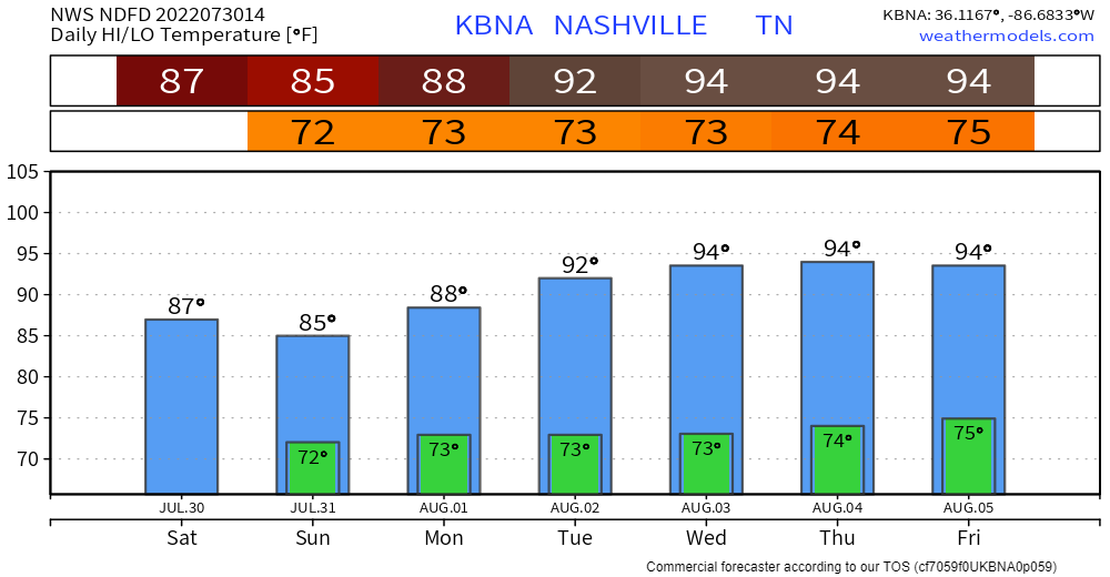
Tuesday things return to “normal”. And by normal, I mean high temps in the mid 90’s, heat index approaching 105°, and the Wattery (not as good of chances as the past several days). Typical summertime. Let’s just skip to October, maybe November just to be safe.
Quick References:
Weather changes constantly.
Follow @NashSevereWx on Twitter for any changes to this forecast.
Live coverage during tornado and severe thunderstorm warnings.

Look good.
Support the mission.

We are 100% community supported. No ads. No subscription fees. Keep it free for everyone.


Categories: Forecast Blogs (Legacy)
You must be logged in to post a comment.