There is some chance that we get a decent break in the clouds this afternoon. It won’t bring back summer, but it will be nice to see the big guy.
If we do get to see the sun, please enjoy it. It won’t be long before we’re back to 100% sky cover.

There is some chance that we get a decent break in the clouds this afternoon. It won’t bring back summer, but it will be nice to see the big guy.
If we do get to see the sun, please enjoy it. It won’t be long before we’re back to 100% sky cover.
No surprise here, but we’ve improved quite a bit in the drought department, and will likely improve even more over the coming weeks. We’re now only Abnormally Dry. We’re almost there. Let’s get out of this thing.
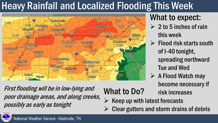
Heavy rainfall this morning caused some streams and creeks to rise, along with some minor flooding in low lying areas.
There is still a Flood Advisory for the SE portion of Williamson County until 3:45pm. If you come across a flooded road, turn around, don’t drown. You can also report any flooding you see in a tweet with #tspotter.

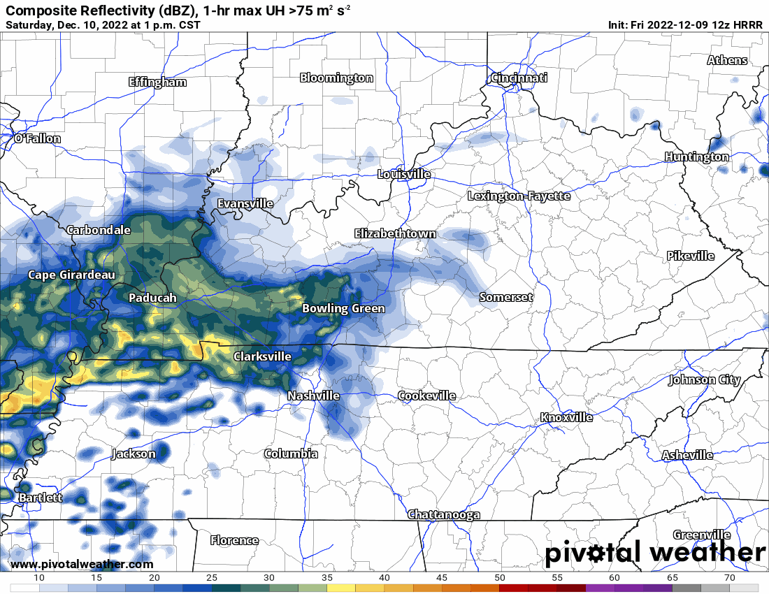
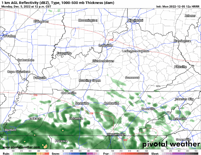
The wet week continues this morning, and will continue on and off throughout the day and into tomorrow – as shown by the HRRR model below.
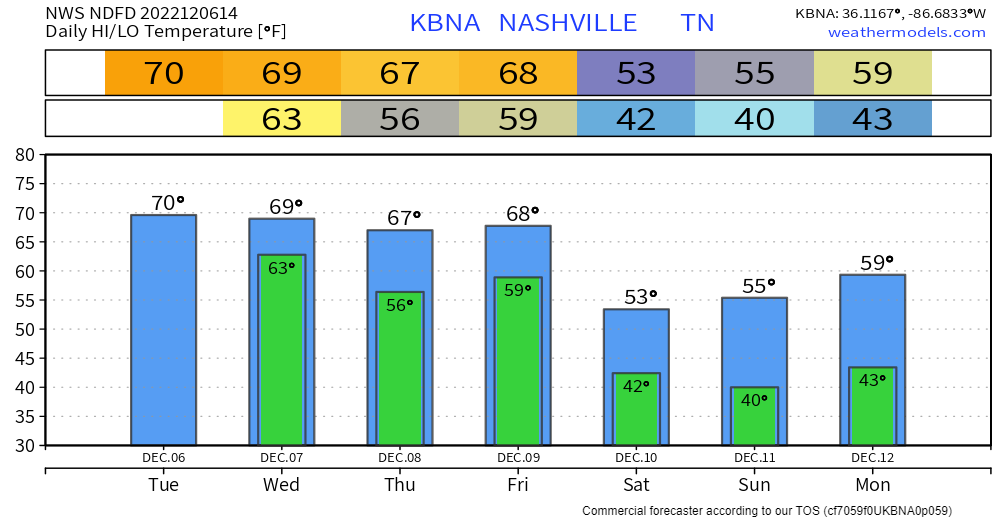
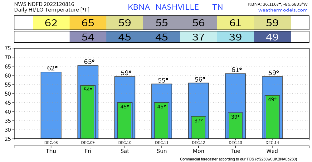
Above average temps continue throughout the week, cooling off to what we are used to for this time of the year by the weekend.
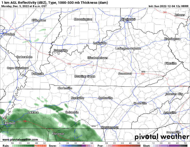
On and off rain for the week begins this morning, continuing through Tuesday and Wednesday – as shown by the HRRR model below. Heavier rainfall totals today will be south of I-40.
Temps mid-week will be above average, eventually making it back to around normal by the weekend.
Today will be chilly, with high temps only reaching the upper 40’s, but will at least be rain-free.
In between watching football and what not today, it’d be a great idea to go check your gutters and drains, chances are they likely have something obstructing them (leaves, twigs, etc.) and with all the rain coming up – it always helps when water flows where it is supposed to go.

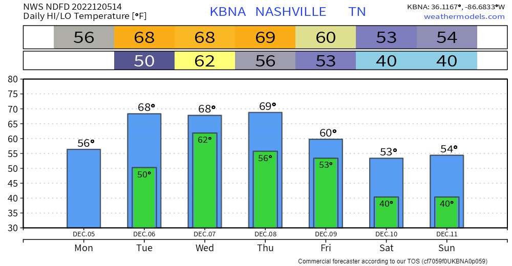
Today and likely Sunday are likely the only dry days in the next seven days, how nice….
Today won’t be the prettiest day, but at least it’ll be rain free. If you step outside now, it’ll be the “warmest” you’ll be all day as temps will gradually fall, ending up around freezing late tonight.
A rainy pattern begins today as warm, moist air moves in. Temps near 60º. Scattered showers are drifting around, but nothing substantial will fall today. Over the next few day significant rain will fall. Let’s get into it.
Was flipping through some TV Channels last night and ran across Bree Smith saying that Thursday (today) is the only day in the 7 day forecast that is free of rain chances. She’s exactly right. A rainy pattern is a’comin. But, details are pretty sketchy.

Now that the rain has moved east, the cold front that caused our story day yesterday is causing temps to plummet.
You must be logged in to post a comment.