

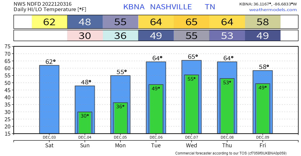
Today and likely Sunday are likely the only dry days in the next seven days, how nice….
Today won’t be the prettiest day, but at least it’ll be rain free. If you step outside now, it’ll be the “warmest” you’ll be all day as temps will gradually fall, ending up around freezing late tonight.
Besides maybe a sprinkle or so, Sunday also looks dry. Temperatures will be nippy, but at least it will be mostly rain free?
Monday the rain resumes. The Weather Prediction Center has outlooked our counties for a 5-15% chance of flash flooding. This is likely for the chance that heavy rain trains over the same area.
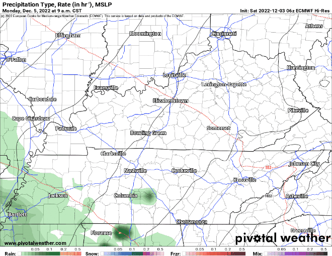
The EURO model (above) thinks rain starts about midday and continues on/off through Tuesday.
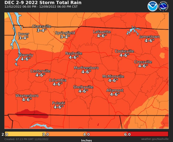
Rain chances will continue daily through at least Saturday. It’s too far out to speculate any timing for the rest of the days.
Widespread flash flooding is not likely. River flooding may begin to be a problem by the end of the week as the rain totals pile up. But flash flooding wise, if these rainfall totals are spread out throughout the week, we can handle it. We may just about completely knock out our drought with this.
At least temperatures will be fairly warm throughout the week? We may end up hearing some rumbles of thunder with the rain at the end of the week, but no severe weather is expected as of right now.
Quick References:
Weather changes constantly.
Follow @NashSevereWx on Twitter for any changes to this forecast.
Live coverage during tornado and severe thunderstorm warnings.

Look good.
Support the mission.

We are 100% community supported. No ads. No subscription fees. Keep it free for everyone.


Categories: Forecast Blogs (Legacy)
You must be logged in to post a comment.