
Heavy rainfall this morning caused some streams and creeks to rise, along with some minor flooding in low lying areas.
There is still a Flood Advisory for the SE portion of Williamson County until 3:45pm. If you come across a flooded road, turn around, don’t drown. You can also report any flooding you see in a tweet with #tspotter.
The HRRR model (below) shows little additional rainfall today, with rain chances picking back up Thursday morning and lasting on and off through the evening.
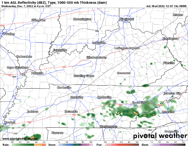
Models show additional rain chances during the day Friday and midday Saturday.
- No major flooding is expected with any of this – potentially some more minor flooding in low-lying, flood prone areas – and areas that received heavy rainfall this morning.
- Some rumbles of thunder are possible, but no severe weather is expected.
- Additional rainfall totals look to amount to 1-2″, with locally higher amounts possible.
- Sunday looks to be mostly dry, fingers crossed for the Titans game.
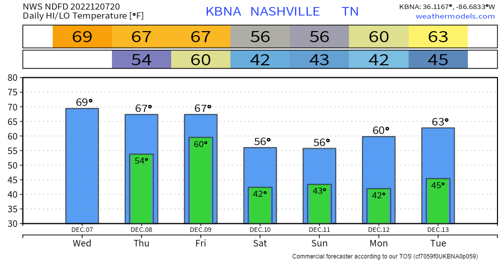
Mild temperatures will continue until the weekend, where we return to seasonal temperatures. We quickly return back to above average temperatures by Monday.
Another system looks to head to our area by Tuesday, and could bring some more heavy rainfall with it.
Quick References:
Weather changes constantly.
Follow @NashSevereWx on Twitter for any changes to this forecast.
Live coverage during tornado and severe thunderstorm warnings.

Look good.
Support the mission.

We are 100% community supported. No ads. No subscription fees. Keep it free for everyone.


Categories: Forecast Blogs (Legacy)
You must be logged in to post a comment.