
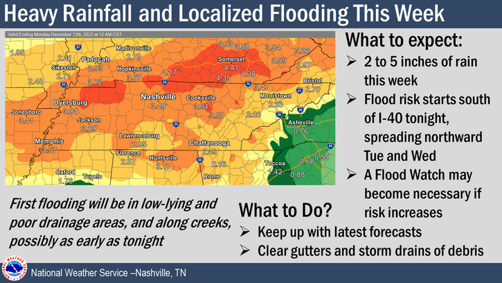
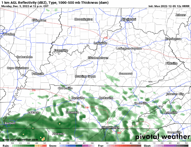
On and off rain for the week begins this morning, continuing through Tuesday and Wednesday – as shown by the HRRR model below. Heavier rainfall totals today will be south of I-40.
- Multiple rounds of heavy rain will continue throughout the week and into the weekend.
- Generally, rainfall totals will be from 2-4″, with locally higher amounts possible. In these locally higher amounts is where flash flooding risk will be elevated, along with the areas that usually flood. Unsure of where these higher rainfall totals may happen.
- NWS Nashville says a Flood Watch may be needed for areas that are believed to get higher rainfall totals – unsure if this would include our counties at this time.
- Some rumbles of thunder will be possible in the heavier downpours, but no severe weather is expected.
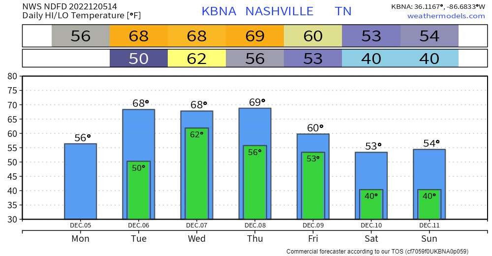
Temps mid-week will be above average, eventually making it back to around normal by the weekend.
Quick References:
Weather changes constantly.
Follow @NashSevereWx on Twitter for any changes to this forecast.
Live coverage during tornado and severe thunderstorm warnings.

Look good.
Support the mission.

We are 100% community supported. No ads. No subscription fees. Keep it free for everyone.


Categories: Forecast Blogs (Legacy)
You must be logged in to post a comment.