

Was flipping through some TV Channels last night and ran across Bree Smith saying that Thursday (today) is the only day in the 7 day forecast that is free of rain chances. She’s exactly right. A rainy pattern is a’comin. But, details are pretty sketchy.
We Still Need the Rain
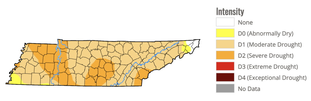
The weekly drought map was released this morning. Remember, the data cutoff for this map is Tuesday morning, so we’re sure to see improvement in next week’s map from this past Tuesday night’s big rainer. But, alas, the drought remains.
We might just knock this thing out if this happens…
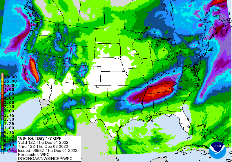
That’s the 7 day qpf (precip forecast) from the Weather Prediction Center, forecasting 3-4+ inches of rain for Middle Tennessee over the next week.
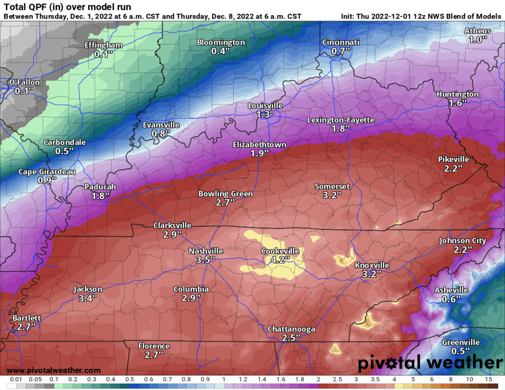
The NWS Blend of Models product agrees.
Details on Timing
This section will be short because we really don’t have much in the way of details. So, let’s just take tomorrow.
HRRR thinks we’ll see spotty light showers here and there for Friday with heavier downpours dotting the radar overnight into Saturday. Loop through 6:00 am Saturday.
After the overnight rain moves out on Saturday morning, we might get away with a nice afternoon with temps around 60 if the sun will come out.
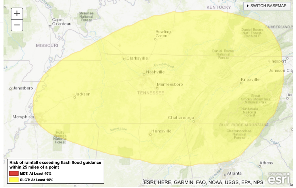
Rain picks up again on Sunday and especially Sunday night through Tuesday night. This would be the most likely time for us to experience any flooding problems. The Weather Prediction Center gives us “at least a 15% chance” of experiencing flash flooding in our area Monday morning through Tuesday morning.
Quick References:
Weather changes constantly.
Follow @NashSevereWx on Twitter for any changes to this forecast.
Live coverage during tornado and severe thunderstorm warnings.

Look good.
Support the mission.

We are 100% community supported. No ads. No subscription fees. Keep it free for everyone.


Categories: Forecast Blogs (Legacy)
You must be logged in to post a comment.