Current Radar
630 PM Update: A Flash Flood Warning is in effect for Williamson County. If you’re in the green box, my advice is to stay home.
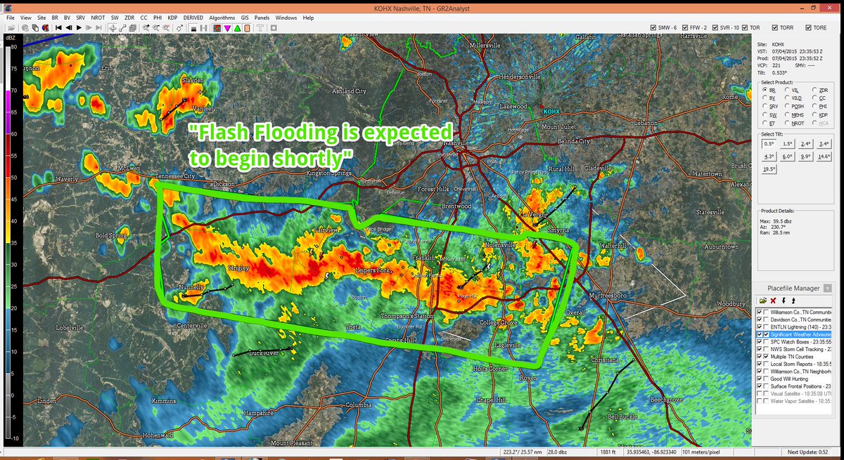
This Afternoon and Tonight – Looks Rainy
The stationary front remains north of us. Rain and storms have been firing off it as it feeds off the humid air mass overhead.