Sunny Skies Continuing through Saturday, Showers in Sight to Begin Next Week

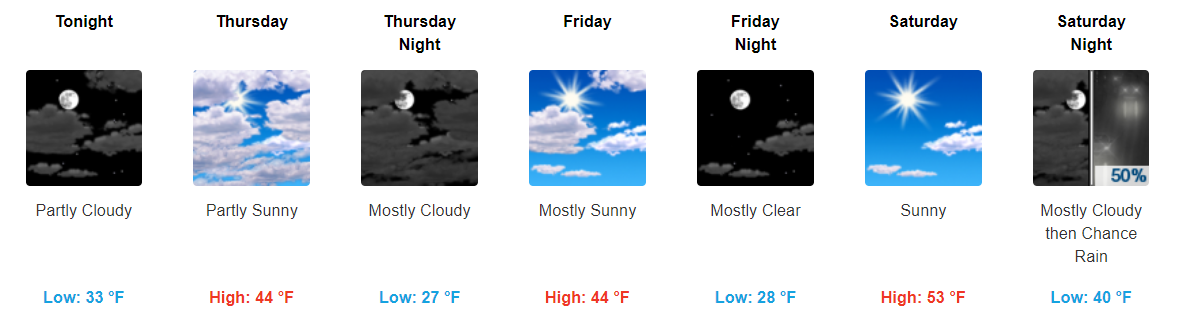
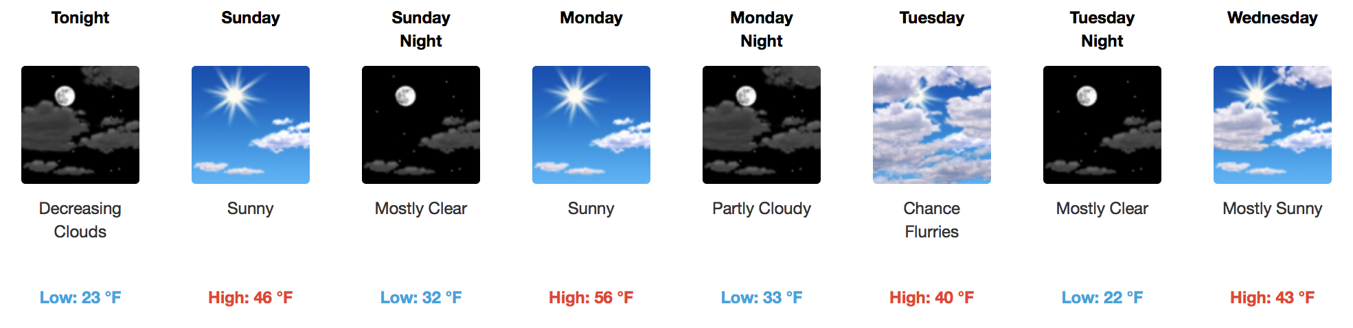
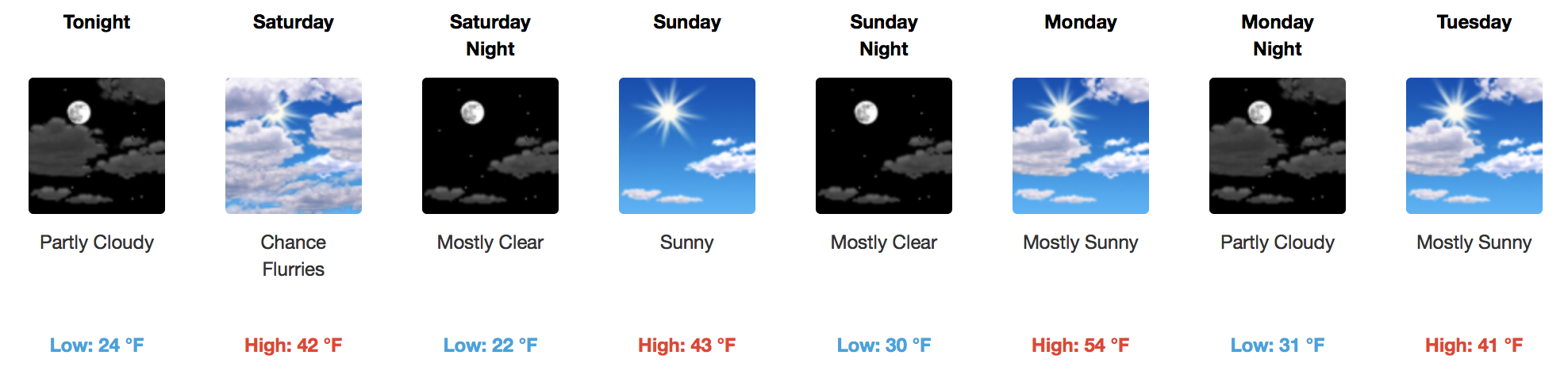
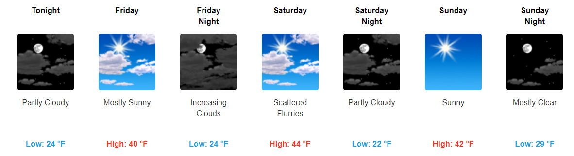
Rapid Warm Up Today, Some Gusty Winds Too

A very bitterly cold morning with the majority of us seeing temps all the way into the mid to low 20s. Luckily, these temps will continue to climb through the day into the mid-50s for our high. Plenty of sunshine will be around to help warm our temps quickly. read more

Raw, Cold Day! Sun Intermittently Before Weekend Rain

Dry Spell, Not Much Moisture To Work With

GFS Model Loop Through Sunday

Temperatures will fall after a high in the 50s on Wednesday back into the 40s on Thursday and Friday afternoons. Winds will pick up on Wednesday afternoon with the passage of a dry cold front, gusting to 25 mph. Expect variable cloudiness and a decent amount of sunshine. read more

Sunny Skies Through Most of the Week, a Couple of No-Worry Flurries Possible

Up & Down Temps This Week

Our temps will continue to stay below average through the majority of the week with a few fluctuations in high/low temps each day. Today will be, by far, the warmest day of the work week with temps reaching the upper-50s for our high. read more

A Few Not-Concerning Flurry Chances This Week; Ranting Against Apps Going All “White Christmas” On Us

Monday • 30°/56° • Warmer

Southwest wind pumping in warmer air.

Tuesday • 34°/39° • Let’s Discuss That Chance of Flurries

The afternoon forecast shift for NWS-Nashville removed our slight chance of flurries. The flurry chance is really for the Plateau, further east and at higher elevation. read more

This Week: 2 Unimpressive Chances for Flurries, Meh

Sunday • High 49°

Finally, the sun comes out. Warmer. A bit breezy. We may even reach the lower 50°s.

Monday • 23°/55°

Another cold start, but more sun, more southwest winds, therefore warmer.

Tuesday • 34°/41° • Chance of Flurries

A small area of low pressure will streak across Middle Tennessee Monday night into Tuesday morning. This will bring sprinkles and some flurries mainly across the plateau, but we could see a few flakes fly over here. read more

Sunshine Returns Sunday, Cold Remains

Sunshine is Back, A Few Clippers This Week

Highs will reach into the 40s for Sunday and well into the middle 50s by Monday thanks to a southwest wind. Our next “weather maker” arrives Tuesday with a reinforcing shot of cold air and a few flurries possible. read more

Cloudy and Cold, Some More Sun Into the Weekend

Cold Continues, Not Much Moisture To Work With

Quiet and cold conditions are in control for today with snow and wintry precipitation well to our southeast. In fact, this forecast blog is being written from snow-stricken Mississippi, where areas down yonder have accumulated nearly 6″ of white, heavy powder. read more

Cold Temps are Here to Stay

Cold Continues and Mostly Sunny Skies Remain

Cold, cold weather continues to be the main story here in Middle TN. Highs will continue to be in the low-40s through the rest of the week with overnight temps dipping down into the mid to low 20s. read more

Cool Conditions Continue. A Look at the Wintry Precip. Possibility on Saturday.

Some Sun and Some Clouds Carry Us into the Weekend

Our cooler temperature pattern looks to continue for the foreseeable future. Temps generally look to stay in the 40s for our highs, and drop into the 20s for our overnight lows.

https://giphy.com/gifs/blanket-M6VwB7tIUdZYI read more

Temperatures Plummet, Rain Ending. Sunny to Chance of Snow By Saturday.

Rain Exits By Lunchtime, Temperatures Already Falling

Radar Loop at 10:15AM

Rain is moving out and colder temperatures are rushing in! We hit 64ºF very early this morning, but ever since then, we’ve been slowly dropping into the 50s (now 54ºF at BNA). Expect this trend to continue for the rest of today as a deep, cold airmass dives southward over the next 24 hours. read more