We had a Blerg (No snow √, No sun √, Temps under 40° √) today, our first this fall.
Tomorrow, things get worse.
A cold rain is coming Wednesday, with the possibility of wintry mix/snow very late Wednesday into Thursday.

We had a Blerg (No snow √, No sun √, Temps under 40° √) today, our first this fall.
Tomorrow, things get worse.
A cold rain is coming Wednesday, with the possibility of wintry mix/snow very late Wednesday into Thursday.
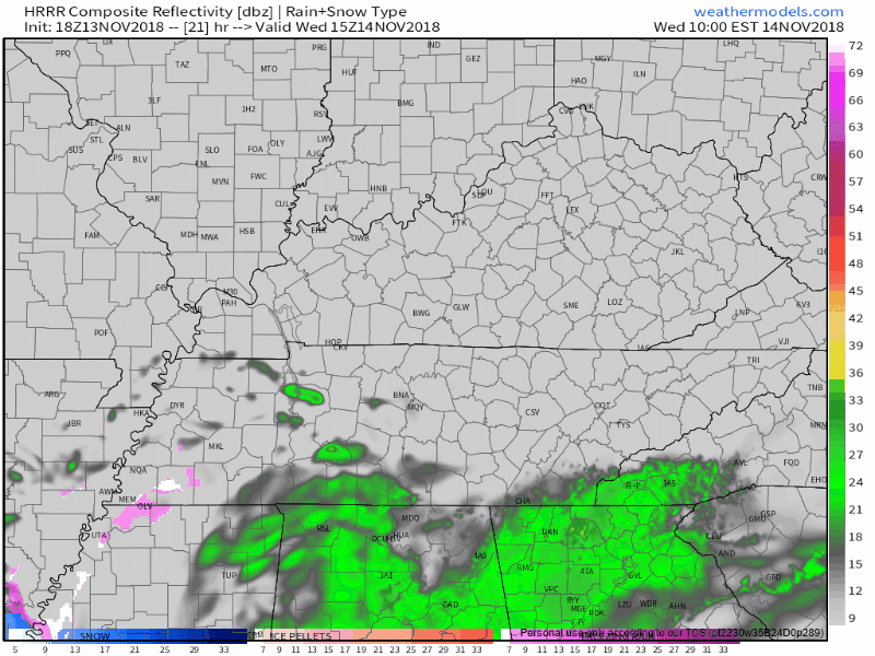
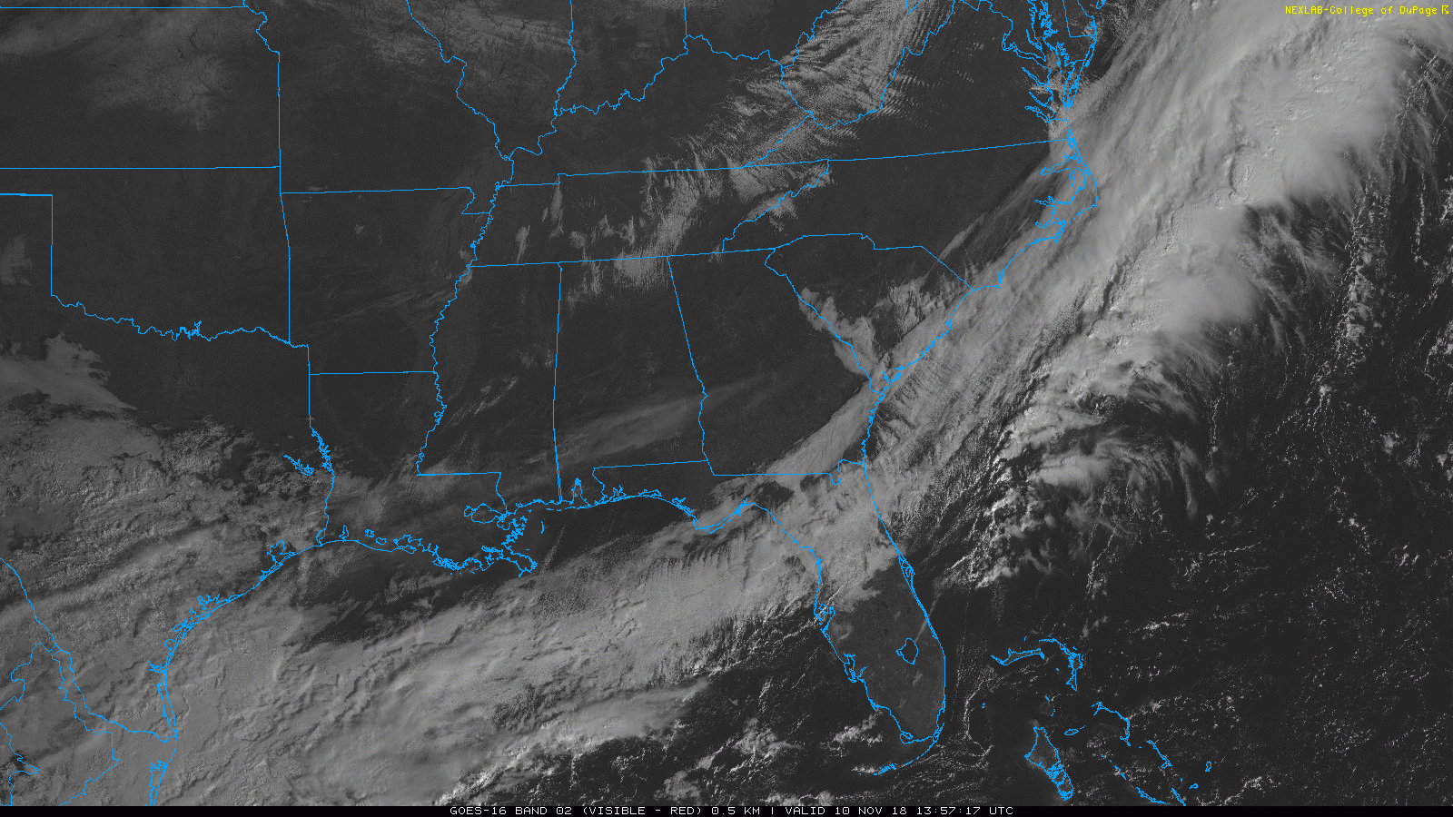
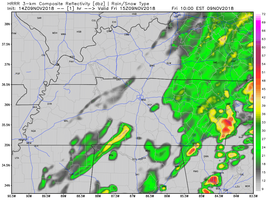
Rain moved out of Middle Tennessee, leaving behind a very cold and dry afternoon.
Here’s the departing precip per the HRRR model:
Temps earlier this morning were creeping toward 40°. They’re now dropping and should settle in the mid/upper 30°s throughout the afternoon. The wind is strong today, blowing around 10 MPH and gusting stronger than that, keeping wind chills at and below freezing today and certainly tonight and overnight. Temps should drop below freezing after midnight, with a pre-dawn low Wednesday of 31°.
Gross. It’s been a cold rainy day with temps stuck in the 40s.
those S of I-40 my have seen a half inch of rain today. However much was in your rain bucket, it was enough to make it feel pretty nope outside. Drizzle/fog will continue overnight.

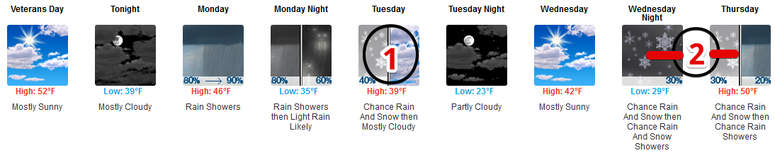
The afternoon NWS-Nashville forecast removed Tuesday and Thursday snow chances for Nashville and Williamson County.
This morning’s comic strip forecast:
This afternoon’s comic strip forecast:

Tornadoes were the topic one week ago. Today, snow chances. Don’t get excited.
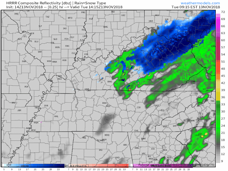
Rain is likely Monday morning.
ETA: after the Monday morning rush-hour, according to the extended HRRR model:
High pressure has moved into the Midstate, mixing out any remaining clouds.
And it is COLD! High temps today will struggle to reach the low 40s, overnight temps will easily drop into the mid/upper 20s.
This morning’s showers are going to hang around for a few more hours and that is going to keep our high temperatures well below average for this time of year.
We will top out at 51º this afternoon, however, that will not be right before sunset as usual. The high temperature will occur right before the passage of our latest frontal boundary between 2-5 PM.
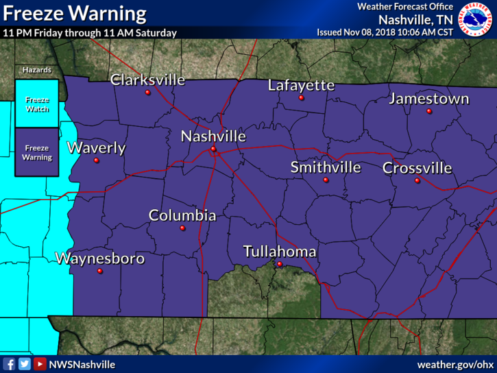
Friday’s overnight temps could fall into the mid/upper 20s, bringing a hard freeze to Nashville.
Afternoon rain chances are low ahead of another cold front slated to push through the midstate this evening.
A wet and cool afternoon is the story of the day here in Nashville. We are still watching the light rain traverse the area from west to east. High temperatures will struggle to reach 60º this afternoon with cloudy skies overhead. The rain will be exiting by midnight. Keep an umbrella handy through the day.
The clouds and storms are gone. As details about the tornado outbreak last night arrive, we’ll post them to Twitter.
Weak surface ridging will build in this afternoon and tonight – therefore, no rain, high temps this afternoon in the upper 60°s. Temps will fall into the upper 40s by sunset.
You must be logged in to post a comment.