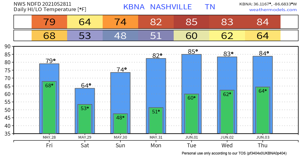
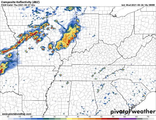
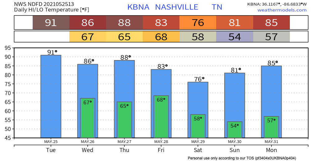
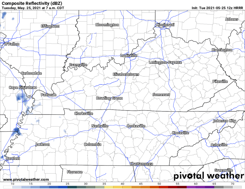
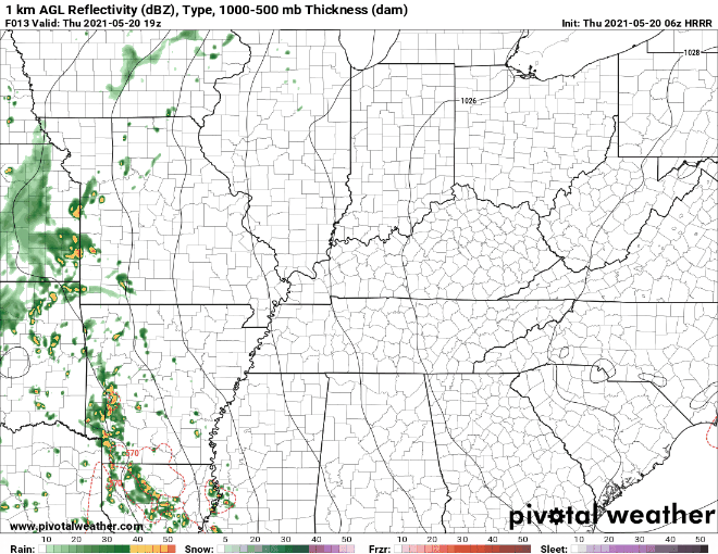
A cold front moving across the southeast will bring AM storms and rain to our area today. The HRRR has rain directly over Williamson and Davidson counties at 9 AM. Storms and heavier rain will follow, so be prepared for not so great weather through 3 PM.
Category: Forecast Blogs (Legacy)
Cold Front Inbound, Brings Along Rain/Storms
On and Off Rain for Wednesday and Friday
Looks Like Rain Wednesday, Likely Also Friday, With Rising Humidity.
Hot! Hot! Hot!
Today is going to be, if the title didn’t give it away, hot. And also dry.
Code Orange Air Quality Alert
We’re currently under an advisory until midnight for the ozone levels at the surface. High concentrations of ozone can be unhealthy. The code orange means that although the general public probably won’t be affected, people with respiratory diseases like asthma, or people who spend a lot of time outdoors, such as marathon runners or construction workers, should try to limit their outdoor physical activity, especially during the middle of the day when the sun is the strongest.
Warming Trend Continues, No Rain in Sight
Heat Wave on the Way, but Have no Fear

Friday and The Weekend
Temperatures are on the rise, and will continue to do so throughout the weekend. Above average temperatures are expected and there is a possibility for record highs, specifically on Sunday.
That unbreathable humidity reminiscent of the Tennessee summer will not yet be in full effect, making more comfortable to be outside than say, Late July.