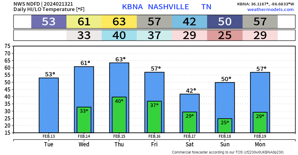
After quite the interesting night, today turned out nicely with high temps getting up into the low to mid 50s.
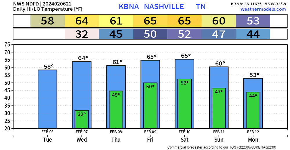
Wednesday and Thursday will be lovely with high temps reaching into the low 60s. Cold mornings to deal with tho.

After quite the interesting night, today turned out nicely with high temps getting up into the low to mid 50s.
Wednesday and Thursday will be lovely with high temps reaching into the low 60s. Cold mornings to deal with tho.
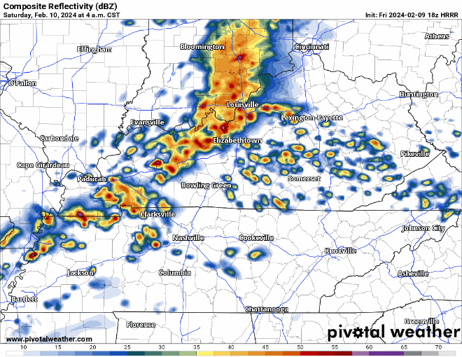
Changeover from rain to a mix of rain/sleet/snow currently happening in some areas.
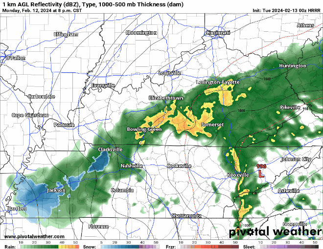
HRRR model (above) suggests that a mixture of frozen precipitation may fall for a few hours tonight, but we have reason to believe that very little, if any of it will stick.
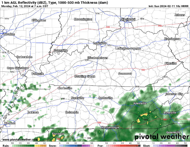
Rain is currently missing us to the south, and we should be able to get by with a dry evening. A few of us could see a brief shower though.
Rain chances pick back up tomorrow.
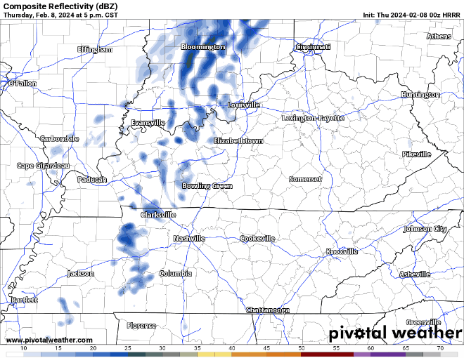
HRRR model (above) shows:
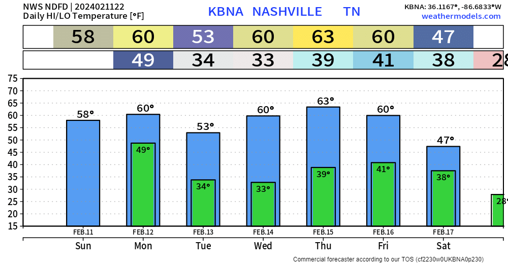
Tuesday, we dry out and will have cold mornings and mild afternoons throughout the work week. No rain chances until maybe late week.
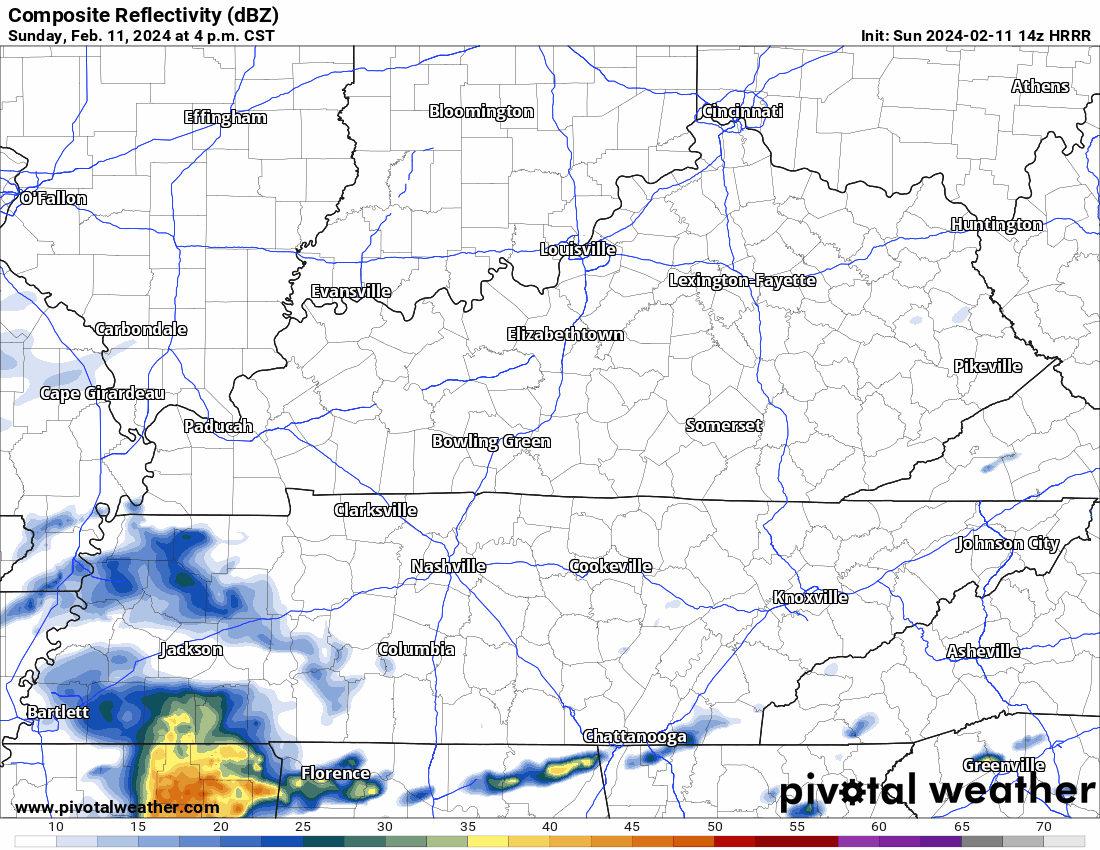
Rain misses us south during the Buper Sowl (I don’t think you’re allowed to say it unless you’re an official sponsor which we are /checks notes/ not). HRRR model below.

Monday
Surface low – the 997 red R below – passes overhead. Off/On morning and afternoon rain. No flood concern.
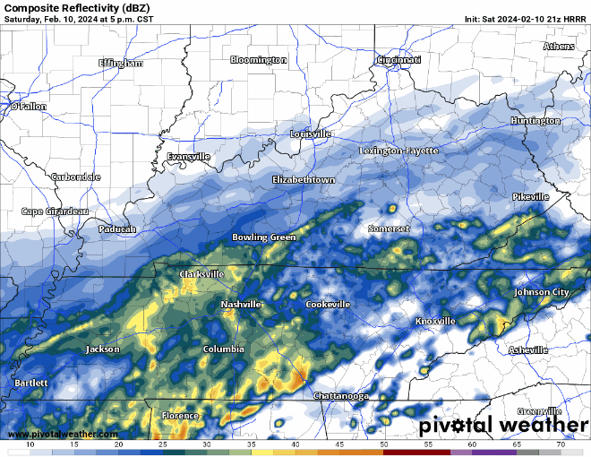
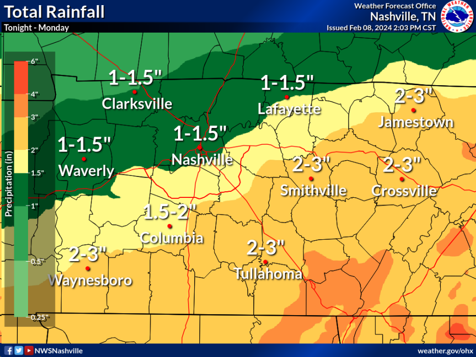
Rain, rain, and more rain expected today. Thankfully, we should be able to avoid any thunderstorms.
HRRR model (above) shows rain continuing throughout the remainder of today, ending before Sunday morning. No major flooding concerns, but flood-prone places could see some minor flooding.
We’ve been dodging rain/t-storms today and will continue to do so for the next while before rain clears out for the night. I think most evening/night plans will be dry, but having a rain jacket on standby would be nice.
Besides a few showers, fairly nice, but windy day. Today was our last nice-day weather wise for a hot minute.
Rain chances ramp up tomorrow and stick around for the weekend.
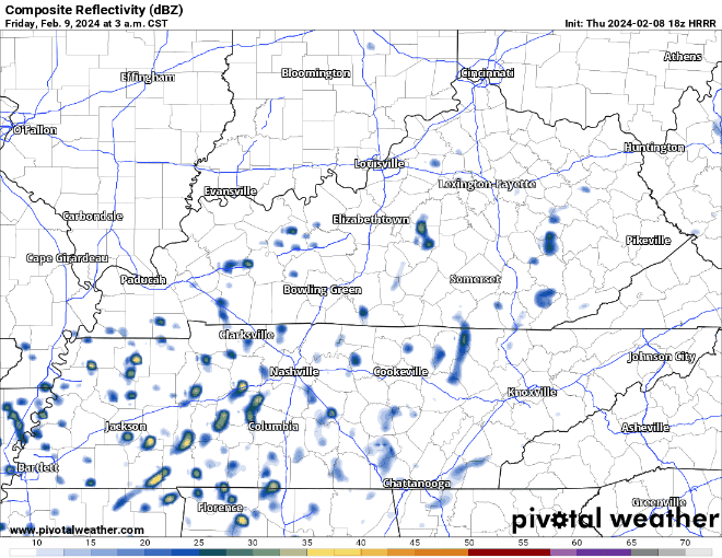
HRRR model (above) shows the sporadic nature of the showers/non-severe t-storms throughout Friday.
We had a wonderful day today, but unfortunately all good things must come to an end.
At least the first half of Thursday will be nice, but rain chances start to creep in as we hit the PM hours and stick around for the weekend.
We didn’t quite make it to 60° today, but with plenty of sun we still had a beautiful day.
Wednesday will be even warmer, with high temps in the mid 60s with plenty of sun.

First half of Thursday will be nice, with high temperatures returning to the low 60s.
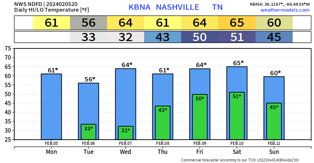
High temperatures running 10-15 degrees above average this week + dry until Thursday PM =
Remarkable start to the month.

All quiet until Thursday PM.
“A series of shortwave troughs…will bring us several waves of rain and a few thunderstorms throughout the extended period.” – NWS Nashville
You must be logged in to post a comment.