
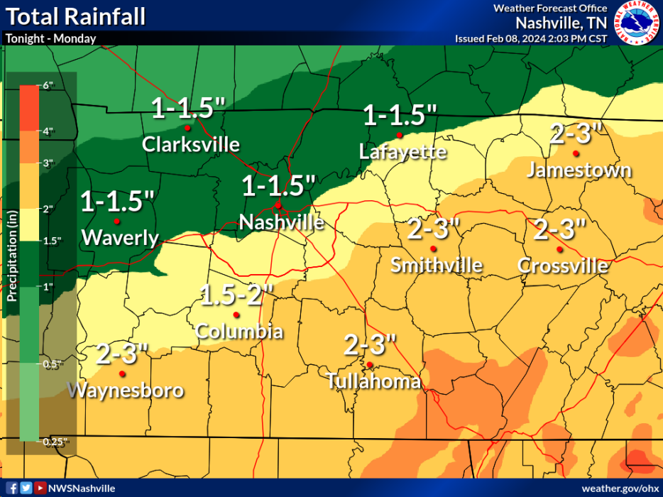
Besides a few showers, fairly nice, but windy day. Today was our last nice-day weather wise for a hot minute.
Rain chances ramp up tomorrow and stick around for the weekend.
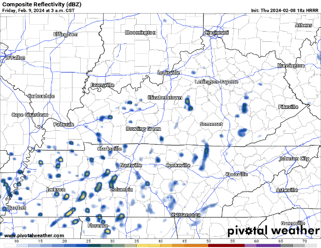
HRRR model (above) shows the sporadic nature of the showers/non-severe t-storms throughout Friday.
- “Most models are indicating off and on showers through much of the day tomorrow, with a few isolated thunderstorms in the mix. Some of these thunderstorms could lead to periods of heavy rain, but widespread flooding isn’t a concern at this point.” – NWS Nashville
- Specific ETAs will be hard to nail down with the isolated nature of the rain, keeping a rain jacket on standby will be a good idea
Saturday will be more of the same.
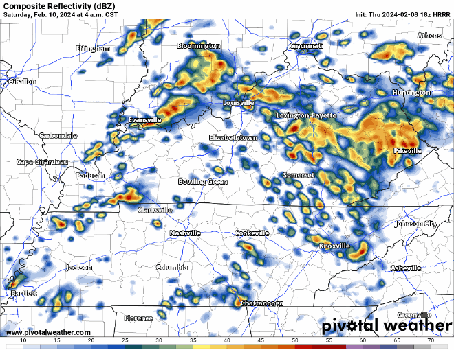
HRRR model (above) only goes out until noon Saturday, but shows the possibility of more on/off rain with maybe a thunderstorm mixed in.
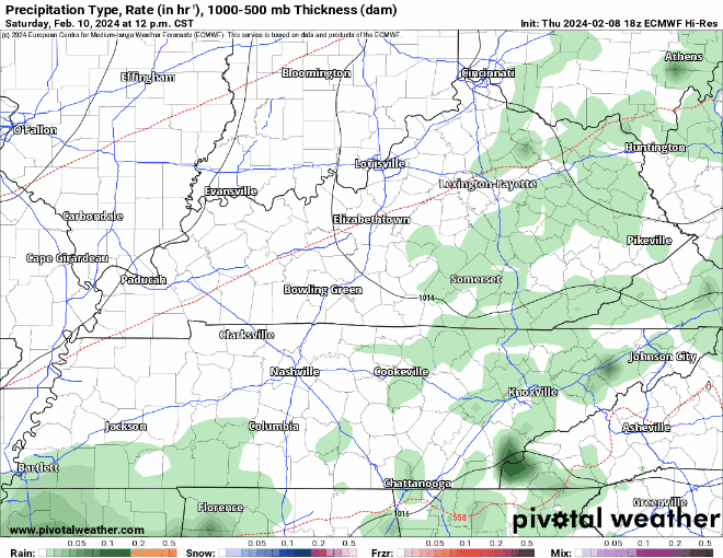
Switching over to the Euro model (above), showing another rain of heavy rain moving in Saturday evening,
- “Looks like the two periods of heaviest precipitation will likely be Saturday morning as well as Saturday evening into Sunday morning.” – NWS Nashville
- Still no severe weather expected with this round, maybe a thunderstorm or two
We should get a break Sunday afternoon before, yet another rain of rain moves in Sunday evening, with chances lasting thru Monday.
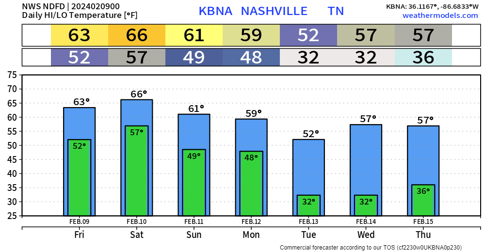
High temperatures over the weekend will remain in the 60s, before cooling down a bit into the 50s by next week.
Categories: Featured Blog