9:00 AM Update
We have new forecast graphics.
Looks like a pretty nice day! Keep reading.
Snow ETA is 6 PM to 9 PM, but could be as low as 5 PM. Rain should begin before then (around 4 PM or so).

9:00 AM Update
We have new forecast graphics.
Looks like a pretty nice day! Keep reading.
Snow ETA is 6 PM to 9 PM, but could be as low as 5 PM. Rain should begin before then (around 4 PM or so).
Current Official Hourly Observation:

9:38 PM NWS Forecast Discussion
9:30 PM Update
The models continue to do some
GFS only gives us a dusting through Monday at 6 AM:
Current Official Hourly Observation:
Today – Sunny & Breezy – Afternoon High 46
9a 29 . 12p 40 . 3p 45 . 6p 42 . 9p 40
This is the calm before the storm.

Consider today your prep day:
Current Official Hourly Observation:
Tonight – Clear & Cold – Midnight Temp 23
Wind chills will drop into the teens tonight. Those will seem warm compared to what’s up ahead…
At 3:05 PM, our NWS issued a Special Weather Statement titled “Anywhere from 1″ to 4″ of Snow Possible Sunday Afternoon and Evening.” The 4″ is more likely for the plateau and counties north of Davidson Co. Click here to read the statement. Much of what it says is covered below.
Latest Official Hourly Observation:
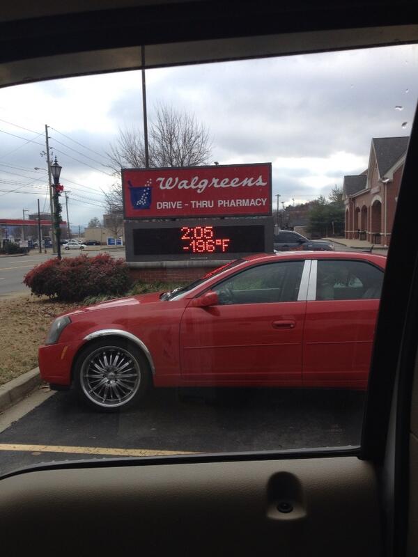
@KeelyHall tweeted this photo of a supercold spot in Brentwood today:
Tonight – Light Snow & BRRR – Midnight Temp 22
Attention snow lovers and non-lovers alike. A special weather statement has been issued by our NWS.
Latest Official Hourly Observation:
@KeelyHall tweeted this photo of a supercold spot in Brentwood today:
Tonight – Light Snow & BRRR – Midnight Temp 22
Attention snow lovers and non-lovers alike. A special weather statement has been issued by our NWS.
Latest Official Hourly Observation:
Tonight – Chilly Rain – Midnight Temp 41
HAPPY NEW YEAR EVERYONE!
Rain is starting to move into Middle TN tonight. It’s too warm for it to fall as snow.
This afternoon’s weather “is the warmest we’ll see for quite a while.” (NWS).
Thursday
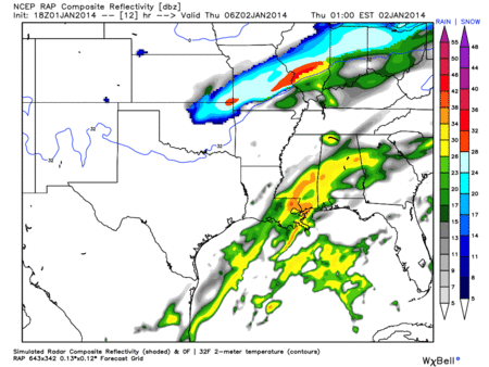
The RAP shows the rain-changing-to-snow approaching tonight, Midnight to 6 AM:
Most of the rain will fall before the freezing line pushes through:
Latest Official Hourly Observation:
Tonight – Cold & Clear
6p 38 . 9p 33 . 12a 31 . 3a 29
Cold, but not too bad.

New Year’s Day – Mostly Sunny, Warmer, Rain Very Late – Morning Low 24 / Afternoon High 51
You must be logged in to post a comment.