
Latest Official Hourly Observation:

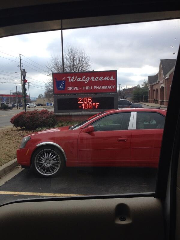
@KeelyHall tweeted this photo of a supercold spot in Brentwood today:
Tonight – Light Snow & BRRR – Midnight Temp 22
Attention snow lovers and non-lovers alike. A special weather statement has been issued by our NWS.
@PanicCatfish get ready for this!

Moisture has eased in on the backside of this system, causing light scattered snow showers.
No one saw this coming, not even our beloved HRRR model. We will see if anything shows up on the next run.
Up to an inch of snow along and east of I-65 is POSSIBLE.
This will mainly be on elevated grassy surfaces. Less traveled roads could become snow covered. Take it slow, some slick spots will be developing as temperatures continue to drop.
The winds that accompany the cold air behind the front will drive wind chills into the single digits tonight.
Check out HRRR model winds Thursday 6 pm – Friday 3 am (Blue 11+ mph, Green 23+ mph) :

Friday – C-O-L-D & Mostly Clear – Morning Low 15 / High 30
6a 18 . 9a 21 . 12p 26 . 3p 28 . 6p 26 . 9p 24
Wind chill of 6 in the morning!
*The Intern Has Something Personal To Share* — Y’all got nothing on me! I am in Montreal, Canada. My high today was -13, with wind chill values of -42 to -33 so enjoy your “warm day”. Yes, I am frozenly jealous. *End*
Friday’s wind chill is not forecast to get above 26.
Saturday – Warmer; Rain Very Late – Morning Low 18 / Afternoon High 45
6a 22 . 9a 30 . 12p 40 . 3p 45 . 6p 42 . 9p 39
Thankfully, a warmer day once we get past the wind chill of 13 at 6am.
Rain/wintry mix chances begin after midnight.
Extended Official NWS forecast:

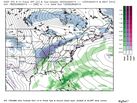
Sunday – It May Snow
The GFS model below is certainly a believer. It gives us 1.5″ of snow.
Canadian model is snow-stingy. It thinks we will stay almost all rain, with maybe a dusting on the back end, similar to what we kind-of saw this morning. It dusts us with 0.7″.
GFS model Sunday 6 am – Monday 6 am:
There is still a lot of time between now and Sunday. Keep checking back for updates as we get closer. It’s a snow forecast so it’ll probably change another 17 times.
FRIGID Next Week – We’ll see the coldest temps since 1996:
Monday morning 9°, wind chill 4°.
Monday afternoon’s high 14°, wind chill -4°.
Tuesday morning 3°, wind chill -3°.
Tuesday’s afternoon high 18, wind chill 2°.
Those “-” are minus signs.

RIP Uncle Phil
Questions? We’re on Twitter @NashSevereWx.
Categories: Forecast Blogs (Legacy)
You must be logged in to post a comment.