
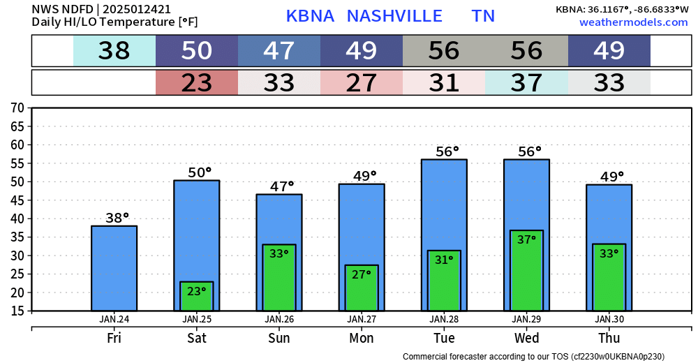
After today, it’s all warm.
High temperatures will be 20+ degrees above average, getting close to our daily record highs on Monday, Wednesday and Thursday.
Our start to February will feel more like April.

After today, it’s all warm.
High temperatures will be 20+ degrees above average, getting close to our daily record highs on Monday, Wednesday and Thursday.
Our start to February will feel more like April.

Showers/storms have moved off to our east – leaving us with a dry rest of the weekend.
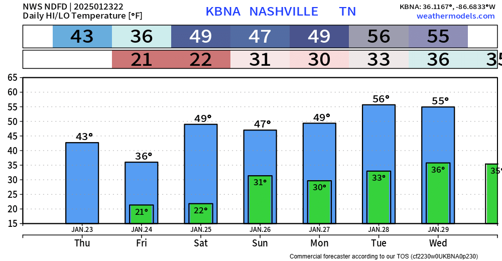
Relative to the rest of the forecast, Saturday will be cool. However, 53° is still ~5° above average.
Starting Monday thru at least Thursday, we’ll be 20 to 25 degrees above(!) average. This will lead to us getting very close to daily record high temps. February making quite the entrance.

There’s been about half an inch of rain already measured at BNA so far, with more on the way.
HRRR model (above) thinks rain continues on/off throughout the night, tapering off near the AM commute. Not a bad idea to have rain jackets handy in the morning. Can’t totally rule out a rumble of thunder overnight, but it’s unlikely.

Rain is expected to move into the area Thursday morning, some break during parts of the afternoon and evening, then more soaking rain overnight Thursday into early Friday AM. Not expecting any thunderstorms, just rain. Rainfall totals low enough to keep our flooding threat very low, although some low-lying areas could see some ponding.

Most of us reached the upper 50s today, and we’ll continue the warmer trend throughout the week. Highs sticking close to average, if not a little above average.
We get a break from the freezing temps for the foreseeable future – but we certainly aren’t done with the freezing temps. Our average last freeze isn’t until March 8.

We are back to near average temperatures, and we’ll stay there for the remainder of the week – even getting above average several days. We’ll get a break from freezing temps for at least a little bit starting Thursday/Friday.

The Dry Air Monster is eating most of the moisture right now, but it will eventually get full, and we’ll see some showers overnight. HRRR model demonstrates how it might go down.
You might see a few flurries if you wake up early enough Monday morning, but no accumulation is expected. Most of the activity should be outta here by Monday AM commute time. Rainfall totals generally 0.25″ or less.

We are finally back in the 50s – the first time we’ve been this “warm” in 7 days. Only the 7th day this month we’ve seen 50°, it’s been a cold one.
Temps will be fairly consistent over the next week or so. Right around average for this time of year, with the exception of Tuesday and Wednesday.
We’ve been below average for the majority of the start to January. If it seems like every morning has been cold, you’d be right on.
We’re finally getting back towards average for this time of year (highs upper 40s, lows around 30°), and we’ll even get above average by next week.
You might see a few flurries tonight – these would be no-worry-flurries, no accumulation expected.
Temps tonight/tomorrow morning will still be cold, just not as cold. We’ll bottom out around 20° for the next 2 nights.
You must be logged in to post a comment.