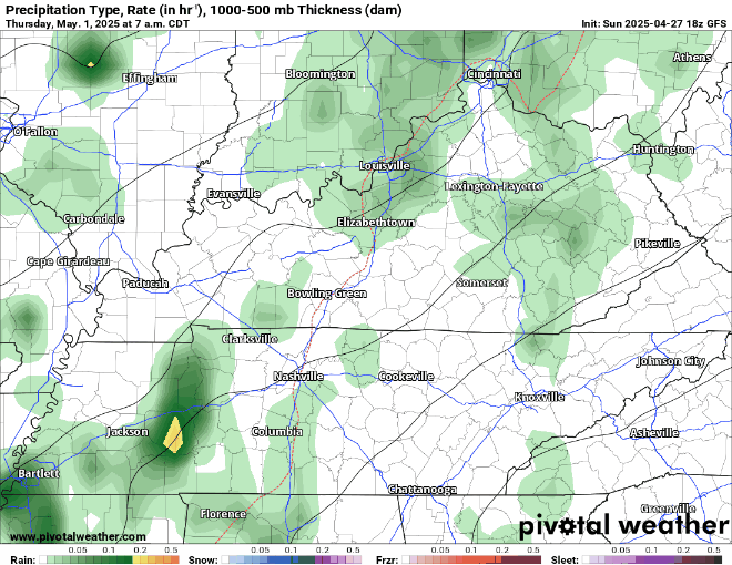
Models have sorta backed off on our rain chances for Monday, Tuesday, and Wednesday – although chances still exist.
HRRR model (amongst others) think we stay dry on Monday. A stray shower can’t be ruled out though.

Models have sorta backed off on our rain chances for Monday, Tuesday, and Wednesday – although chances still exist.
HRRR model (amongst others) think we stay dry on Monday. A stray shower can’t be ruled out though.
Great weather instore for the remainder of the weekend. No rain chances + warm.

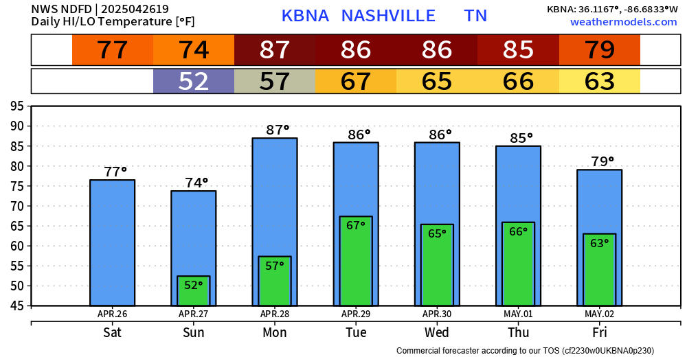
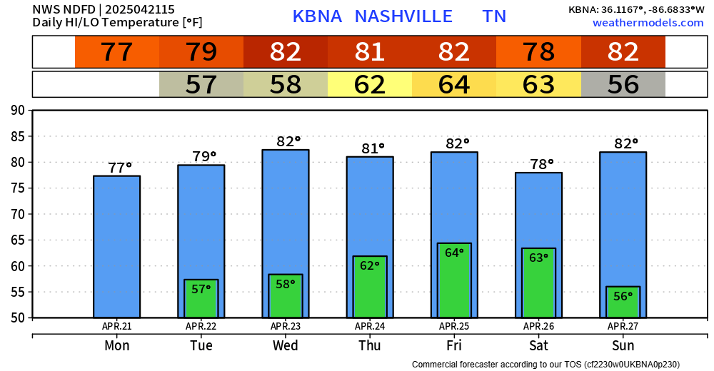
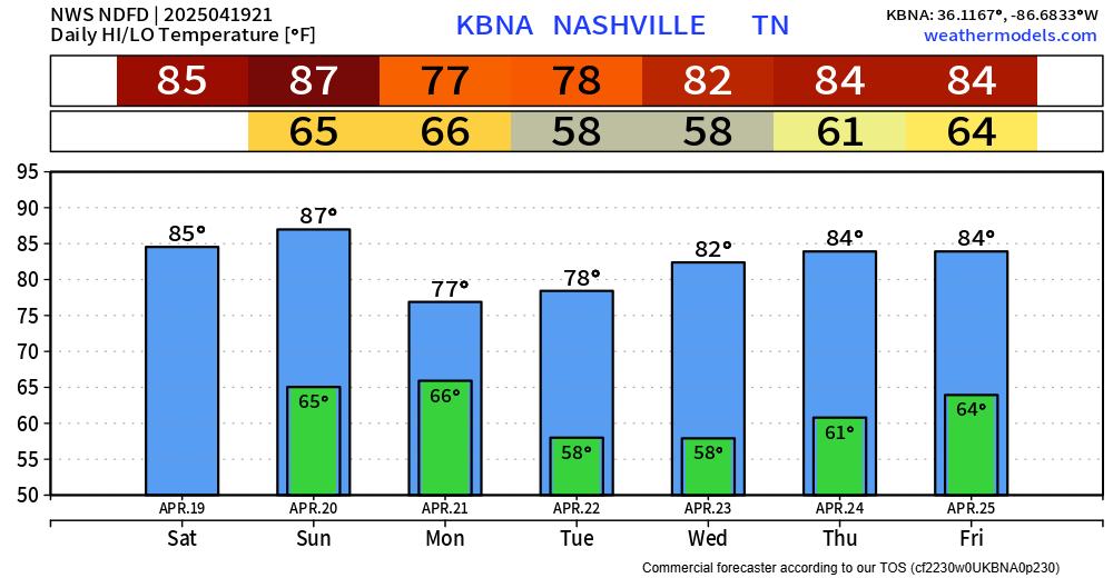
Temps quickly climb up into the mid to upper 80s by Monday and will stay there for several days. We could get close to a couple daily record highs.

While you probably won’t need a light jacket, you probably could use a rain jacket today.
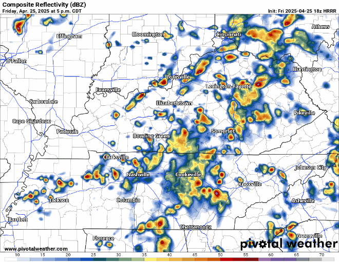
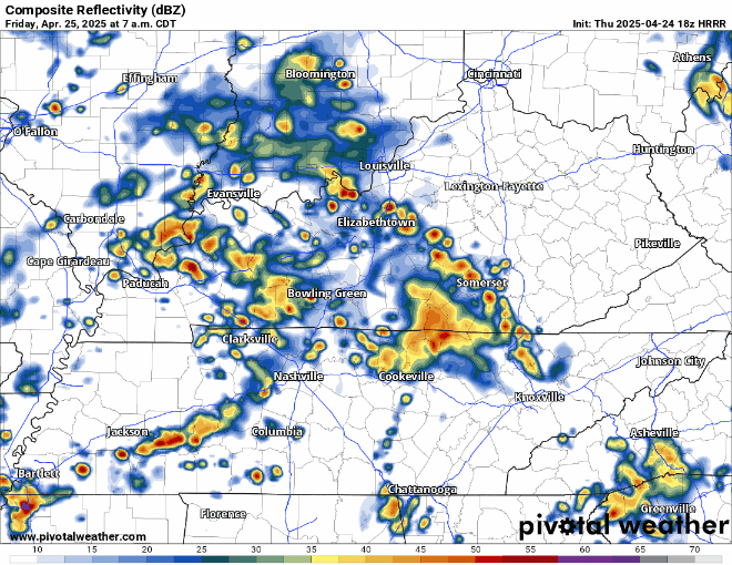
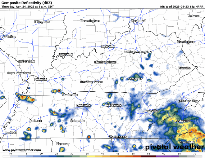
Scattered showers/storms will continue to move thru our area until tonight. Impossible to know exactly when and where, it’s more a Wattery type deal. Rain gear nearby will be helpful. HRRR tries its best below:
We’ve been dealing with a summerlike pattern these past couple of days – and this will continue thru Friday, bringing us more Wattery chances today and Friday.
Most of us have already seen rain today – some a decent bit. More random, scattered showers/storms will be possible thru the evening. Isolated flash flooding will be possible under the heaviest downpours. Turn around, don’t drown. You can view the radar anytime on our website here: Radar | Nashville Severe Weather
Although each afternoon/evening will have rain/storm chances thru Friday, chances will gradually increase from today to Thursday, peaking on Friday.
Blanket statement: no severe weather is expected, although you may see a decent thunderstorm one of these days.
Rest of today and majority of Wednesday should be dry. I wouldn’t be totally shocked if a few of us saw a quick shower Wednesday afternoon/evening – but think majority of folks should stay dry.
A quick shower will be possible over the next hour or two, but the majority of the day should end up dry.
Tuesday should be dry, along with the majority of Wednesday – but a shower or two isn’t totally out of the question.
Great weather on this Easter Sunday. High temps will creep up into the mid 80s over the next few hours. Chocolate may melt a bit in eggs if not found quickly.

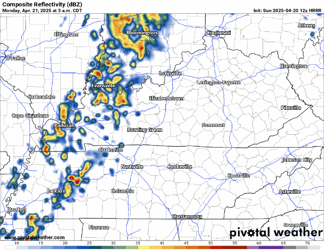
Rain chances return to the forecast starting Monday morning. No severe weather – maybe a rumble of thunder or two. Rain should exit by Monday afternoon, HRRR guesses below:
High temps only made it to the low 80s today due to some high-level clouds.
Tomorrow on Easter we’ll have another chance to make it up into the mid 80s. Our record high for April 20th is 87° – so at least a tie of the daily record high seems like a good bet.

Winds have died down a bit, but some additional gusty winds are possible thru this evening.
Saturday weather looks great. Dry with highs in the mid 80s – about 10° above average for this time of year.