
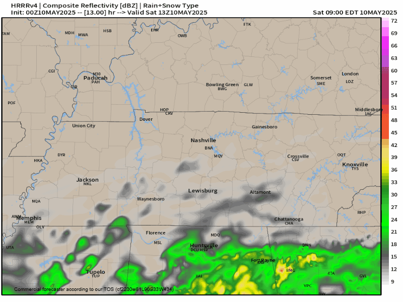
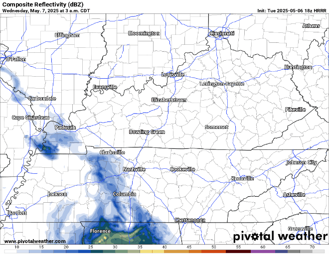
A system passing to our south continues to wobble, tossing us forecast uncertainty. Latest HRRR is wobbling north and bringing us nuisance rain chances:
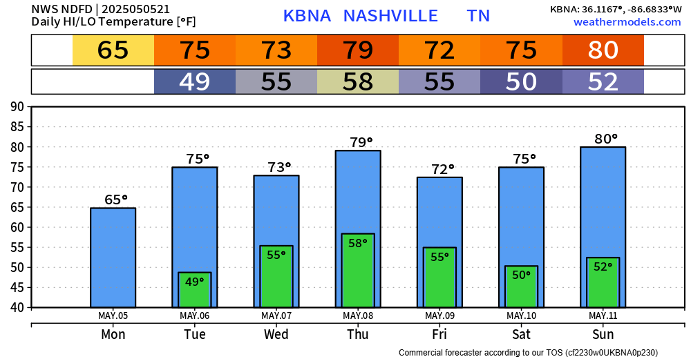
Three Things.
- Light rain may drift into our area Saturday afternoon/night. We expect neither lightning, flooding, nor hazards. Keep your plans.
- Same for Sunday, except we might be able to squeeze out a rogue lightning strike or two in the afternoon. Mostly OK tho. Don’t forget Mom. Retain plans.
- Rainout Alert. “Widespread scattered showers and thunderstorms can be expected for Monday. Instability will increase but should remain below 1000 j/kg. Overall profiles are not going to be supportive of severe storms with very poor lapse rates but bulk shear will push to 25-35 knots. Right now severe thunderstorms are looking unlikely but afternoon thunder can be expected. The upper level low will start to lift out of Tenn. on Tuesday but shower and thunderstorm activity will linger for the afternoon and evening.” Nice prose, NWS-Nashville.
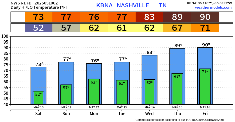
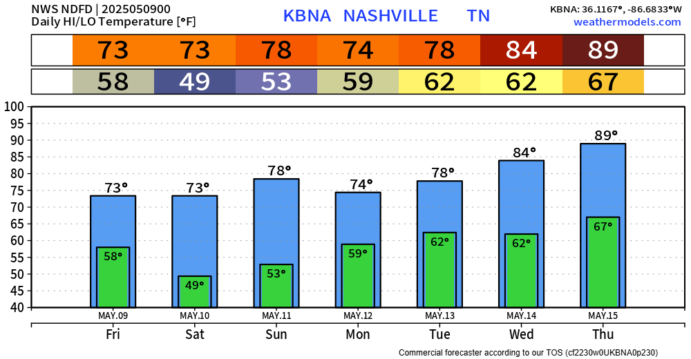
FOENUS: We may hit 90° later next week.

You must be logged in to post a comment.