

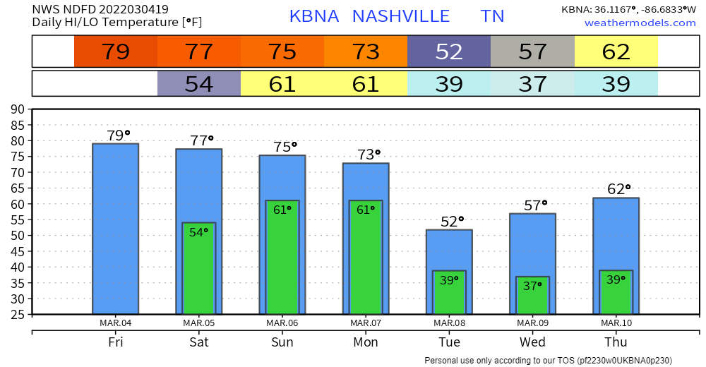
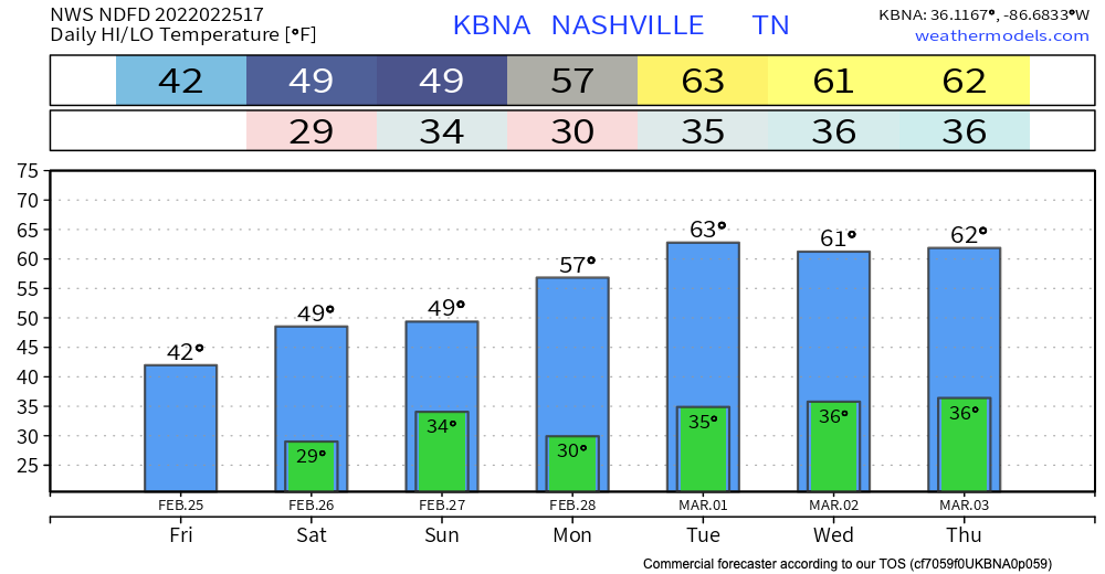
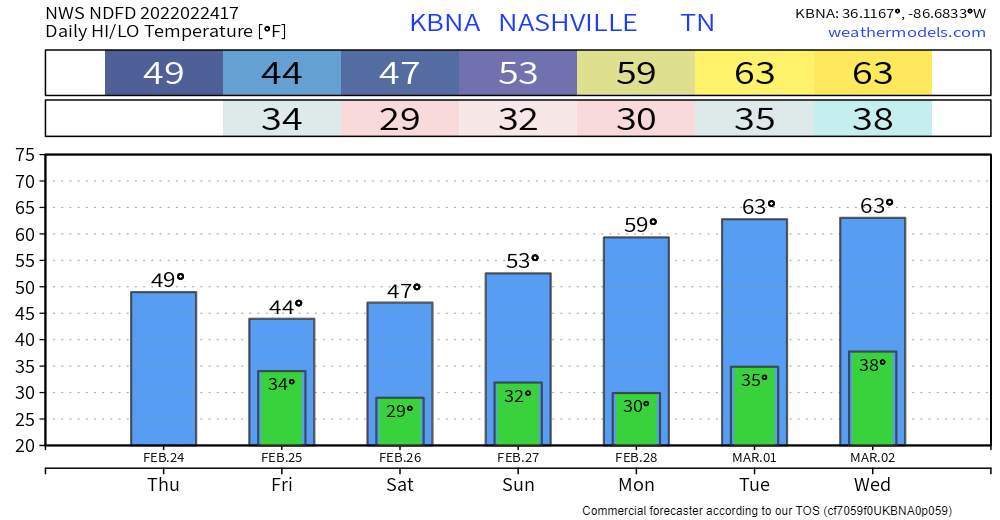
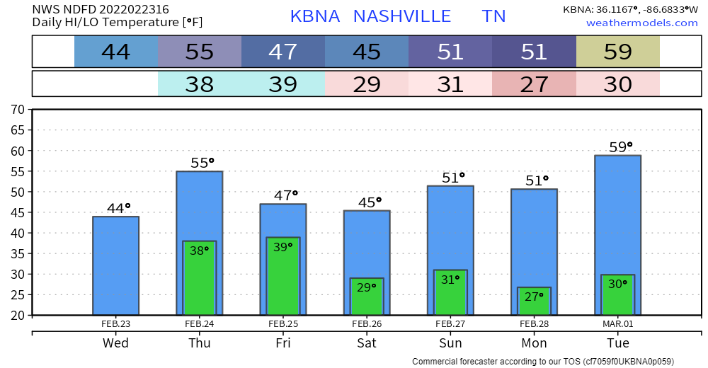
LADIES & GENTLEMEN THE WKND
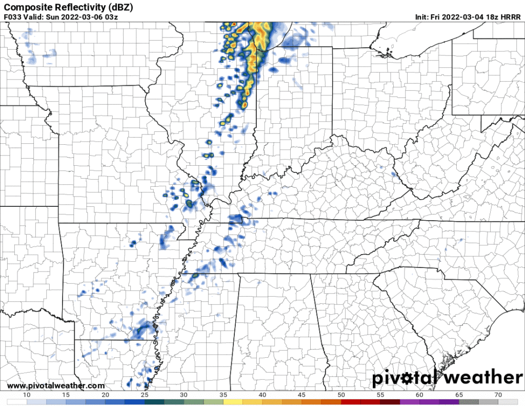
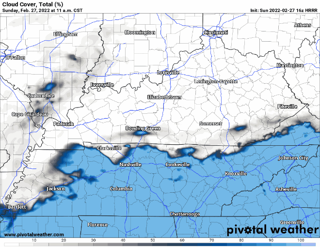
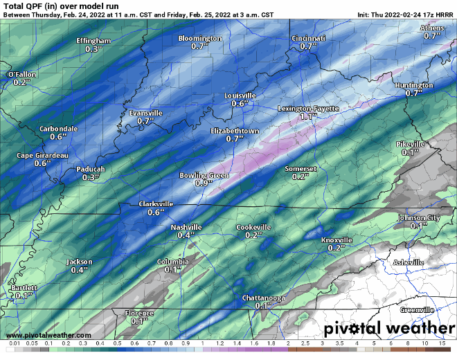
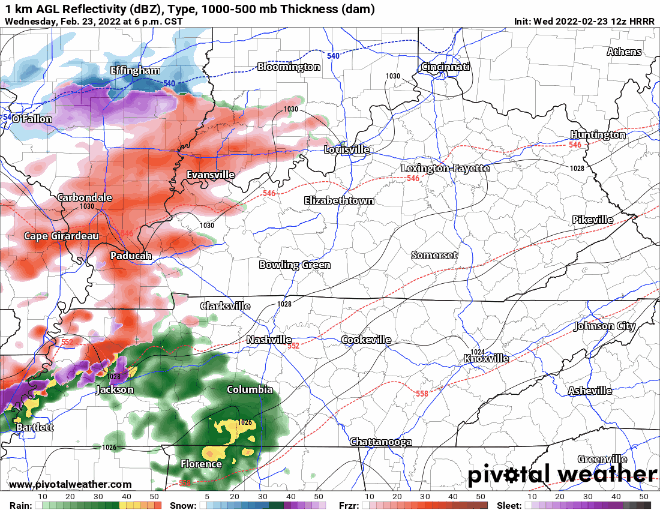
A few showers may sneak Saturday night into Sunday morning, no big deal. Just for some of us tho. Here’s the HRRR showing coverage and intensity. Meh.
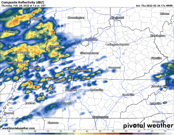
Showers and a few storms will stretch out in a line Sunday but the line may stay northwest of us as shown below by the Euro.


You must be logged in to post a comment.