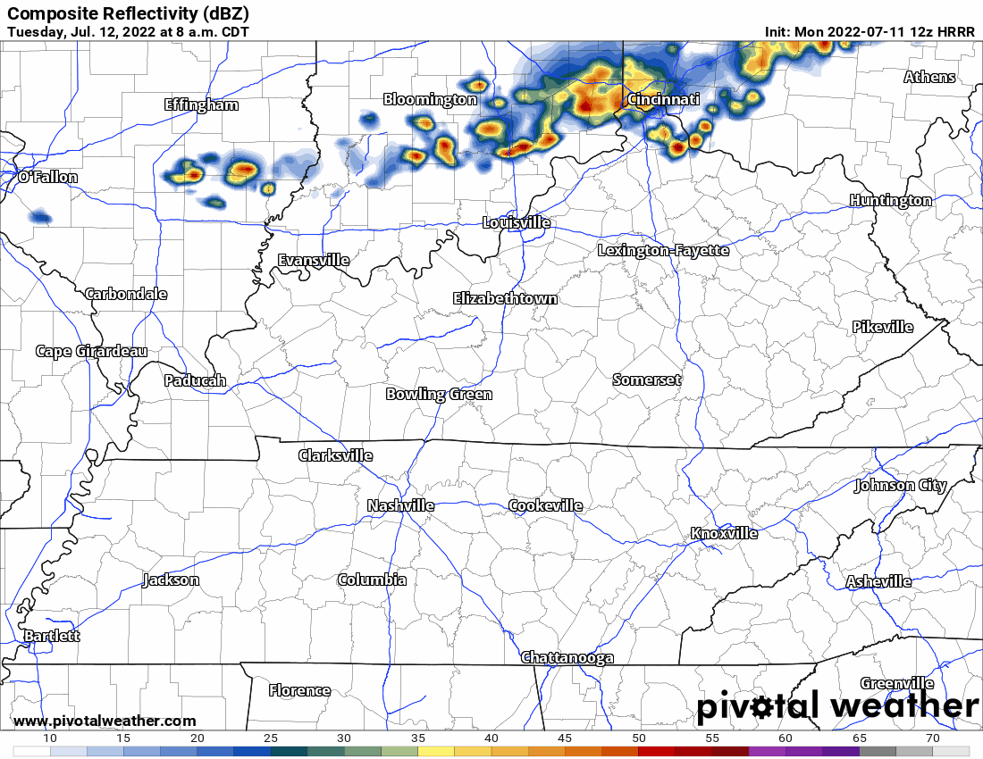
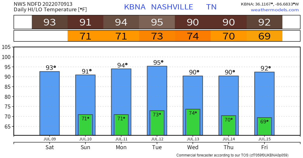
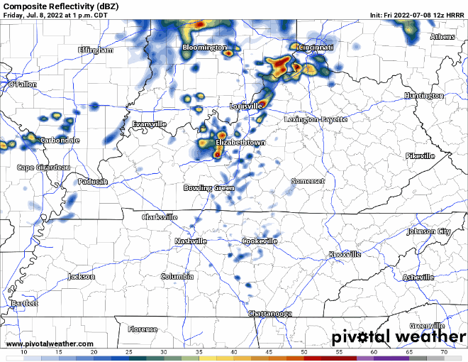
Temps look like they will climb to 60 degrees today, so not as chilly as yesterday. The lows tonight won’t get down to freezing temps.
No rain in the forecast today. Looks like it’ll be a really nice fall day.
Slightly warmer today with highs right around 50 degrees. Lows tonight could get below freezing, especially if you factor in wind chill. Warmup tomorrow to the upper 50s (if not 60s). Back down to low 50s Thursday and freezing temps possible again in the overnight. Here’s a look ahead at how it’s going to feel through Thanksgiving Day (these are wind chill numbers, not actual temperatures):
Tonight, overnight lows could dip back into freezing temps. Clear skies giving way to more clouds overnight.
We can expect a warmer Saturday and Sunday, but another cold front will be making its way through our area Sunday, bringing rain. GFS shows rain for most of the day. More specific timing as we get closer.
Warm today with temps creeping up to the mid 70’s and wind gusts up to 30 mph. A cold front passes through early tomorrow morning. HRRR has sprinkles in our counties starting around midnight with the bulk of the system starting around 2am. Heaviest rain is overnight. Leave a tad early tomorrow as the rain persists during the morning commute. Showers move out by 11am. No severe weather is tagging along.
Pretty normal for November today–highs around the mid 50s. No Tuesday morning freezing (mid 40s). We warm each day. We won’t freeze until after the next rain event.
ETA Wednesday night through Thursday morning. Nothing severe, but can’t rule out rumbles of thunder. No more than half an inch forecasted for us right now, maybe less, maybe much less. The latest Euro run hasn’t changed much since yesterday: