
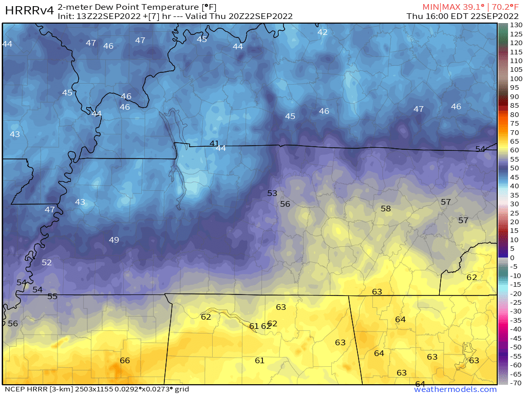
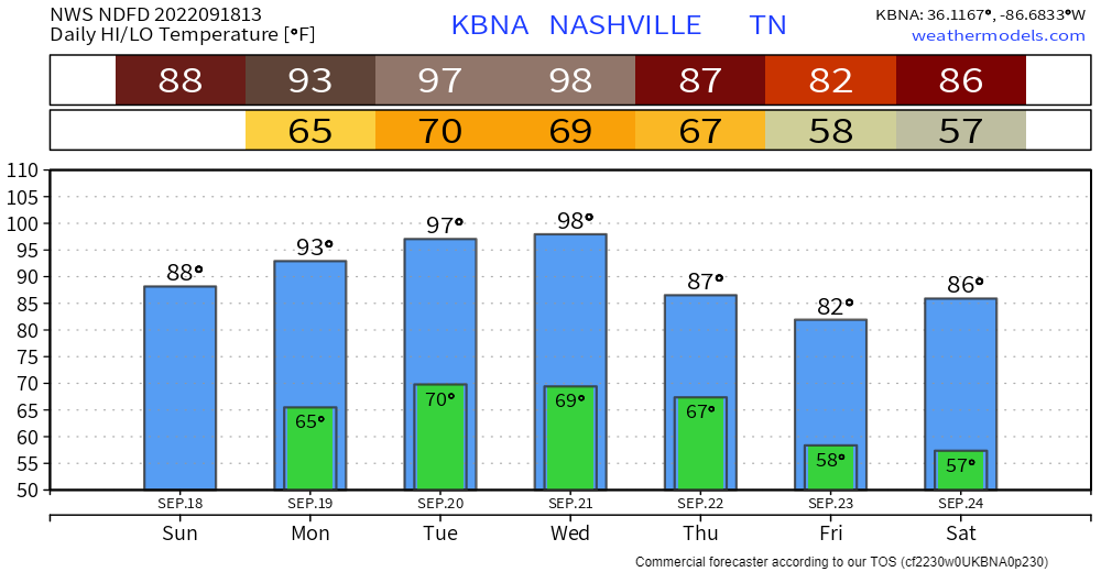
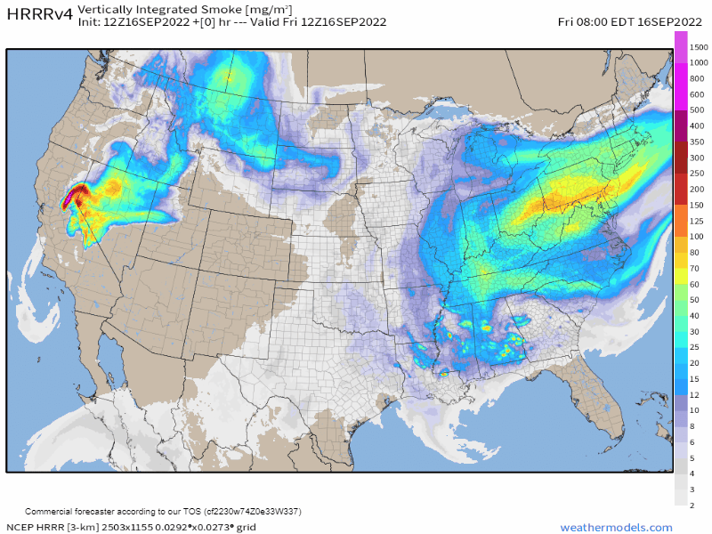
Rain today should miss us.
South and east of us according to the HRRR model 👇🏽.
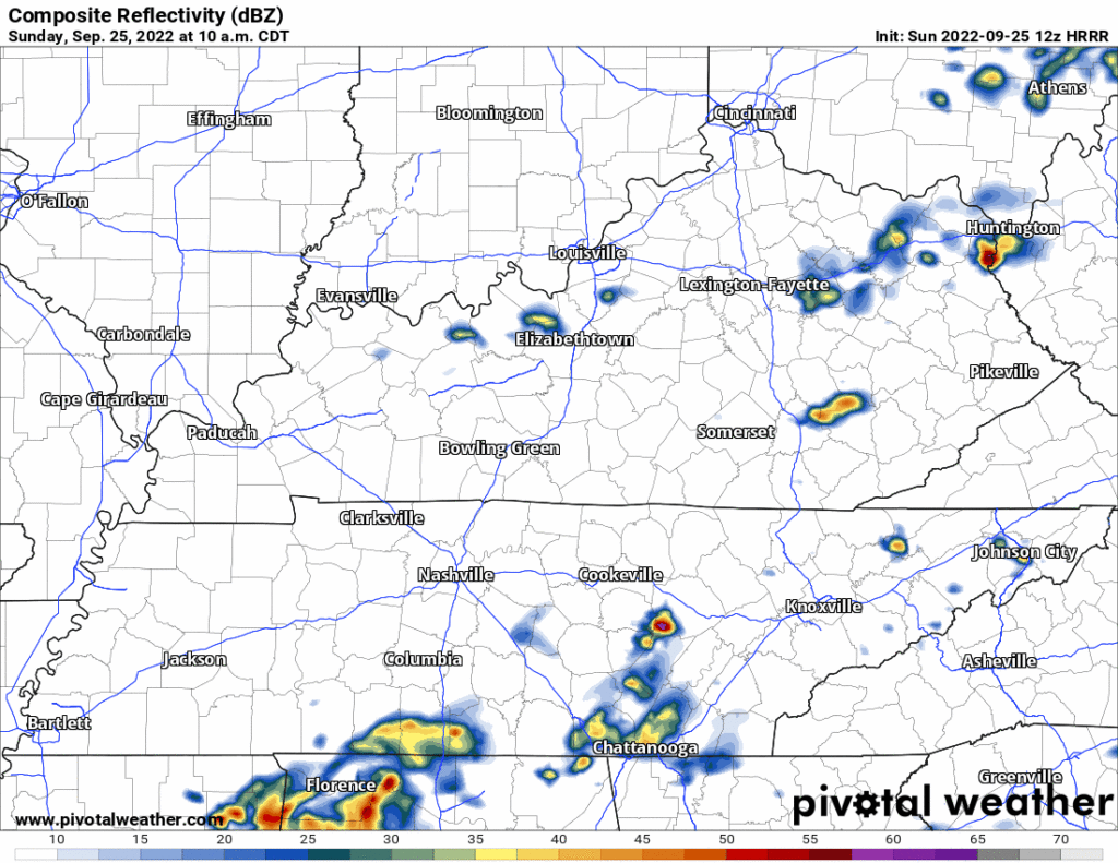
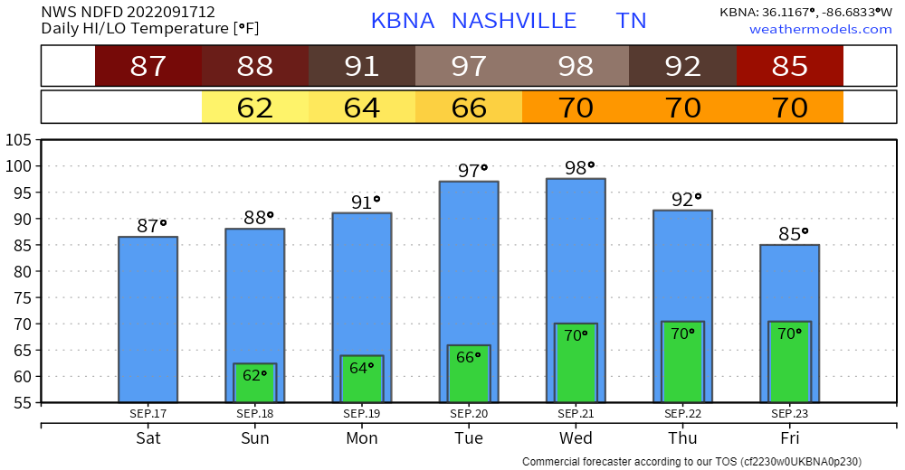
No promises but activities today look good.
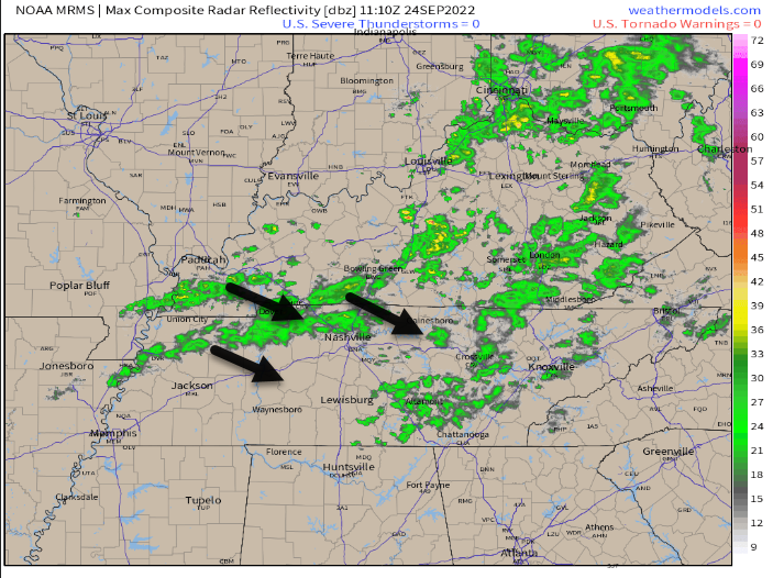
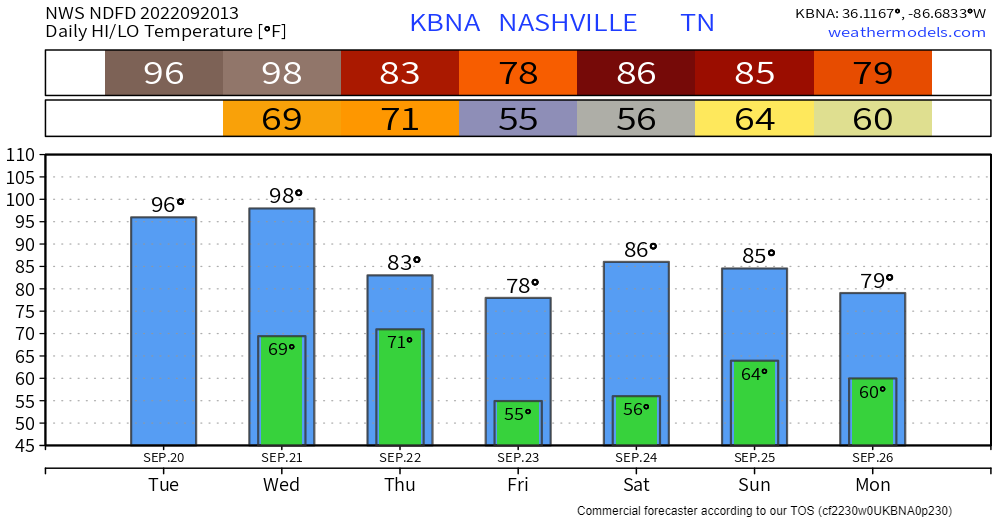
Maybe don’t burn things tomorrow.
Where the ground is dry, when relative humidity drops, and where wind is picking up, you should not burn things. Fire loves dry ground, winds, and low relative humidity. This will be Monday, which “could bring some marginal fire danger.”


You must be logged in to post a comment.