

Today will be the same as yesterday and the day before. Then things get…worse.
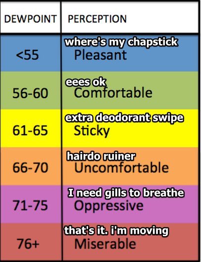
- The dewpoint will rise a from Comfortable to Sticky starting Sunday, continuing through Wednesday.
- Temps go Full Summer through the end of Summer. Fall begins Thursday at 8:03 PM.
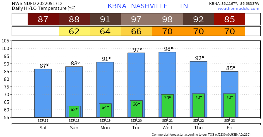
This is hot but it’s not even close to the worst heat we’ve seen this summer because dewpoints — although Not Great, Bob — won’t be that bad.
Rain remains unlikely for the foreseeable future. NWS-Nashville is carrying a non-zero chance starting Monday just in case humidity overperforms, temps get hot enough, and the Very Strong Ridge keeping the rain away and heat up is defeated. Two fronts should come by in the next 10 days, both look dry for us.
Next Friday is the first full day of Fall. Right on time, by Friday most models think 90°s heat will end, temps will drop into the mid/upper 80°s, with lower humidity continuing as we approach October. Next weekend is still fuzzy but right now looks pretty good.
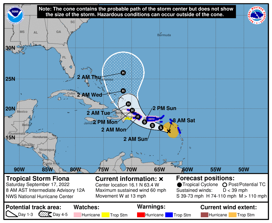
Fiona is forecast to stay in the Atlantic for at least another 7 days. Doesn’t look like it’ll impact our weather, at least not right now.
We still don’t know when our next legitimate chance of rain might occur.
NWS-Nashville, 9/17/22, AM Forecast Discussion
Quick References:
Weather changes constantly.
Follow @NashSevereWx on Twitter for any changes to this forecast.
Live coverage during tornado and severe thunderstorm warnings.

Look good.
Support the mission.

We are 100% community supported. No ads. No subscription fees. Keep it free for everyone.


Categories: Forecast Blogs (Legacy)
You must be logged in to post a comment.