

Record highs at BNA on Tuesday (97 in 2018) and Wednesday (97 in 1955) could be tied or even broken.
NWS-Nashville, 9/18/22, AM Forecast Discussion
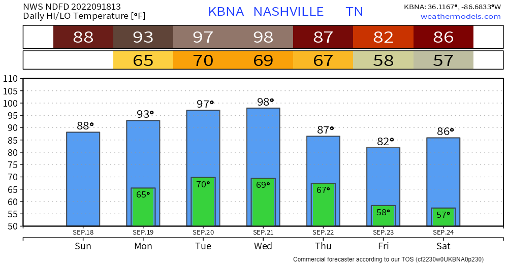
Hot, but not as humid as the other heatwaves this summer. Dewpoints upper 50°s (Comfortable) / lower 60°s (Sticky) during this End of Summer Heatwave.
There’s little to no hope of rain in the next 7+ days.
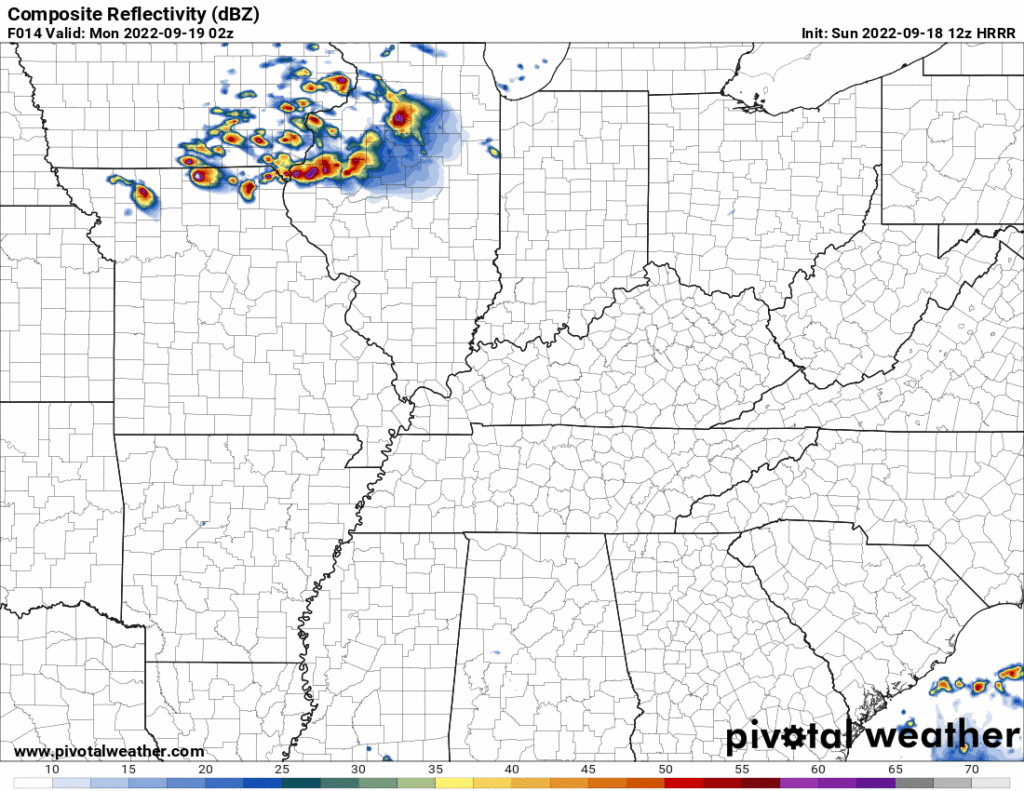
Monday a Midwest storm complex will dive southeast. It should dissipate before it gets to us.
[I]t’s not completely out of the question that an isolated shower could sneak across the [Kentucky – Tennessee] border late tomorrow, although that’s unlikely.
NWS-Nashville, 9/18/22, AM Forecast Discussion
Thursday, a strong cold front should end the heat wave. Previous model runs thought Friday but now models deliver the cold front Thursday. Looks like a dry frontal passage. Temperature relief will last through the weekend.
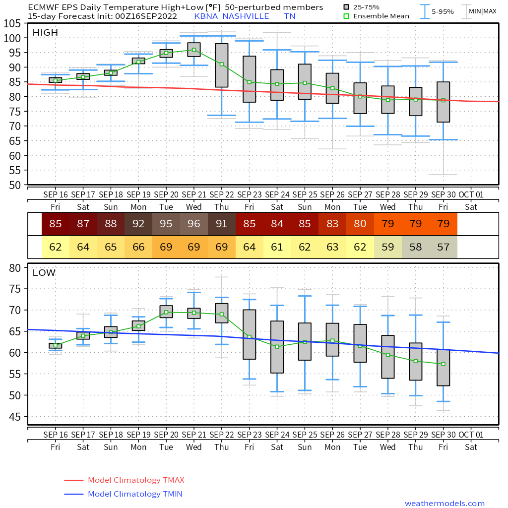
But it won’t be PSL, Fall, Leaves, Windows Open temp relief. Even tho Fall begins at 8:03 PM Thursday. Temps will still be above normal, except only slightly above normal, not way above normal. That’s what the chart below means. The green line is where temps will probably be. The red line is normal for this time of year.
Humidity returns briefly Monday the 26th, only for another cold front to come in right behind it and sweep 60° dewpoints away. A few models show maybe a little rain (?) as this happens. But that’s eight days from now!
Fall is approaching, slowly and unevenly.
Quick References:
Weather changes constantly.
Follow @NashSevereWx on Twitter for any changes to this forecast.
Live coverage during tornado and severe thunderstorm warnings.

Look good.
Support the mission.

We are 100% community supported. No ads. No subscription fees. Keep it free for everyone.


Categories: Forecast Blogs (Legacy)
You must be logged in to post a comment.