
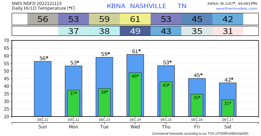
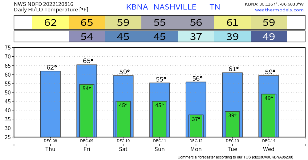
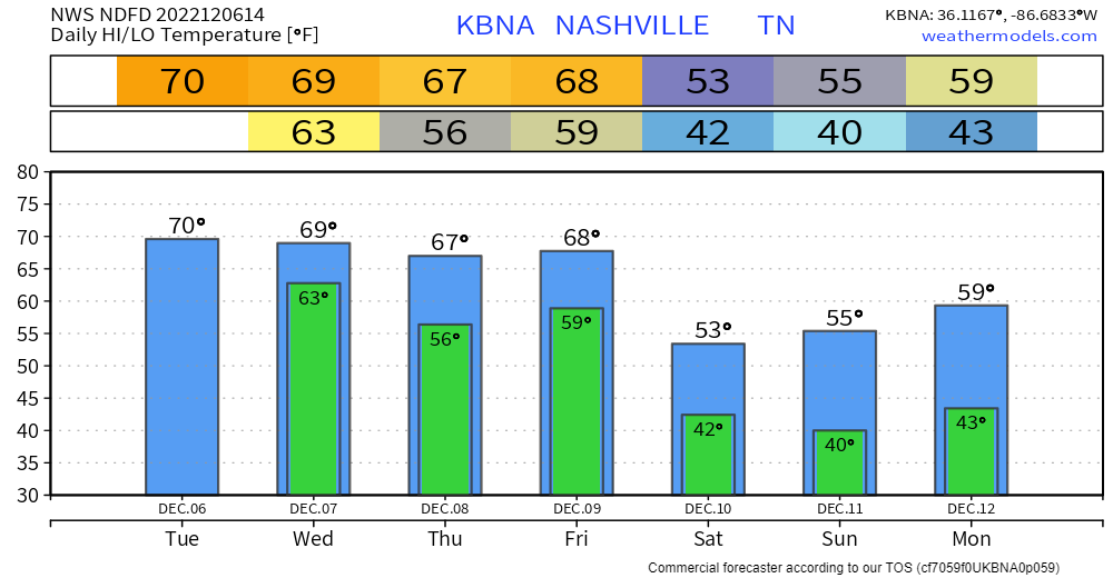
Today will be a nice day as high temps reach the 60° mark. Cloud cover will move in as the day goes on.
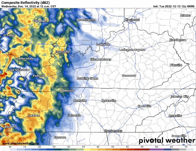
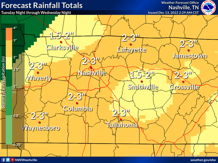
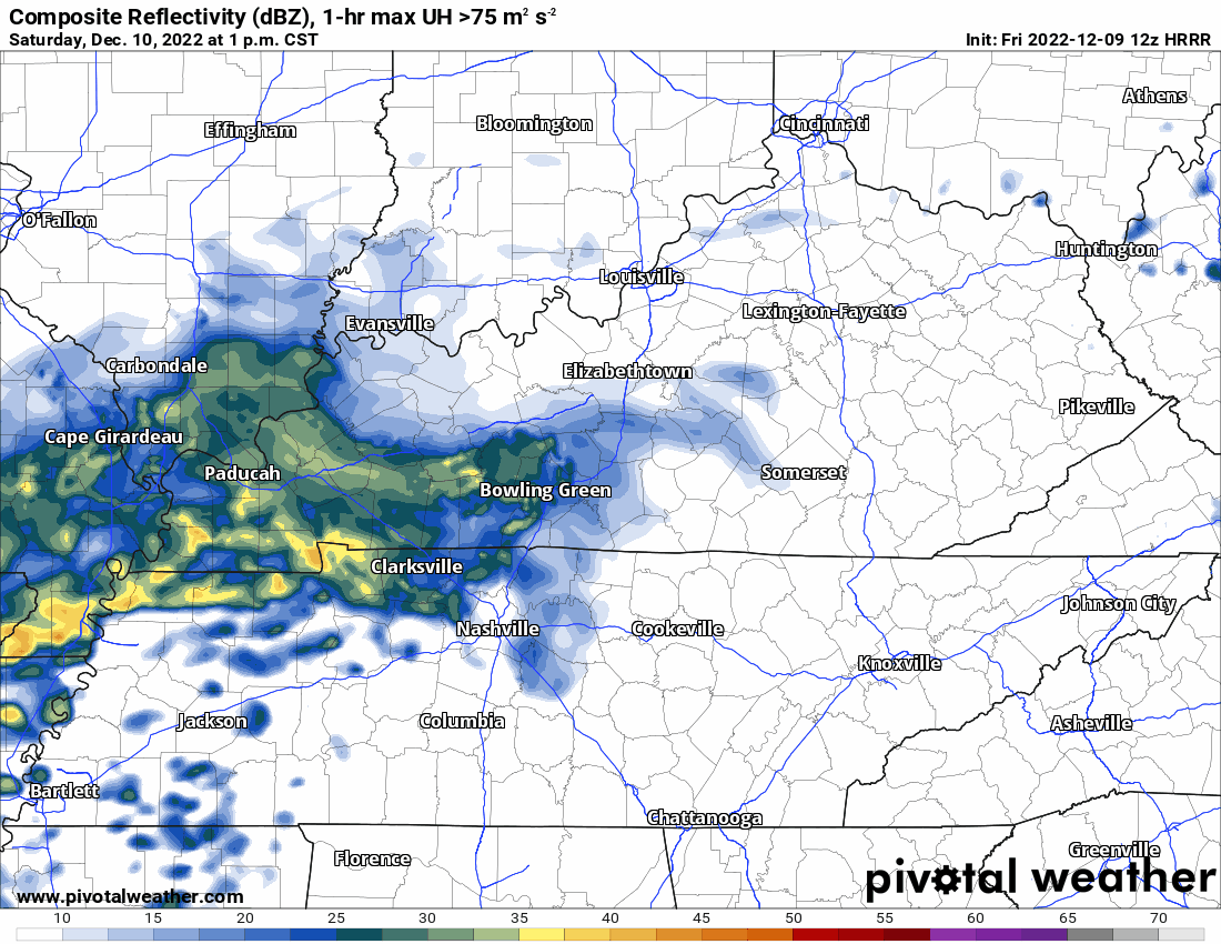
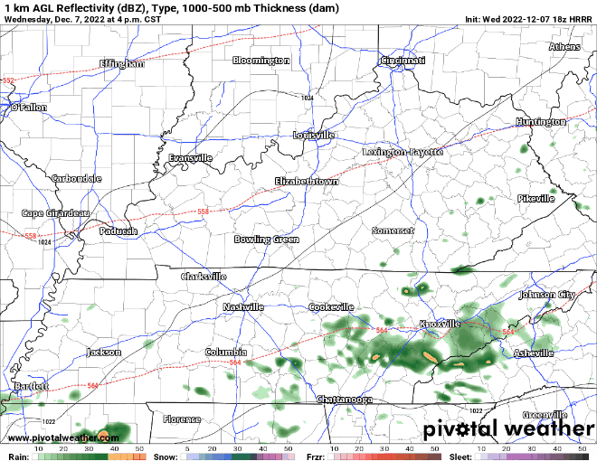
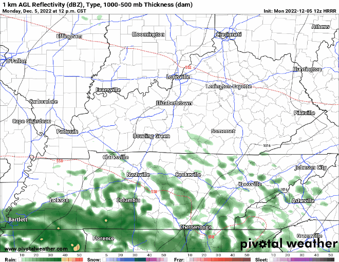
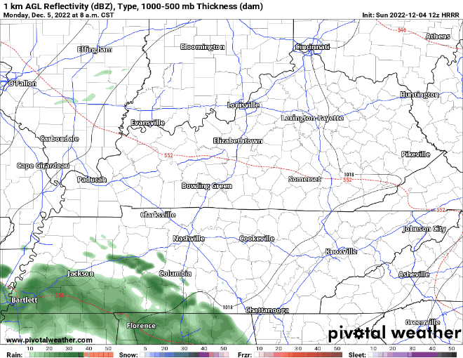
The HRRR model (above) shows two rounds of rain for Wednesday. The first one beginning in the wee hours of Wednesday morning, hopefully clearing out by AM rush hour. The rain resumes around noon and continues through Wednesday night.


You must be logged in to post a comment.