
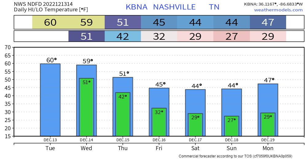
Today will be a nice day as high temps reach the 60° mark. Cloud cover will move in as the day goes on.
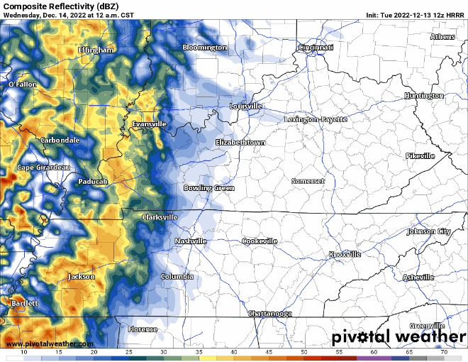
The HRRR model (above) shows two rounds of rain for Wednesday. The first one beginning in the wee hours of Wednesday morning, hopefully clearing out by AM rush hour. The rain resumes around noon and continues through Wednesday night.
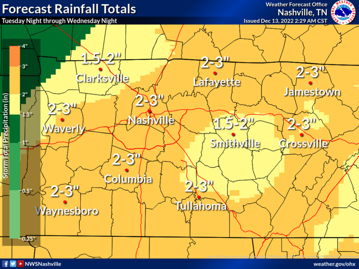
- Rainfall totals look to be 2-3″
- Isolated flash flooding is possible, particularly with the second round in the afternoon/evening
- The Weather Prediction Center has our counties in a 15% chance of flash flooding within 25 miles
- Some thunderstorms may be possible, but no severe weather is expected
The rain will move out before Thursday AM.
After the rain and cold front push through, it’ll leave us with a dry, but cold rest of the week and weekend.
With the colder temperatures coming in, a lot of crap apps will start to put the snowflake icon up and get a lot of hopes up. But as Lee Corso would say…

As of right now, no accumulating snow is in the forecast. Now, that doesn’t mean that can’t change, and it very well may, but any confidence on any snow chance that is seven days+ away is very low. Right now, the GFS and EURO models disagree on exactly how cold it will be for the remainder of the year, they’ll eventually begin to agree, but until then, confidence is very low.
Quick References:
Weather changes constantly.
Follow @NashSevereWx on Twitter for any changes to this forecast.
Live coverage during tornado and severe thunderstorm warnings.

Look good.
Support the mission.

We are 100% community supported. No ads. No subscription fees. Keep it free for everyone.


Categories: Forecast Blogs (Legacy)
You must be logged in to post a comment.