
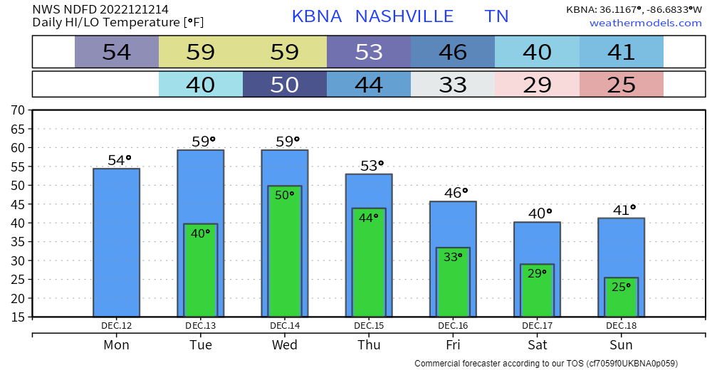
Not too bad of a day today, hoping the sun can peak through later, but cloud cover will dominate for the majority of the day. No rain.
Tuesday will be pretty much a repeat of Monday, except for high temps should be able to reach 60°. Can’t totally rule out some sprinkles during the afternoon, but the majority of the rain should hold off until after midnight on Wednesday.
Wednesday will be a wet, gross day.
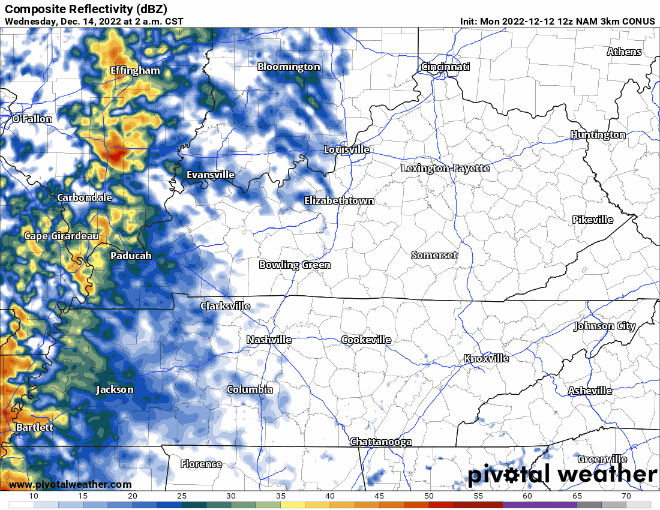
The NAM3k model (above) thinks rain will begin early Wednesday morning, lasting on/off through the day.
- Isolated flash flooding is possible, especially in the usual spots, along with places that received a lot of rain last week.
- The Weather Prediction Center has us outlooked with at least a 15% chance of flash flooding within 25 miles.
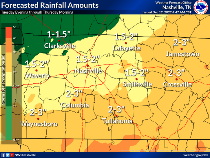
- Rainfall totals look to be 1.5″ – 2″, higher totals in isolated spots are possible.
- Some rumbles of thunder are possible, but severe storms are not expected.
Rain will clear out by Thursday morning, leaving us with cooler temperatures for the rest of the week. High temps will struggle to make it to 40° and lows dipping into the 20’s. With that being said, there is no snow in the forecast as of right now.
Quick References:
Weather changes constantly.
Follow @NashSevereWx on Twitter for any changes to this forecast.
Live coverage during tornado and severe thunderstorm warnings.

Look good.
Support the mission.

We are 100% community supported. No ads. No subscription fees. Keep it free for everyone.


Categories: Forecast Blogs (Legacy)
You must be logged in to post a comment.