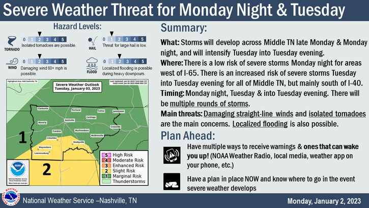
We are looking at three possible rounds of severe weather. Let’s break them each down. BTW, none of these looks like “slam dunk” chances.
First Chance:
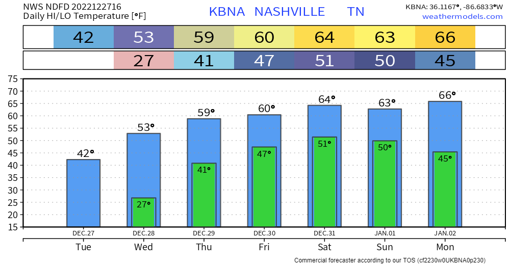
We may see some scattered showers this afternoon – these should not be severe.

We are looking at three possible rounds of severe weather. Let’s break them each down. BTW, none of these looks like “slam dunk” chances.
First Chance:
We may see some scattered showers this afternoon – these should not be severe.
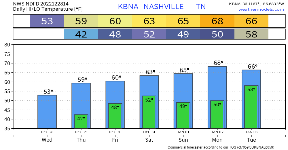
Today, temperatures will be above average and after some fog (both literal and figurative) this morning, a sunny day is in store for most of us. Enjoy it!
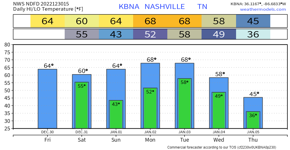
Monday begins a wet pattern. By the time rain is done late Tuesday, we could see up to 2″ over the next few days.

Two weather makers are going to pass by in the next few days. One today, one on Monday. Let’s dive into it.
The Main Thing: The main thing we’re watching in this forecast is the potential for strong storms overnight Monday night into Tuesday morning. More below.
Rain moves back in during the day today. HRRR thinks it’ll be light/scattered, then pick up overnight tonight. Loop through 1 am.
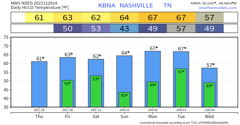
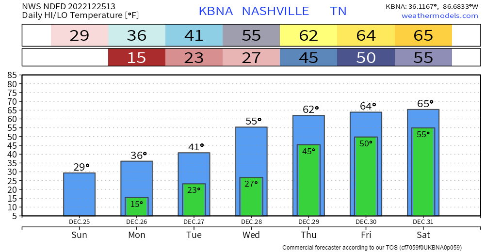
For the next 6 days or so, we’ll get a little preview of spring, as temperatures shoot well above average into the 60’s.

We’ll also see rain chances pick up today and this afternoon. Won’t amount to much – if any. Just a quick passing by shower.
For at least the next 7 days, we won’t see the freezing mark, which is a welcome sight for many. For fans of winter, maybe not so much.
Rain looks to return Friday and Saturday. No severe weather or flooding concerns with this. Models are hopeful that the rain will move out before NYE night activities, this could change though.
It was a storm we’ll tell our grandkids about one day. With a gust of wind we plummeted into a nasty season of spending 88 hours below freezing, some of those below zero, with punishing wind chills. Rolling blackouts, broken pipes and hazardous travel were part of the narrative for many of us this Christmas. But, better days are here.
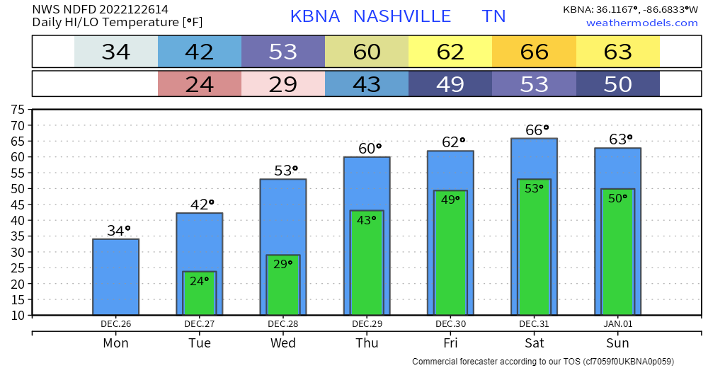
Both of our counties are under a Winter Weather Advisory until noon today. Isolated snowfall amounts of one inch are possible in some isolated areas, but most places will be around half an inch.
We shouldn’t see any major travel impacts, but any snow that falls will stick, so take it easy on the roads and give yourself some extra time today. Snow should end around noon, and we may see temps briefly get above freezing, which will help with melting.
Merry Christmas!

We’ll take waking up to temperatures in the upper teens, certainly feels like Christmas! Winds have died down, so wind chill isn’t much of a factor, but it’s still cold. Certainly not the 76° we had last year…but at least it’s not also a high of 15° like in 1983.
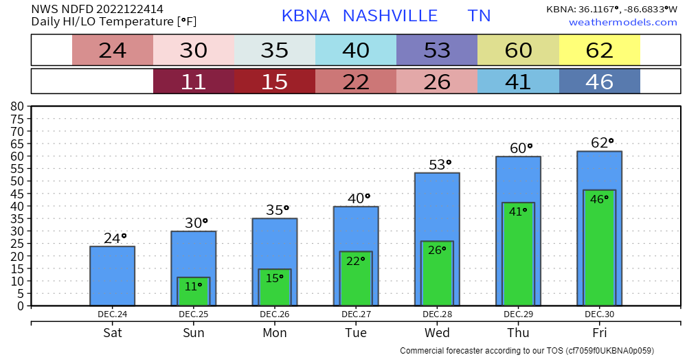
As of 8:30am, BNA is reporting double digits temps (10°) for the first time in ~32 hours. Temps will rise to the low 20’s, along with some sun, will hopefully help some road conditions improve, but several roads will still be hazardous, continue to take it easy. The “warmer” temps should also help to relieve some stress on the power grid.
You must be logged in to post a comment.