
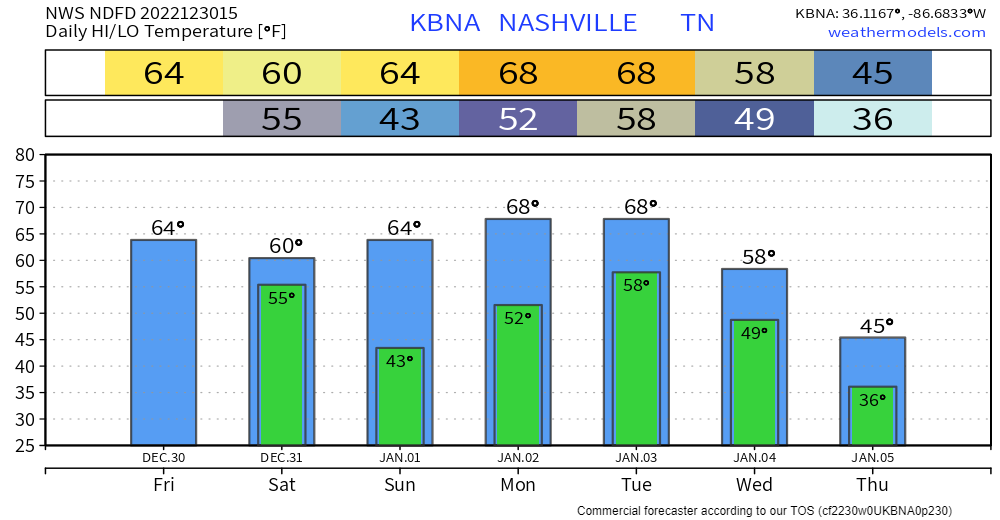
The Main Thing: The main thing we’re watching in this forecast is the potential for strong storms overnight Monday night into Tuesday morning. More below.
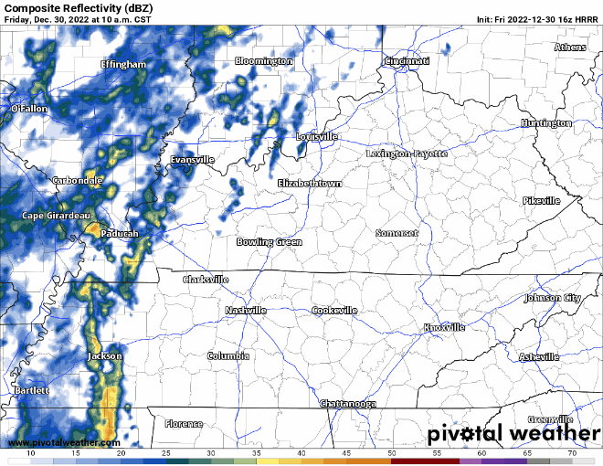
Rain moves back in during the day today. HRRR thinks it’ll be light/scattered, then pick up overnight tonight. Loop through 1 am.
This rain should move out Saturday afternoon and set us up for a precip-free NYE. We might even get some sun out of the deal just before sunset.

Our next system comes in Monday and Monday night. At the moment, it looks like showers develop Monday afternoon. Then, a front comes through Monday night. This front could bring severe weather to our west and southwest. The current outlook from the SPC keeps the highest severe chances juuuuust to our west.
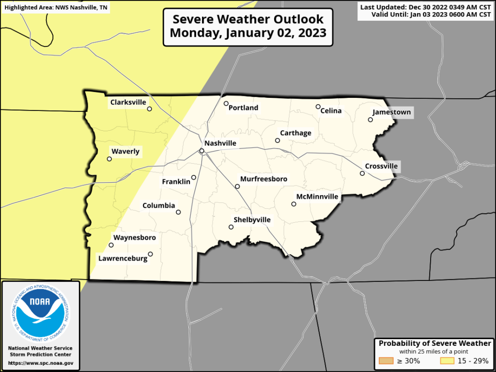
It’s possible the storms will weaken as they move east….since they’re coming through at night without any daytime heating. We’ll keep an eye on this setup.
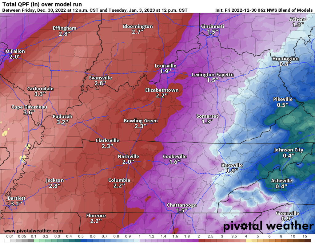
The NWS Blend of Models is predicting a couple of inches of rain for us through noon Tuesday.
Quick References:
Weather changes constantly.
Follow @NashSevereWx on Twitter for any changes to this forecast.
Live coverage during tornado and severe thunderstorm warnings.

Look good.
Support the mission.

We are 100% community supported. No ads. No subscription fees. Keep it free for everyone.


Categories: Forecast Blogs (Legacy)
You must be logged in to post a comment.