
As of 8:30am, BNA is reporting double digits temps (10°) for the first time in ~32 hours. Temps will rise to the low 20’s, along with some sun, will hopefully help some road conditions improve, but several roads will still be hazardous, continue to take it easy. The “warmer” temps should also help to relieve some stress on the power grid.
Bundle up today if you are going to be out and about today, wind chill values will still make it feel like we are in the single digits/teens. Frostbite can occur very quickly, wear multiple layers and don’t leave skin exposed. We are still under a Wind Chill Advisory until noon today.
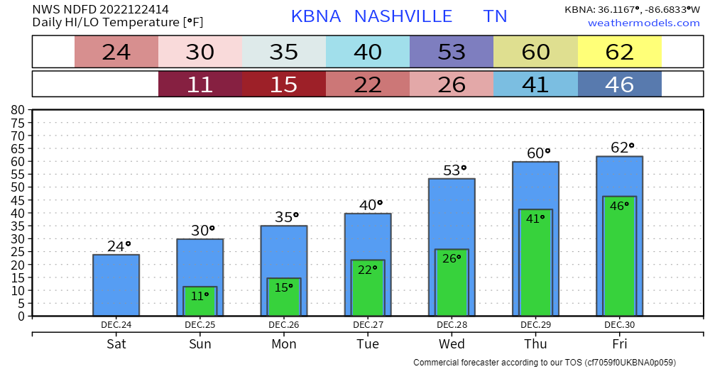
Christmas Day will be a cold one, as high temps reach just 30°. Winds will be relaxed, so wind chills won’t be too much of a factor.
Monday will bring us one last shot of winter weather for a while, as a clipper system swings into our area.

The NAM3k model thinks snow chances begin Monday morning and last through the afternoon, with maybe another shot at night. This may look like it’ll put down a good amount of snow, however our atmosphere will be really dry at first, and the Dry Air Monster will be eating a lot of it. NWS Nashville thinks areas north of I-40 have the best shot at some accumulation, at around half an inch or so. We’ll be watching.
We finally start to really warm up as temperatures get up close to 40° on Tuesday, 50° on Wednesday, and the 60’s by end of the week, leaving this weekend in distant memory. Rain chances look to accompany the 60’s, but better than a wintry mess.
Quick References:
Weather changes constantly.
Follow @NashSevereWx on Twitter for any changes to this forecast.
Live coverage during tornado and severe thunderstorm warnings.

Look good.
Support the mission.

We are 100% community supported. No ads. No subscription fees. Keep it free for everyone.


Categories: Forecast Blogs (Legacy)
You must be logged in to post a comment.