
Happy New Year!
Today, temperatures will be above average and after some fog (both literal and figurative) this morning, a sunny day is in store for most of us. Enjoy it!
Wet and Stormy Weather Ahead?
Monday begins a wet pattern. By the time rain is done late Tuesday, we could see up to 2″ over the next few days.
Scattered showers begin Monday around 10am and remain hit of miss through the afternoon. Some us could even see a break in the rain mid-day Monday. Monday afternoon these scattered showers could turn into isolated thunderstorms. These storms continue through the evening and overnight. A rumble of thunder and some gusty wind ins’t out of the question. The biggest severe threat on Monday looks to stay well to our SW. Good news for us.
Tuesday, that severe threat moves a little closer to our two counties. As a front gets closer, we’ll see some of the ingredients necessary to produce damaging wind. The storm prediction center has outlooked us for a 5-14% chance of severe weather on Tuesday.
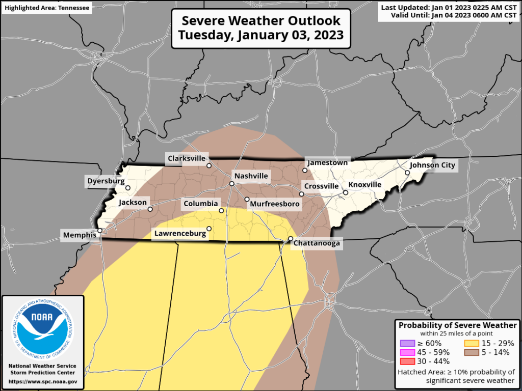
We will continue to refine our message as we get closer to Tuesday and higher resolution models get in range. This does not look like a widespread severe weather outbreak for us, but the best chance for potentially damaging thunderstorms we’ve had in a while. Stay tuned!
Quick References:
Weather changes constantly.
Follow @NashSevereWx on Twitter for any changes to this forecast.
Live coverage during tornado and severe thunderstorm warnings.

Look good.
Support the mission.

We are 100% community supported. No ads. No subscription fees. Keep it free for everyone.


Categories: Forecast Blogs (Legacy)
You must be logged in to post a comment.