
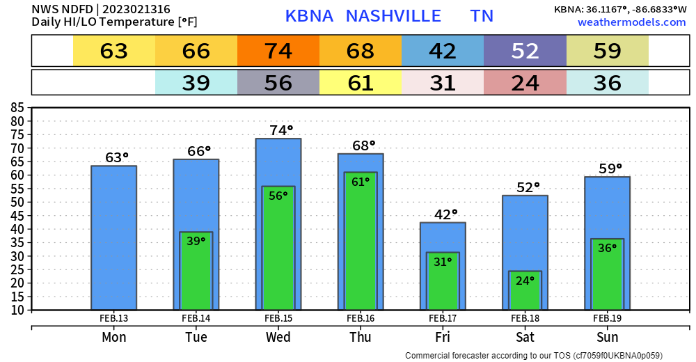
It may be Monday, but it’ll be a beautiful day. Sun, high temps in the mid 60’s.
The first half of Valentine’s Day will be nice. It’ll get windy in the afternoon/evening, sustained winds of 20-25mph, with gusts up to 40mph are possible. A Wind Advisory will be in effect from 3pm Tuesday – 6am Wednesday.
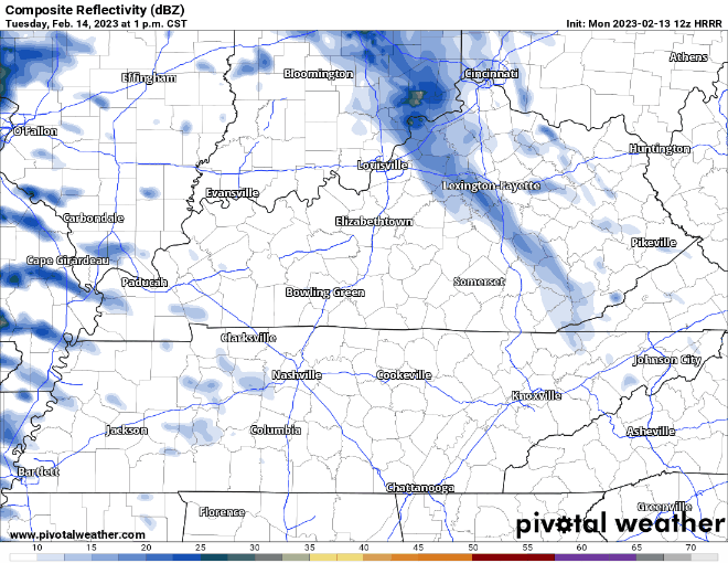
Some showers also move in Tuesday evening, these will be just showers, but may disrupt any outdoor Valentine Day plans you might have for the night.
Wednesday during the day will be all good, temps will soar to the low 70’s, ~20 degrees above average.
Wednesday night a warm front will lift north across our area, bringing a chance of storms, maybe strong/severe, to our area. The Storm Prediction Center has us outlooked with a 5% chance of severe weather within 25 miles. Start planning to have a way to wake up if a warning is issued for you Wednesday night.
We still maintain our 15% chance of severe weather within 25 miles on Thursday, although there are some disagreements.
The high-res models still aren’t in range for this yet, but the two global models have two different outcomes.
The GFS model thinks the line of storms arrives early Thursday morning. This would mean the atmosphere would have no time to recover from any storms we possibly get Wednesday night, therefore limiting, but not eliminating, the severe potential.
The Euro model thinks the line of storms arrives Thursday afternoon/evening. This would allow for the atmosphere to recover, increasing our chances for severe weather.
Which one is right? I dunno. Models will go back and forth for days, and I’ll be interested to see what the high-res models have to say. But one thing is for sure, don’t poo-poo the threat.
“Now, am I poo-pooing it all together? No.”
– NWS Nashville Evening AFD 2/12
If the weather service isn’t poo-pooing it, neither should you. This definitely isn’t some big storm of the century kind of thing, but no reason to disregard it. Know your severe weather plan leading up to these two systems.
After the front moves by, we’ll cool down for Friday and the weekend. Signs point to a dry weekend.
Quick References:
Weather changes constantly.
Follow @NashSevereWx on Twitter for any changes to this forecast.
Live coverage during tornado and severe thunderstorm warnings.

Look good.
Support the mission.

We are 100% community supported. No ads. No subscription fees. Keep it free for everyone.


Categories: Forecast Blogs (Legacy)
You must be logged in to post a comment.