
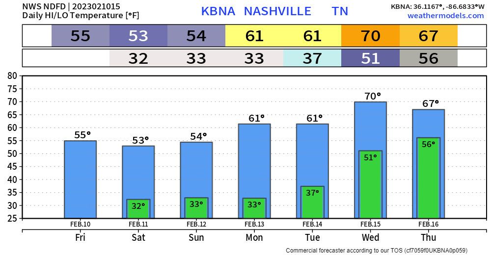
Looks fairly nice until Saturday night. Cool temps, but we’ll be dry.
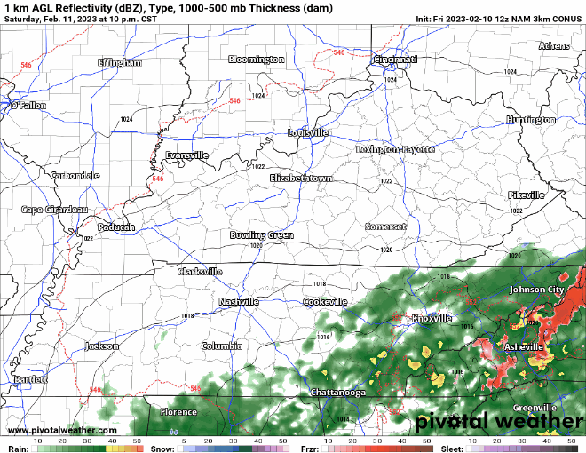
NAM3k model shows maybe some showers moving in late Saturday into Sunday morning, but nothing serious. We may see a few flurries mix in, but we are expected to stay above freezing, so no impacts are expected. Rain should move out by lunch Sunday – Super Bowl parties look to be rain free.
Monday we’ll begin our warming trend, starting in the 60’s, making it to around 70° by Wednesday and Thursday. With this, comes the chance of storms.
Severe Storms Mid Next-Week?
Always seems like there is something to talk about.
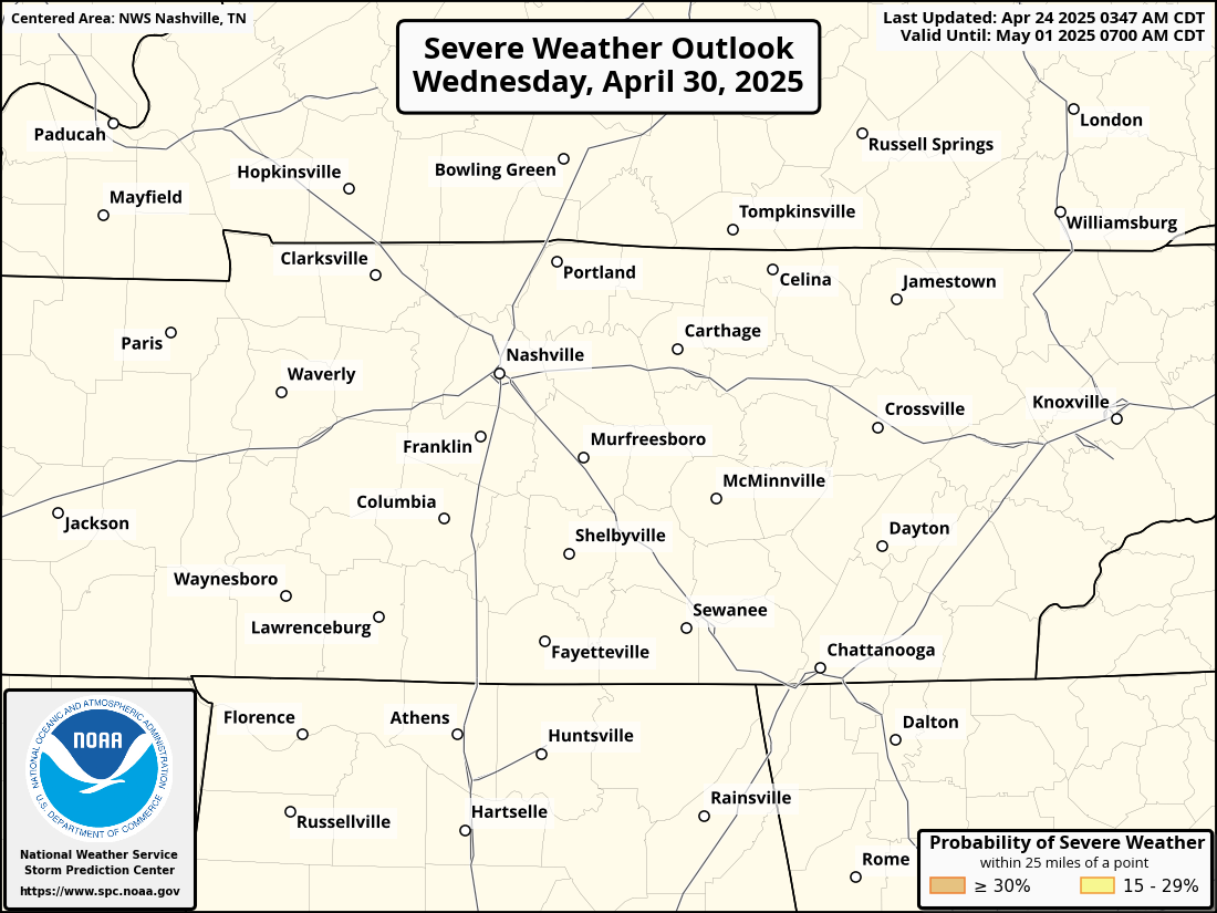
The Storm Prediction Center has outlooked our counties for a 15% chance of severe weather within 25 miles for next Thursday, 6 days out.
Models are in enough agreement a potent system will move into the Southeast sometime next week. Exact timing and location are still unsure. This outlooked area will likely change plenty of times before Thursday actually rolls around. Just something to keep in mind if you have any plans. Wayyyyy too far out to even broach the ideas of ETA’s right now.
Quick References:
Weather changes constantly.
Follow @NashSevereWx on Twitter for any changes to this forecast.
Live coverage during tornado and severe thunderstorm warnings.

Look good.
Support the mission.

We are 100% community supported. No ads. No subscription fees. Keep it free for everyone.


Categories: Forecast Blogs (Legacy)
You must be logged in to post a comment.