
Today will be real nice, with highs in the upper 60’s. Lots of sun streaming through the thin layer of clouds.
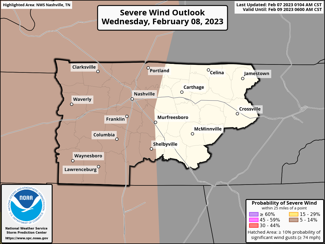
Wednesday, (very low) storm chances move in. The Storm Prediction Center has outlooked our two counties with a 5% chance of damaging winds within 25 miles. We are NOT included in the tornado, hail, or flash flooding outlook.
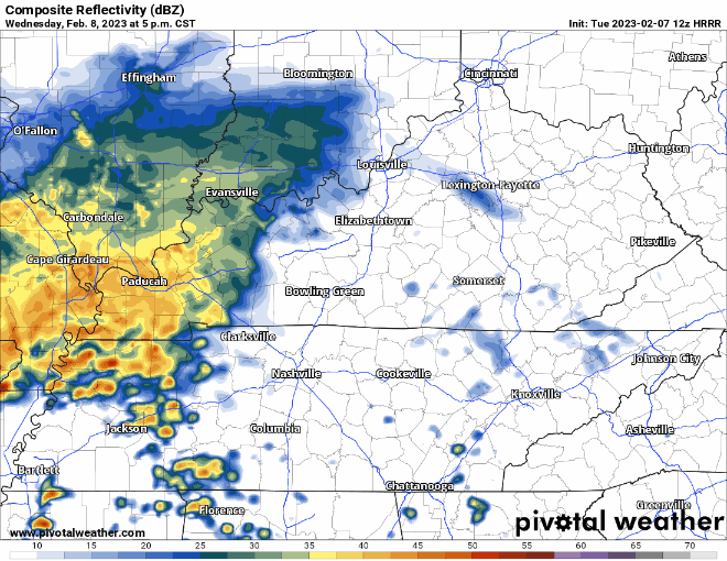
HRRR model thinks some showers roll in here around 6 or 7pm tomorrow night, these would be just rain, maybe a rumble of thunder.
Then very late Wednesday night, could really call it early Thursday AM, ETA looks to be around 3-5AM. This line would have the small, small chance of producing some damaging straight-line winds. With the threat being overnight, you may already know the drill by now, but having your weather radio or a wake-me-up app ready is the best way to go.
I’m really not concerned with this line much at all, it may end up being the type of storms that are nice to sleep to. But it is better to be safe than sorry, and be prepared and have a way to wake up in case a warning is issued for you.
Thursday we dry out, and actually have a decent day with highs in the mid 60’s.
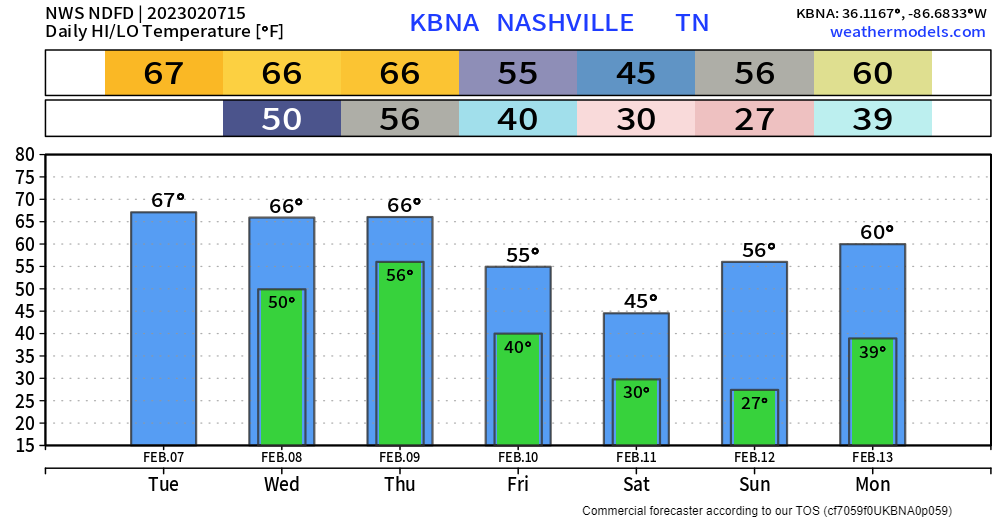
Friday we cool down to near-average temperatures. Some showers roll in overnight Friday. A flurry or two may mix in with the rain, but no accumulation is expected. Other than that, looks like we get away with another dry weekend. Nice.
Quick References:
Weather changes constantly.
Follow @NashSevereWx on Twitter for any changes to this forecast.
Live coverage during tornado and severe thunderstorm warnings.

Look good.
Support the mission.

We are 100% community supported. No ads. No subscription fees. Keep it free for everyone.


Categories: Forecast Blogs (Legacy)
You must be logged in to post a comment.