
Warm day today, with the high temperature expected to get near 75°. Record high for 2/15 is 77°, we might’ve gotten there if we had some more help from the sun, but we won’t see too much of it today.
We should stay dry during daylight hours. Storm chances increase after sunset.
Round One: Overnight Tonight into Thursday Morning
The Storm Prediction Center has outlooked us tonight with a:
- 15% chance of damaging straight-line winds (58mph+) in the yellow, 5% for everyone else (don’t focus too much on exactly where the line is drawn, everyone has a potential for damaging winds)
- 5% chance of severe hail (1″+ in diameter) within 25 miles)
- 2% chance of a tornado within 25 miles
- we also have a 5% chance of flash flooding within 25 miles
Middle TN and overnight severe weather chances, two peas in a pod.
Round One looks to kick off around 10 or 11pm tonight, lasting through the night and into the morning. I think severe chances will slowly decrease as we move through the night as our atmosphere gets worked over.
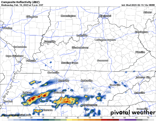
Our main threat will be damaging winds, but some severe hail and a tornado or two cannot be ruled out. With this being overnight, have a way to wake up if a warning is issued for you. Whether it be a weather radio, a wake-me-up app, the Wireless Emergency Alerts on your phone. The more the merrier.
We may get a break for AM rush hour, but no promises. I’d leave a little earlier than you normally would.
Round Two: Thursday Mid-Morning thru Afternoon
Tomorrow we are outlooked with a:
- 30% chance of damaging straight-line winds (58mph+) within 25 miles
- 15% chance of flash flooding within 25 miles
- 5% chance of a tornado within 25 miles
- 5% chance of severe hail (1″+ in diameter) within 25 miles
This is our “main” round, if you want to call it that. In previous blogs we talked about the timing on this round, and how early/late it may arrive, and this would increase/decrease our severe chances. The timing has slowly trended closer to the afternoon, giving us a bigger break in-between rounds, therefore the SPC has bumped up our chances a little. However, this is still not some grand-slam severe weather set up.
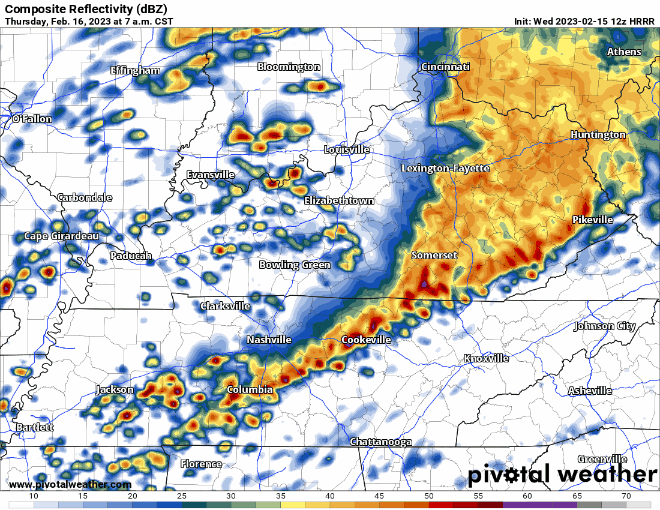
The distinction between rounds is a little hard to tell, but it appears around 9 or 10am Thursday morning we’ll clear out for a few hours. Then a broken line of storms looks to enter our counties at around 1pm, +/- an hour or so. Timing will be likely need updating. There could also be cells in front of the main line, which would arrive before that timeframe.
Main threat for this round will also be damaging straight-line winds, but some hail and a tornado or two cannot be ruled out. Have multiple ways to receive information/warnings tomorrow. We may still see some rain at PM rush hour, but severe threat will be gone.
Rainfall totals look to be 1-2″ for our area, but some locally higher amounts are possible in places that storms “train” over.
If either part of our counties gets warned tonight or tomorrow, we’ll go live on our YouTube channel, you can click here for that. Need a refresher on Tornado Watch v. Warning, and what to do? Click here. Storm anxiety is a very real thing. Click here for an article we have on that. If it helps you at all, think of it as tonight we have a 98% chance of NOT seeing a tornado within 25 miles. Glass half full.
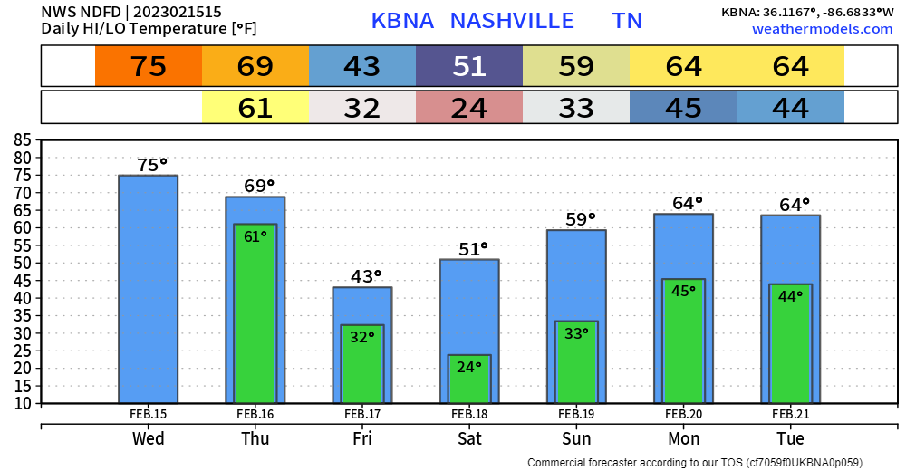
We cool down Friday. Weekend looks dry with a slow warming trend.
Quick References:
Weather changes constantly.
Follow @NashSevereWx on Twitter for any changes to this forecast.
Live coverage during tornado and severe thunderstorm warnings.

Look good.
Support the mission.

We are 100% community supported. No ads. No subscription fees. Keep it free for everyone.


Categories: Forecast Blogs (Legacy)
You must be logged in to post a comment.