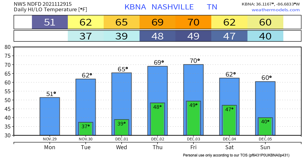
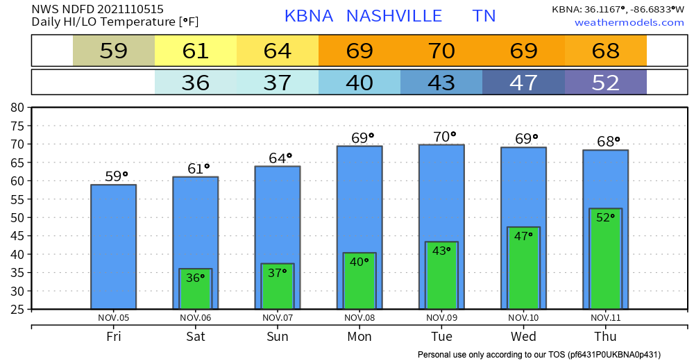
Today’s going to be pretty chilly, but starting tomorrow we’ll start climbing back into the mid and upper 60s. We’re staying in a dry air mass, so no active weather until maybe this weekend.

I am a junior broadcast meteorology major with a communications minor at Mississippi State University.
Today’s going to be pretty chilly, but starting tomorrow we’ll start climbing back into the mid and upper 60s. We’re staying in a dry air mass, so no active weather until maybe this weekend.
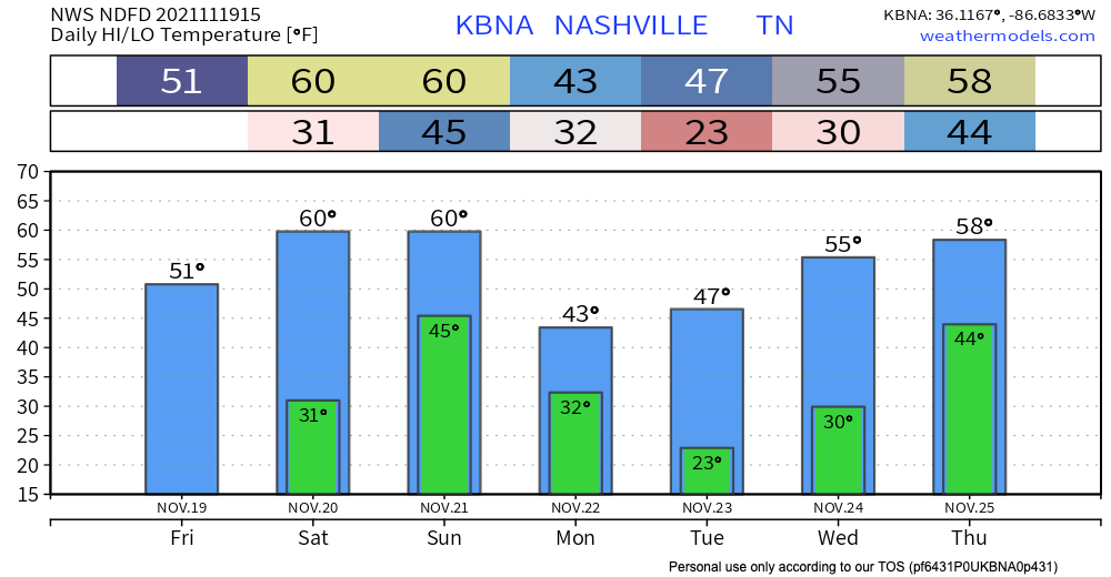
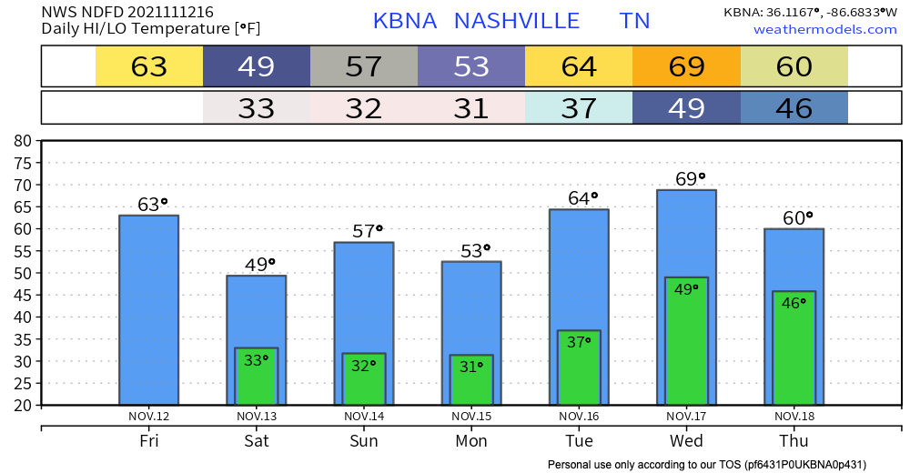
Today will be pretty chilly – fitting weather for those of us who decorate for Christmas the day after Thanksgiving *cue Christmas music*. We will stay dry though!

Black Friday shoppers and workers, you will want to dress warmly today – our high is only 43 degrees. We will be warming up a bit tomorrow and that trend will continue into next week when we jump back into the 60s. Those overnight lows will stay very chilly however. It’ll be that type of weather where you’re freezing in the morning, but don’t need a jacket by lunchtime.
The sun is out but yeah, it’s chilly.
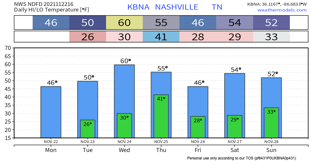
Tonight and overnight expect the coldest overnight lows of the season – definitely bring those plants in or cover them, and make sure pets are taken care of as these temps will drop below freezing.
Tonight, overnight lows could dip back into freezing temps. Clear skies giving way to more clouds overnight.
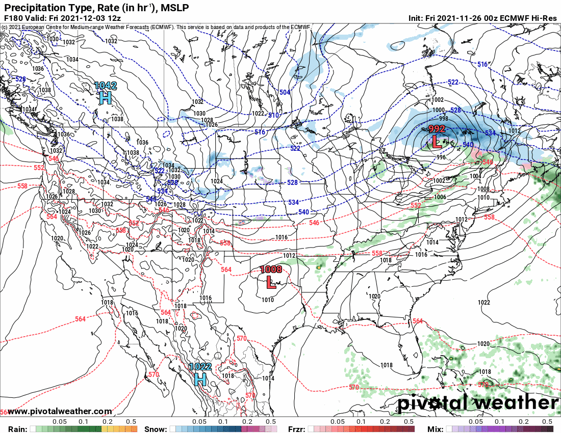
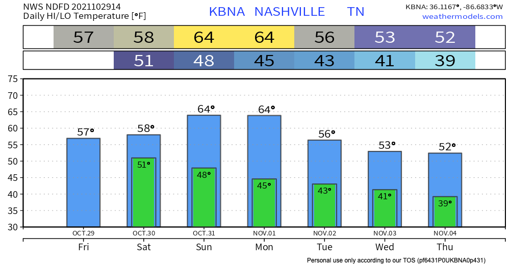
We can expect a warmer Saturday and Sunday, but another cold front will be making its way through our area Sunday, bringing rain. GFS shows rain for most of the day. More specific timing as we get closer.
The HRRR is showing a system making its way through our area in the late afternoon into tonight. The good news, it looks like the heaviest of it will miss us. Nothing severe is expected, but as with any stormy weather event, gusty winds and lightning are possible threats.
Our highs and lows are staying right around the monthly average, and steadily getting warmer throughout the next few days. As of now, there is no freeze warning in effect for tonight, but this could change as the day goes on.
The upper low pressure system is going to keep hanging out with us in Middle Tennessee today, bringing us scattered showers all day and throughout the night.

For the most part, these storms won’t be strong, but some lightning and small hail is possible. This pattern will continue through Saturday, but we will dry out Sunday morning, just in time for Halloween. Here’s what the HRRR thinks about today/tonight.
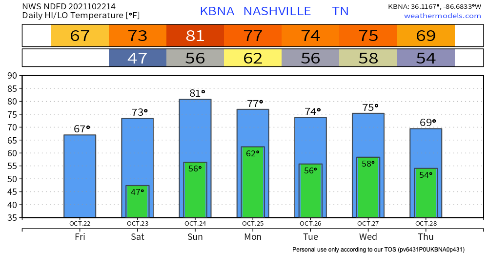
Thanks to the cold front that moved through yesterday, our temperatures are dropping today. Highs in the mid 60s and lows in the 40s mean you can wear some of those fall sweaters. Today is the day to go to a pumpkin patch, or do any other fall activity your heart desires. Unfortunately, these temps will rise back up starting Saturday, but still will remain mild.
Today is going to feel a lot like the past few days – temps in the upper 70s, sunny with a handful of clouds, and comfy dewpoints in the 40s. Models look clear for today, but starting early tomorrow morning, some rain is possible.
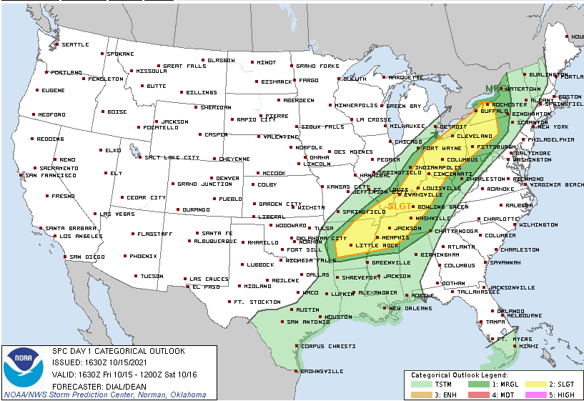
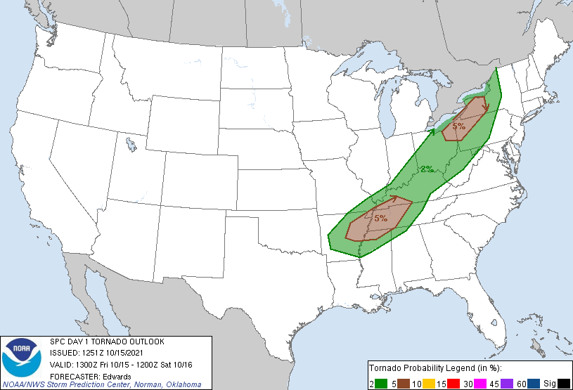
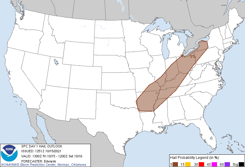
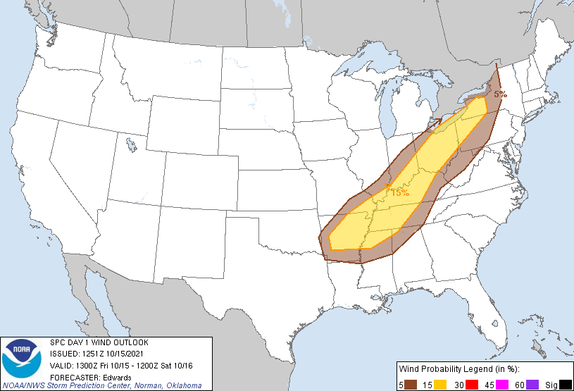
Today we’re looking at the possibility of dangerous storms. Here are the Storm Prediction Center outlooks we are a part of:
The HRRR model has been back and forth with whether storms will come through mid/late afternoon. The latest runs suggest mid/late afternoon storms are not likely, but we wanted to mention the possibility.
You must be logged in to post a comment.