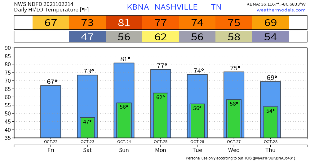
Thanks to the cold front that moved through yesterday, our temperatures are dropping today. Highs in the mid 60s and lows in the 40s mean you can wear some of those fall sweaters. Today is the day to go to a pumpkin patch, or do any other fall activity your heart desires. Unfortunately, these temps will rise back up starting Saturday, but still will remain mild.

If you’re out early on Saturday, you may see patches of heavy fog, especially near bodies of water. If you encounter this fog, drive carefully and slow down. A slight chance at a passing shower looks possible Saturday afternoon, but no plan ruining impacts are expected.
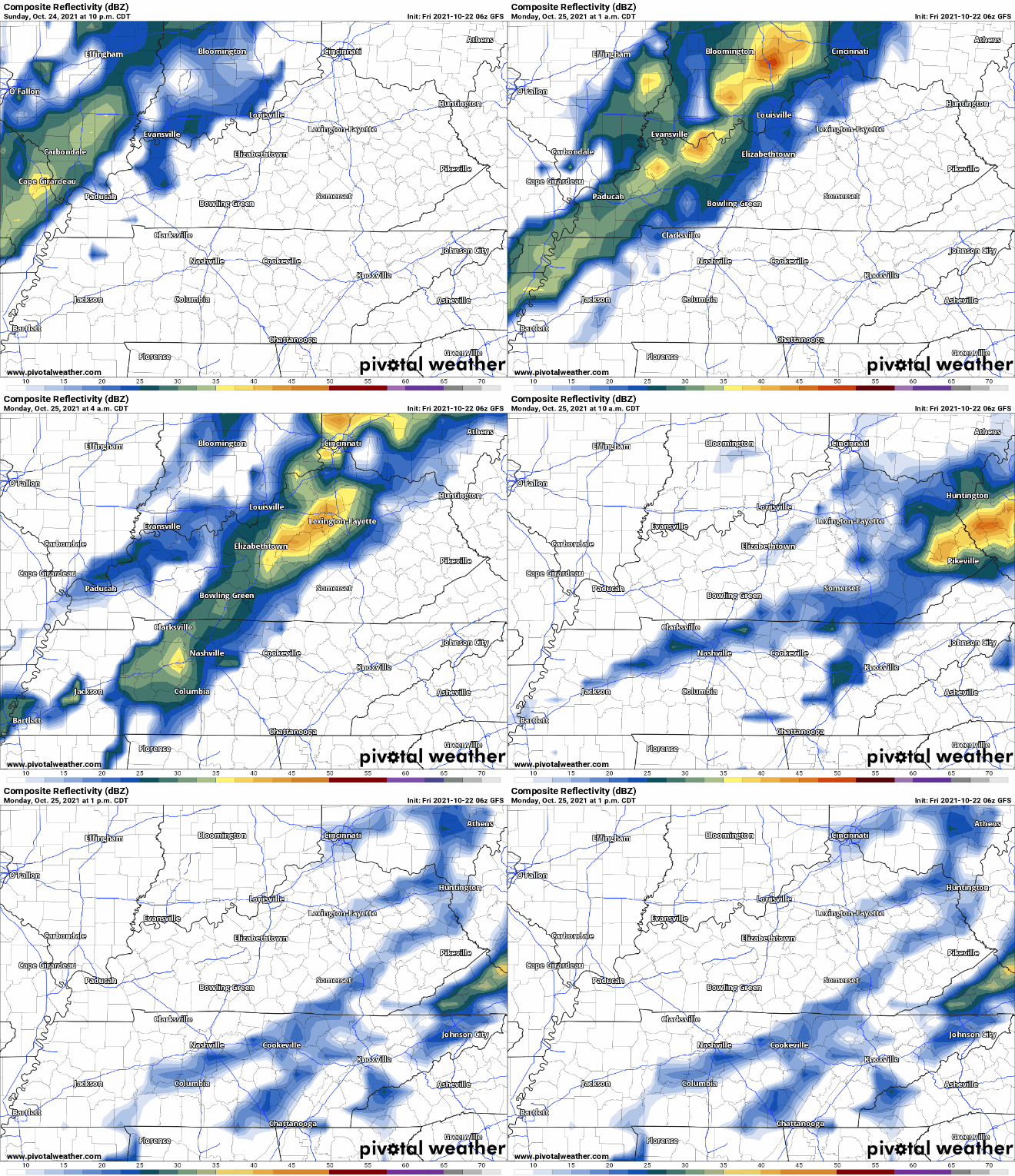
Our next weather event may be Sunday night into Monday morning, when another cold front moves through. Instability in the atmosphere and possible shear mean this system has the potential to bring some strong or severe storms, however this is not certain yet. The GFS shows the timing to be around early morning Monday. The HRRR will come in range soon and we’ll know more.

Looking ahead to after that system, we’ll have a few storm chances next week.
Categories: Forecast Blogs (Legacy)


You must be logged in to post a comment.